Babni Vrt - Sveti Lovrenc (Bašelj) (through the forest)
Starting point: Babni Vrt (602 m)
| Latitude/Longitude: | 46,32300°N 14,38270°E |
| |
Route name: through the forest
Walking time: 50 min
Difficulty: easy unmarked way
Elevation gain: 290 m
Elevation difference along the route: 290 m
Map: Karavanke 1:50.000 - osrednji del
Recommended equipment (summer):
Recommended equipment (winter): ice axe, crampons
Views: 2.290
 | 1 person like this post |
Access to starting point:
a) From the Ljubljana - Jesenice motorway, take the Brnik exit, then when reaching the Mengeš - Kranj road, continue left towards Kranj. Drive along the main road towards Kranj to the first roundabout, from which take the first exit right towards Šenčur. Continue through Šenčur on the main road, then, upon reaching the Kranj - Zgornje Jezersko road, continue right towards Jezersko. Upon arriving in Preddvor, leave the main road and continue left towards the centre of the mentioned place, from there follow the signs to the Bašelj settlement. Just beyond the Bašelj settlement, the road descends to the Milka stream and crosses it via a bridge. Here, a road branches off to the right leading to Babni Vrt, but we drive above the settlement, where the asphalt road to the last farmhouse turns left, and we continue right. Further on, we drive past a quarry, behind which we reach a small intersection where we park in a suitable spot.
b) From the Jesenice - Ljubljana motorway, take the Kranj west exit, then continue driving towards Golnik. Upon arriving in Tenetiše, leave the main road towards Golnik and continue right towards Trstenik. Approximately 1 km beyond the Trstenik settlement, we reach a small intersection, where first a road branches off left towards the Povlje settlement, a few 100 m further also towards Babni Vrt. Continue towards Babni Vrt, from the intersection above the settlement turn right onto the gravel road, along which we then drive past the quarry. Park behind the quarry in a suitable spot at the next intersection.
Route description:
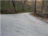
From the starting point, continue along the left road, which runs along the right side of the quarry (straight ahead the path under Storžič), a little further it splits into two wide tracks. Continue along the right track, which immediately enters the forest, then it ascends gently at first, moderately to steeply after the left serpentine. Further on, at junctions follow the right directions, at the small pass continue left upwards onto the poorer track, which soon ends. From the end of the track or logging trail, we begin to ascend steeply along the forest path, along it in a few minutes we reach another track, which we follow to the right, along it we quickly join the path from Bašelj or Laški.
Continue left upwards and after a minute or two of further walking arrive at the Dom na Lovrencu.
From the hut, continue in the direction of Javornik, Velika and Mala Poljane, Kališča and Storžič, along a path that moderately ascends through the forest. The well-marked path quickly takes us out of the forest onto a vast meadow, across which we stroll with beautiful views to the church of sv. Lovrenc.
Starting point - Dom na Lovrencu 0:45, Dom na Lovrencu - sv. Lovrenc 0:05.
Description and photos refer to the situation in 2017 (April).

Photos:
 1
1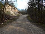 2
2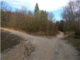 3
3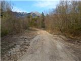 4
4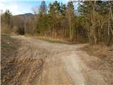 5
5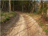 6
6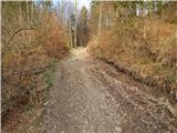 7
7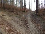 8
8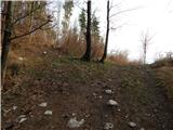 9
9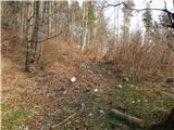 10
10 11
11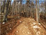 12
12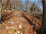 13
13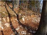 14
14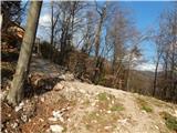 15
15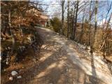 16
16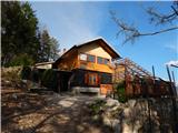 17
17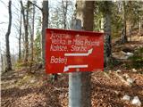 18
18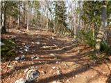 19
19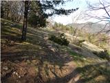 20
20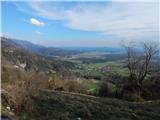 21
21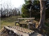 22
22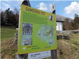 23
23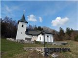 24
24 25
25
Discussion about the trip Babni Vrt - Sveti Lovrenc (Bašelj) (through the forest)
To post a comment you must log in:
If you do not yet have a username, you must first
register.