Badasconytomaj - Badacsony (north path)
Starting point: Badasconytomaj (162 m)
Route name: north path
Walking time: 50 min
Difficulty: easy marked way
Elevation gain: 276 m
Elevation difference along the route: 276 m
Map:
Recommended equipment (summer):
Recommended equipment (winter):
Views: 2.044
 | 1 person like this post |
Access to starting point:
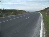
From the Pomurska motorway, we take the Dolga Vas exit, then continue driving towards Hungary. The route then takes us through the town of Redics, after which we follow the signs for the town of Zalaegerszeg, from there towards Blatno Lake / Balaton, Heviz and Keszthely. When we arrive in Keszthely, we turn onto the bypass and then follow the signs for Balatonfüred (there are roundabouts along the bypass). When the road to Sopron branches off at the end of Keszthely, we continue east, but only for 2 km, then turn right towards the village of Badacsonytördemic. We continue through the village (the road in the middle of the village is cobblestoned). After leaving the village, at the first junction we go right in the eastern direction. The road will become four-lane. Exactly at the place where, after a slight ascent, the road begins to descend slightly towards Badacsonytomaj, we will notice stairs with blue markings on the right. There are no suitable parking spots at the starting point, so we must park in a suitable place along the road before or after the start of the path (best at the junction of the side road).
A somewhat shorter route is Lendava - Pince - Tornyszentmiklos - Nagykanizsa - Balatonszentgyörgy exit - Keszthely, but it is much more difficult orientation-wise.
Route description:
From the place where we parked, we first walk to the start of the path, from there we begin to ascend the stairs. When the stairs end, the path levels out and we can already see our goal ahead. The trail we continue on quickly takes us to a gravel road, which we follow straight ahead. The road gradually turns into a cart track, and at two junctions we continue right. The path continues between vineyards, then we reach a cemetery, behind which we quickly arrive at a junction by a well. Here we continue left towards the south, where we soon reach the next junction. Here too we continue left and proceed along the path over which there are concrete slabs. Further on, the path becomes steeper and gradually turns into a narrower cart track. The narrow cart track quickly joins a wider one, which we follow straight ahead. The path further leads past the last stone hut by the vineyard, then turns into forest. We ascend through the forest for a while, then reach the point where the path that circles the top of Badacsony joins (path marked with - red line). We cross this mentioned path, then arrive at the most interesting part of the path (Kökapu), where the path from the center of Badacsonytomaj also joins (Kökapu is a steep passage through the rocky world of basalt rocks and stalactites). Above the Kökapu section, the path levels out and to the right a path branches off to the nearby viewpoint, we continue straight and arrive at a junction where we take the left path (the right path is marked with blue plus markings and later joins the western path).
The path ahead becomes steeper again, but levels out a bit below the summit and joins paths from the south and west. Here we again continue left and in a few dozen steps of further walking we arrive at the forest-covered summit.
From the summit, we can at our own risk climb to the viewpoint tower, from which a view opens up reaching as far as Donačka gora, Boč, Ivanščica, Ravna gora and Pohorje.

Photos:
 1
1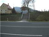 2
2 3
3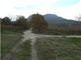 4
4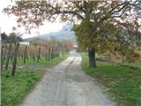 5
5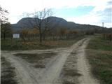 6
6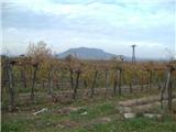 7
7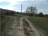 8
8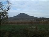 9
9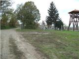 10
10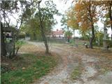 11
11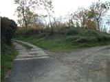 12
12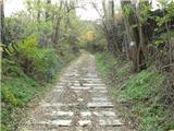 13
13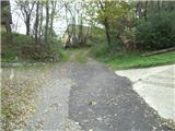 14
14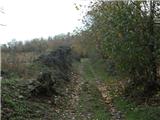 15
15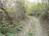 16
16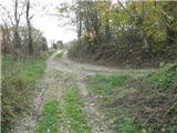 17
17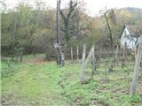 18
18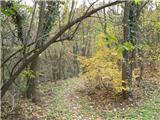 19
19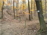 20
20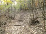 21
21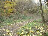 22
22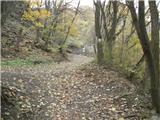 23
23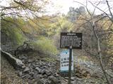 24
24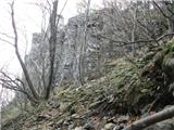 25
25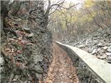 26
26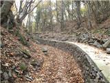 27
27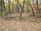 28
28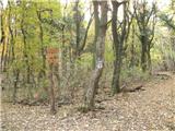 29
29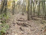 30
30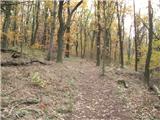 31
31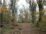 32
32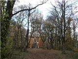 33
33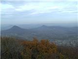 34
34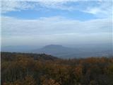 35
35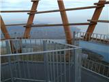 36
36
Discussion about the trip Badasconytomaj - Badacsony (north path)
To post a comment you must log in:
If you do not yet have a username, you must first
register.