Baita Sun Bar - Punta dei Ross
Starting point: Baita Sun Bar (1150 m)
| Latitude/Longitude: | 46,46419°N 12,21575°E |
| |
Walking time: 4 h
Difficulty: difficult pathless terrain
Elevation gain: 1310 m
Elevation difference along the route: 1330 m
Map: Tabacco 03 1:25.000
Recommended equipment (summer): helmet
Recommended equipment (winter): helmet, ice axe, crampons
Views: 390
 | 2 people like this post |
Access to starting point:
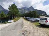
Access from Gorenjska: From Rateče or Predel we cross the border to Trbiž / Tarvisio and then we continue on a highway in the direction of Videm / Udine to exit Tolmezzo. From Tolmezzo we follow the road in the direction of village Ampezzo and mountain pass Passo della Mauria. The road then descends and it brings us to a crossroad, where we continue left in the direction of Cortina d'Ampezzo. At all next crossroads, we follow the signs for Cortina d'Ampezzo. We follow the road to San Vito di Cadore where we leave the main road towards Cortina d'Ampezzo and go right where signs point us to the mountain hut Rifugio Scotter and ski slope Ski San Vito. On the left side of the road by the crossroad is a church. The road then turns to the right and it brings us to a crossroad. We go left upwards and follow the signs for mountain hut Rifugio Scotter. We follow the road to bar Sun Bar where there are also signs that prohibit further driving. We park on a large parking lot, which is located by the road on the right side.
From Primorska: We drive on the highway towards Venice / Venezia. At town Portogruaro we leave the highway towards Venice and continue right on the highway towards Pordenone. At the next highway junction near Conegliano, we continue right towards Belluno. Near Belluno the highway ends and at the next crossroads we continue in the direction of Cortina d'Ampezzo. Further, we follow the description above.
Route description:
The road which leads straight and is at first still paved with asphalt was destroyed by rockfall and is closed. It's closed for hikers and cyclists as well. At the starting point, we go left on a macadam road. The relatively gently sloping road soon crosses the gate and leads us above the riverbed of a torrent. The road then turns to the left and crosses the riverbed. Here are also warning signs, which indicate that crossing the riverbed during the rain is dangerous because of possible sudden large waves. The road then starts ascending steeper and on some spots, it is also paved with concrete. We are ascending mostly through the forest and from the road then a footpath towards the mountain hut Rifugio Scotter branches off to the right. A little higher, the road and the footpath join again. Forest then becomes thinner and beautiful views start to open up on surrounding peaks where nearby Monte Antelao especially stands out. Soon, we come to a crossroad where from the right side also the old road which is closed joins.
We continue to walk on the road which is on a short section also paved with asphalt. A little before the hut, we come to a crossroad where we continue right and only few steps follow to the hut Rifugio Scotter Palatini.
From the starting point to the mountain hut is otherwise also organized transport by vans. They start driving at 8:30, the price of a return ticket is 10€ (August 2018).
At the mountain hut, we go left and on the stairs return to the road. We leave the road immediately above the mountain hut and we go on a footpath towards the mountain hut Rifugio San Marco. The footpath is at first ascending through dwarf pines and turns a little to the left and then for some time in a gentle ascent crosses slopes towards the northeast. A little later we cross a wide riverbed of a torrent, and then the path soon brings us into the forest where from the right joins also the path from the end of the road. Further, we then start ascending a little steeper through the forest and then we cross a smaller stream by which a notice on a sign warns of the danger of falling stones. Next again follows the ascent through the forest from which occasionally still beautiful views are opening up towards Monte Pelmu and Monte Antelau. On such path we then soon reach the mountain hut Rifugio San Marco.
At the crossing behind the mountain hut, we go left upwards on the path 226 towards the notch Forcella Grande. From the crossing, we at first ascend a little through a thin forest after that mostly in a gentle ascent, we cross little steeper slopes towards the northwest. The path then leads us past water reservoir and soon turns right upward on torrent gully. The path soon avoids the gully and then it ascends through dwarf pines on the left side of the gully. A little higher, the path brings us out of the dwarf pines and then turns a little to the right and we cross the gully. Here is on a slope a lot of compacted sand and if the footpath isn't well-beaten it can be also dangerous for slipping. The slope then becomes less steep and the path leads us on a wide valley towards the notch Forcella Grande. At the crossing, a little before the notch we go left, and the right path leads downwards towards the valley Val di San Vito. After a short crossing, the path then brings us to the signposts on notch Forcella Grande from which breathtaking views open up on Monte Sorapiss and other precipitous peaks nearby.
At the signposts, we leave the marked path 246 towards the bivouac Slataper and go on an unmarked footpath which leads a little left from the marked path. Our path in a gentle ascent crosses scree and runs parallel with the marked path, which is visible below us. We still cross scree on the north side of the peak Punta Taiola, which are interrupted by a short lane of very steep slopes. Here the path becomes demanding and on a narrow ledge crosses exposed slope. At the crossing quite some caution is needed. This part we can otherwise also avoid if from the notch for some time we continue on a marked path and go left on pathless terrain later when the slope isn't so steep anymore.
After the crossing of a steep slope, we soon come on a grassy terrain where the footpath vanishes. We continue to walk towards the west and we ascend on a pathless grassy slope towards the notch Forcella Pala di Dentro on which there is also a wooden cross.
Left on a ridge leads a little more demanding ridge towards the summit Punta Taiola, and on the notch, we go right and we continue by the ridge towards the summit Punta dei Ross. Further, we are all the time ascending on a grassy slope by the ridge, which is on the west side precipitous. On such terrain, we then soon reach a very panoramic peak.
We descend on the ascent route.

Photos:
 1
1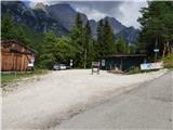 2
2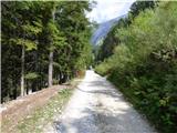 3
3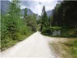 4
4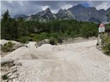 5
5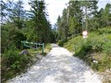 6
6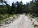 7
7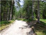 8
8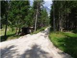 9
9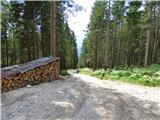 10
10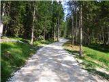 11
11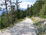 12
12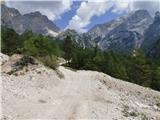 13
13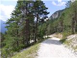 14
14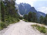 15
15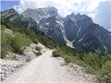 16
16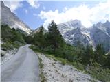 17
17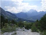 18
18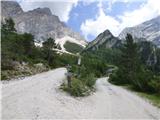 19
19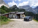 20
20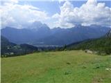 21
21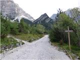 22
22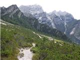 23
23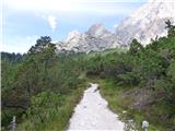 24
24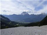 25
25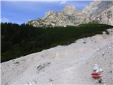 26
26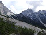 27
27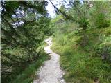 28
28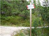 29
29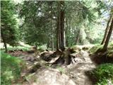 30
30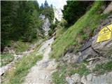 31
31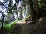 32
32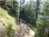 33
33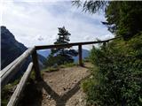 34
34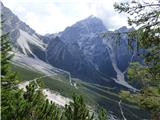 35
35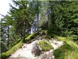 36
36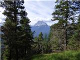 37
37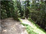 38
38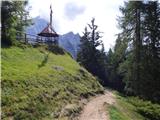 39
39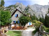 40
40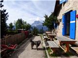 41
41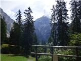 42
42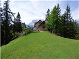 43
43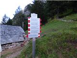 44
44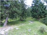 45
45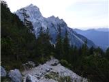 46
46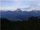 47
47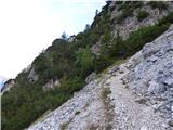 48
48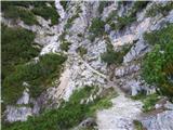 49
49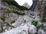 50
50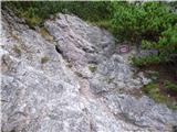 51
51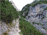 52
52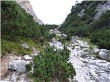 53
53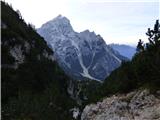 54
54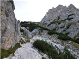 55
55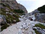 56
56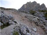 57
57 58
58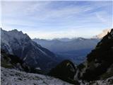 59
59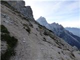 60
60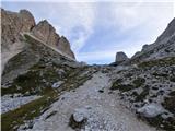 61
61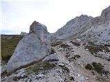 62
62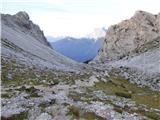 63
63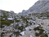 64
64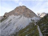 65
65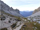 66
66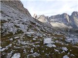 67
67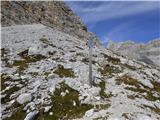 68
68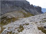 69
69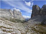 70
70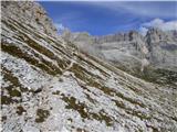 71
71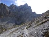 72
72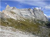 73
73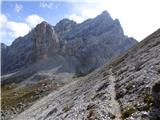 74
74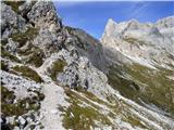 75
75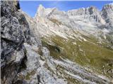 76
76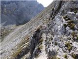 77
77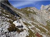 78
78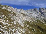 79
79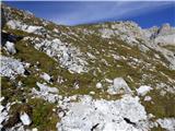 80
80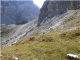 81
81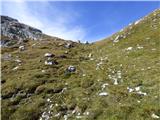 82
82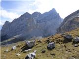 83
83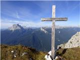 84
84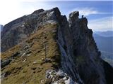 85
85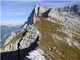 86
86
Discussion about the trip Baita Sun Bar - Punta dei Ross
To post a comment you must log in:
If you do not yet have a username, you must first
register.