Benedikt - Sveti Trije Kralji v Slovenskih goricah
Starting point: Benedikt (253 m)
| Latitude/Longitude: | 46,60788°N 15,88941°E |
| |
Walking time: 13 min
Difficulty: easy unmarked way
Elevation gain: 43 m
Elevation difference along the route: 43 m
Map:
Recommended equipment (summer):
Recommended equipment (winter):
Views: 123
 | 1 person like this post |
Access to starting point:
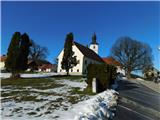
From Gornja Radgona we drive towards Lenart in the Slovenian Hills, or vice versa, but only to the settlement of Benedikt, where at the main roundabout we take the exit towards Sv. Ana. We drive another approximately 100 metres and then park in the parking lot under the parish church of St. Benedict.
Route description:
From the parking lot we return to the main roundabout, then we head onto the road towards Sv. Trojica.
We continue walking along the sidewalk for a short time, just beyond Gostilna Lekežič the main road turns right. Here behind the last house on the left we leave the road and head onto the trail that ascends along the right side of the nearby houses, higher up it leads us to stairs, along which with beautiful views of the surroundings, especially Benedikt, we climb to the second road, which is already located in the settlement of Sv. Trije Kralji in the Slovenian Hills. Here we go right, then we soon arrive near the church of the Three Kings, to which only a short walk remains.
Description and photos refer to the condition in February 2026.
Photos:
 1
1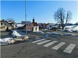 2
2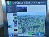 3
3 4
4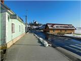 5
5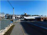 6
6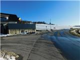 7
7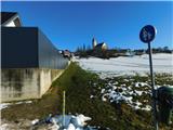 8
8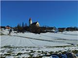 9
9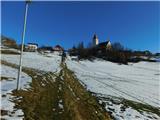 10
10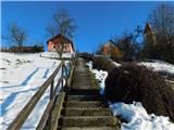 11
11 12
12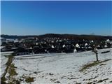 13
13 14
14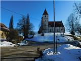 15
15 16
16 17
17 18
18
Discussion about the trip Benedikt - Sveti Trije Kralji v Slovenskih goricah
To post a comment you must log in:
If you do not yet have a username, you must first
register.