Starting point: Bevški vrh (1080 m)
| Latitude/Longitude: | 45,96137°N 13,84531°E |
| |
Walking time: 1 h 35 min
Difficulty: easy marked way
Elevation gain: 415 m
Elevation difference along the route: 455 m
Map:
Recommended equipment (summer):
Recommended equipment (winter): ice axe, crampons
Views: 680
 | 1 person like this post |
Access to starting point:
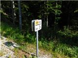
a) We drive to Col, from where we follow the road towards Otlica and Predmeja. The route leads us across the Gora plateau through several villages. When we join the road from Ajdovščina at Predmeja, we turn right towards the settlement of Lokve. The road initially leads through a small valley, where one of the marked paths towards the Golaki first branches off to the right. A little further on, the road turns left and ascends the slope. When the road higher up turns right again, we drive to the road marker 3.5 km. Here we first notice a suitable parking space on the left, and about 50 meters further on also on the right side, near which there are mountain markings for Čaven and the Golaki.
b) We drive to Ajdovščina, from where we follow the signs for Lokavec and Predmeja. This is followed by a fairly steep ascent along the winding road to Predmeja, where at the intersection we continue straight towards the settlement of Lokve. The road initially leads through a small valley, where one of the marked paths towards the Golaki first branches off to the right. A little further on, the road turns left and ascends the slope. When the road higher up turns right again, we drive to the road marker 3.5 km. Here we first notice a suitable parking space on the left, and about 50 meters further on also on the right side, near which there are mountain markings for Čaven and the Golaki.
Route description:
On the northern side of the road we notice markings for Iztokova koča and Mali Golak, while the path towards Koča na Čavnu continues to the south. The signposts direct us onto a cart track, which quickly turns into a footpath leading through the wooded karst landscape of Trnovski gozd. A short, somewhat more overgrown section follows, after which we reach a gravel road and follow it to the right, where we first descend slightly. When the path begins to ascend gently again, the markings for Mali Golak and Iztokova koča direct us slightly left into the forest. Higher up we reach another road and follow it to the right towards Iztokova koča. After a few minutes of walking along the road we arrive at the Strgarija pass. Here the path from Male Lazne joins from the left, and the path from the Kozarnice starting point or from Predmeja joins from the right.
At the pass, where there is also an intersection of several roads, we take the footpath towards Iztokova koča and Mali Golak. After another five minutes of ascent we reach Iztokova koča below the Golaki.
We bypass the hut on the right side and continue the ascent towards Mali Golak, which is still about 40 minutes away. The trail ascends through the forest, then at a junction by an information board and a small shrine (chapel) it splits in two directions. We can continue straight on the steep path or left on the gentler one. Both variants merge again after about 10 minutes. The path then turns slightly to the right and ascends steeply. After this short, steep section we reach a wooded ridge, where the path from Predmeja joins from the right, leading past Koča Edmunda Čibeja in Tihi dolini. We continue straight and follow the moderately steep path to a small pass west of the main summit. Here we turn right; the path quickly leads us out of the forest into a belt of dwarf pines, through which we ascend to the summit of Mali Golak in a few minutes.
Starting point - Iztokova koča 0:55, Iztokova koča - Mali Golak 0:40.

Photos:
 1
1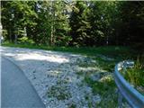 2
2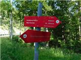 3
3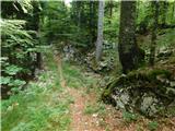 4
4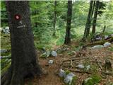 5
5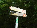 6
6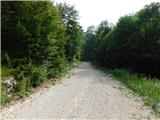 7
7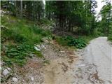 8
8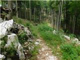 9
9 10
10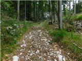 11
11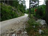 12
12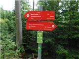 13
13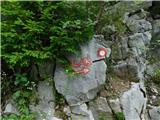 14
14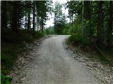 15
15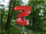 16
16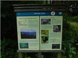 17
17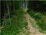 18
18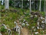 19
19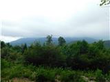 20
20 21
21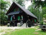 22
22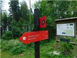 23
23 24
24 25
25 26
26 27
27 28
28 29
29 30
30 31
31 32
32 33
33 34
34 35
35 36
36 37
37 38
38 39
39
Discussion about the trip Bevški vrh - Mali Golak
To post a comment you must log in:
If you do not yet have a username, you must first
register.