Bistriški jarek (Glasbeni dom) - Bivak Piramida (via Sveti Urban)
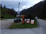
Starting point: Bistriški jarek (Glasbeni dom) (415 m)
| Latitude/Longitude: | 46,64070°N 15,13080°E |
| |
Route name: via Sveti Urban
Walking time: 4 h 30 min
Difficulty: easy marked way
Elevation gain: 980 m
Elevation difference along the route: 1105 m
Map: Koroška 1:50.000
Recommended equipment (summer):
Recommended equipment (winter): ice axe, crampons
Views: 291
 | 1 person like this post |
Access to starting point:
A) We drive to Dravograd, and then continue driving towards Maribor. After the road sign for 8.0 km, we need to pay attention, as we will turn left into the settlement Gortina a little after the bus stop and pedestrian crossing (the turn-off from the main road is not marked). Immediately after leaving the main road, we arrive in the settlement Gortina, and then we drive in the direction of Muta, turning left at the marked intersection where we notice signs for Bistriški jarek. The road then quickly brings us to Bistriški jarek, through which we gently ascend. We park by the former POŠ Branik, today Glasbeni dom; that is the inscription on the building, otherwise the building is used for various activities.
B) First, we drive to Maribor, and then follow the signs for Dravograd. When we are already crossing Mučko Bistrico, a little after the Tuš store we turn right in the direction of the settlement Muta 1. The route ahead brings us to Muta, where at intersections we follow the priority road; from a somewhat larger intersection we go left, so that we continue driving towards Gortina. A little after the settlement Muta ends, from the marked intersection we turn right in the direction of Bistriški jarek. The road then quickly brings us to Bistriški jarek, through which we gently ascend. We park by the former POŠ Branik, today Glasbeni dom; that is the inscription on the building, otherwise the building is used for various activities.
Route description:
From the marked parking lot, we continue on the asphalt road which behind the sports field quickly brings us to a marked junction by the ecological chapel.
We continue left towards Pernice (right Sedelnik waterfall and St. Jernej), from the road we go immediately a little more left on a cart track. On the cart track, we ascend to the nearby farm, where we go behind the house left on a marked cart track. The cart track first ascends diagonally towards the left, then turns right; after the turn we leave it and continue slightly right on a marked footpath which starts steeply ascending through the forest. Higher, we cross an older cart track; after a further shorter ascent we join a somewhat wider cart track, on which we also arrive out of the forest. The path ahead leads us past the hunting observatory, then we cross a wider macadam road and continue on the road which leads to the nearby homestead Abram. Above the homestead, we again continue on a cart track, and the path brings us to a nicely arranged chapel, above which the path temporarily becomes a little steeper. The path ahead leads us along the route of the power line, higher we once again cross a wider road. Further, the path leads us also past the homestead Hribernik, above which the path gradually passes into the forest. There follows a few minutes of ascent through the forest, then we arrive at the pastures below the church of St. Simon and Jude Tadej, where the trail temporarily disappears. We continue with ever better views to the church, where we go left and walk past the NOB monument to the former Mountain Hut Planinsko zavetišče pri Knezu, where there is a stamping box.
From the junction by the former mountain hut we continue right in the direction of Košenjak and St. Urban, first ascending through the forest, then the path flattens and the forest is temporarily replaced by partly grassy terrain. A little further, we reach the macadam road which we follow right towards Košenjak; at the nearby intersection we continue on the slightly left, upper road (slightly right homestead Zgornji Čiček). For a short time we still continue on the road, then signs for Košenjak direct us slightly left on a grassy cart track, on which we continue the ascent. Higher, we go left from the mentioned cart track, a few minutes further we cross a poorer road. There follows a few-minute diagonal ascent, then we reach the ridge of Kozji vrh, where there is a marked junction.
From the junction we go right (left Kozji vrh less than 1 minute) and continue the path along the border ridge, on which we lightly descend. After a good 10 minutes we step out of the forest, where ahead of us we already see the church of St. Urban, to which only a short walk separates us.
We continue to the wooden sign, where signs for Košenjak direct us slightly right on the path which passes into the forest. We continue along the border ridge, initially without major changes in elevation; behind the weather station, which is located on the Slovenian side, a short descent follows. After the descent we again continue for some time without major changes in elevation, then the path leads us past the decaying bivouac, which is located on the Austrian side of the state border. Further, we gently to occasionally moderately ascend for quite some time, then we arrive at a marked junction, where we continue left in the direction of the homestead Lonhtar (straight Košenjak).
There follows traversing to the left, where the path in a gentle descent leads past Volčji kamen. After the stone we walk for a short time on a gentle path, then we arrive at the hunting hut Bivak Piramida.
Bistriški jarek - Pernice 1:45, Pernice - Kozji vrh 1:00, Kozji vrh - St. Urban 0:15, St. Urban - Bivak Piramida 1:10.
Description and pictures refer to the condition in 2018 (November).

Photos:
 1
1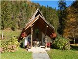 2
2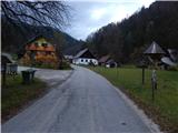 3
3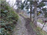 4
4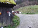 5
5 6
6 7
7 8
8 9
9 10
10 11
11 12
12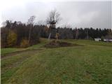 13
13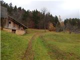 14
14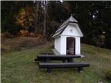 15
15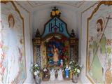 16
16 17
17 18
18 19
19 20
20 21
21 22
22 23
23 24
24 25
25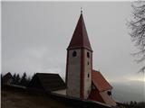 26
26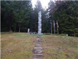 27
27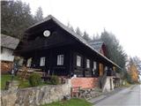 28
28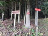 29
29 30
30 31
31 32
32 33
33 34
34 35
35 36
36 37
37 38
38 39
39 40
40 41
41 42
42 43
43 44
44 45
45 46
46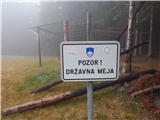 47
47 48
48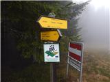 49
49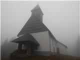 50
50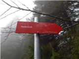 51
51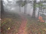 52
52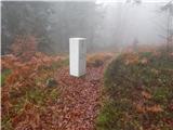 53
53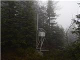 54
54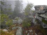 55
55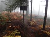 56
56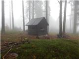 57
57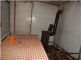 58
58 59
59 60
60 61
61 62
62 63
63 64
64 65
65 66
66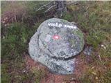 67
67 68
68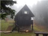 69
69
Discussion about the trip Bistriški jarek (Glasbeni dom) - Bivak Piramida (via Sveti Urban)
To post a comment you must log in:
If you do not yet have a username, you must first
register.