Bitenjska planina - Ribčeva planina
Starting point: Bitenjska planina (919 m)
| Latitude/Longitude: | 46,27310°N 14,03330°E |
| |
Walking time: 35 min
Difficulty: easy marked way
Elevation gain: 196 m
Elevation difference along the route: 196 m
Map: Škofjeloško in Cerkljansko hribovje 1:50.000
Recommended equipment (summer):
Recommended equipment (winter): crampons
Views: 3.347
 | 1 person like this post |
Access to starting point:
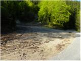
We drive to Bohinjska Bistrica and continue driving towards Soriška planina. After a few kilometers of ascent we arrive at a crossroad, where the road towards Soriška planina branches off sharply to the right, and we continue straight in the direction of Železniki and Škofja Loka. Further, we drive for approximately 1 km, and then we arrive at a smaller crossroad, where a road towards Ribčeva planina branches off to the right. At the crossroad, there are signs for Ribčeva planina and Ratitovec. We park a few meters before the crossroad on a macadam parking lot.
Route description:
From the parking lot, we first walk to the nearby crossroad, by which we notice the first signs for Ratitovec.
We continue right on the road in the direction of Ratitovec, and at first the still asphalt road quickly leads us into a dense forest. We walk for approximately 10 minutes on the mentioned road, and then the blazes direct us slightly to the left onto a marked footpath, which continues on a grassy cart track, the latter along the stream Bitenjski graben. Higher up, we return to the road, which we reach right at the smaller crossroad. We continue on the upper right road, on which we quickly arrive at Ribčeva planina.
Photos:
 1
1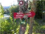 2
2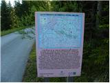 3
3 4
4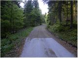 5
5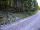 6
6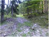 7
7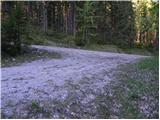 8
8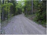 9
9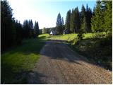 10
10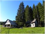 11
11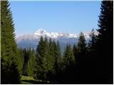 12
12
Discussion about the trip Bitenjska planina - Ribčeva planina
To post a comment you must log in:
If you do not yet have a username, you must first
register.