Starting point: Blagovica (412 m)
| Latitude/Longitude: | 46,17500°N 14,80340°E |
| |
Walking time: 40 min
Difficulty: easy marked way
Elevation gain: 278 m
Elevation difference along the route: 278 m
Map: Posavsko hribovje - zahodni del 1:50.000
Recommended equipment (summer):
Recommended equipment (winter):
Views: 10.063
 | 1 person like this post |
Access to starting point:
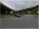
From the highway Ljubljana - Maribor, we take the Blagovica exit, and then continue driving towards the mentioned settlement. Only a few dozen meters after the Blagovica sign, we notice signs for Golčaj, which direct us to the right, onto the road that goes through the underpass below the highway. We park on the parking lot right by the main road, opposite the fire station.
Route description:
From the parking lot, we continue on the ascending road which goes through the underpass, and then signs for Golčaj direct us left onto a steep footpath which further ascends south of the highway, whose traffic we still hear for some time. A little higher we cross the road and continue the ascent on a wider cart track which leads us past the water catchment. The cart track then becomes increasingly steep and brings us higher to a crossing, where we continue sharply left on the left cart track, which we follow only for a short time because then signs for Golčaj direct us right onto a nicely marked footpath. Higher, we join a narrow cart track for a short time, then again continue on a relatively steep mountain path. The path flattens higher up and brings us to a marked crossing in the immediate vicinity of Golčaj. Here we continue left (right Limbarska gora) on a moderately steep forest path, along which in 3 minutes of further walking we arrive at the top.
From the top, we continue slightly right and after a short descent arrive at the nearby church of St. Neža.

Photos:
 1
1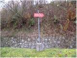 2
2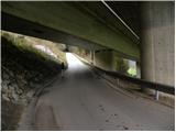 3
3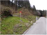 4
4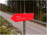 5
5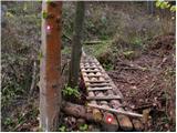 6
6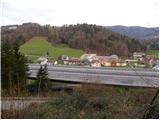 7
7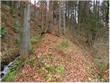 8
8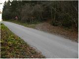 9
9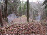 10
10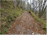 11
11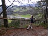 12
12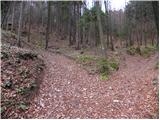 13
13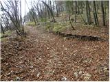 14
14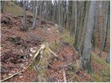 15
15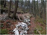 16
16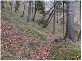 17
17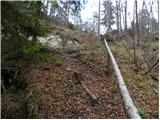 18
18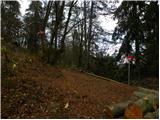 19
19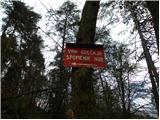 20
20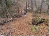 21
21 22
22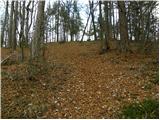 23
23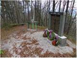 24
24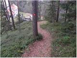 25
25 26
26
Discussion about the trip Blagovica - Golčaj
|
| bruny23. 10. 2011 |
 Today also to Golčaj from Blagovica on a slightly longer hiking tour...The steepness in the section to Golčaj somewhat surprised me and the path is exemplary marked with blazes and signs... Today also to Golčaj from Blagovica on a slightly longer hiking tour...The steepness in the section to Golčaj somewhat surprised me and the path is exemplary marked with blazes and signs...
|
|
|
|
| grega_p4. 01. 2021 |
Very nice trail, kudos to PD Blagovica. They didn't manage to reduce the steepness :-), but they nicely arranged the initial part with railings, fences and footbridges, and generally exemplary marked and provided with markers the trail. The best are definitely the nativity scene and the decorated spruce in the upper part of the trail - original!
For descent, especially in wet conditions, I recommend east - along the road from Sv. Neža and a bit further along the junction to the macadam road (about 200m), then left downhill on a wide, not too steep trail, where we reach a meadow and asphalt road that brings us to the starting point. It takes about 30 min.
|
|
|
|
| zlatica7. 01. 2021 |
No photos though, grega? Such a nice description that photos would complement it excellently.
|
|
|
|
| grega_p9. 01. 2021 |
Yeah, my phone is 12 years old (which I'm actually quite proud of), so the photos would be poorer quality, and I take pictures less often too.
But I like to describe things and feelings and in this way perhaps encourage someone to the trip. Otherwise everyone would just look at the photos :-)
In the past people devoured colorful stories of hikers in books and then eagerly waited for a free and clear day for the tour, today we too often settle just for a picture.. Of course it's not all black and white, everything has its purpose...
|
|
|
To post a comment you must log in:
If you do not yet have a username, you must first
register.