Spodnja postaja žičnice na Krvavec - Skutman (via Kopa)
Starting point: Spodnja postaja žičnice na Krvavec (602 m)
| Latitude/Longitude: | 46,28490°N 14,49680°E |
| |
Route name: via Kopa
Walking time: 1 h 45 min
Difficulty: easy unmarked way
Elevation gain: 309 m
Elevation difference along the route: 480 m
Map: Karavanke - osrednji del 1:50.000
Recommended equipment (summer):
Recommended equipment (winter): ice axe, crampons
Views: 1.080
 | 2 people like this post |
Access to starting point:
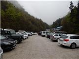
A) From the Ljubljana - Jesenice highway, take the Vodice exit, then continue driving to the first traffic-light intersection in Vodice, where you continue left in the direction of Cerklje na Gorenjskem and Brnik. When you arrive at the main roundabout in Spodnji Brnik, continue driving in the direction of Cerklje and the Krvavec ski centre. At the end of the settlement of Cerklje na Gorenjskem, leave the main road, which continues towards Velesovo and Visoko, and continue driving slightly right onto the road in the direction of the Krvavec ski centre. Park on the large well-maintained parking lot next to the bottom station of the circular-cabin cable car on Krvavec.
B) From the Jesenice - Ljubljana highway, take the Kranj - east exit, then continue driving towards Brnik, Komenda and Mengeš. When you arrive at the main roundabout in Spodnji Brnik, continue driving in the direction of Cerklje and the Krvavec ski centre. At the end of the settlement of Cerklje na Gorenjskem, leave the main road, which continues towards Velesovo and Visoko, and continue driving slightly right onto the road in the direction of the Krvavec ski centre. Park on the large well-maintained parking lot next to the bottom station of the circular-cabin cable car on Krvavec.
Route description:
From the bottom station of the circular-cabin cable car on Krvavec, continue on the asphalt road towards Štefanja Gora, walking along it to the first left bend, in the middle of which a marked path branches off to the right—initially still a poorer road towards Krvavec. The poorer road, along which we continue the ascent, climbs along the right bank of the Reka, but a little higher, at the marked junction, we continue left in the direction of Davovec and the upper cable car station. A short steeper ascent follows, then we reach a cart track, which we follow to the left. Further on, the cart track becomes progressively worse, and we continue the path along a forest trail, which in places follows the same route as the mountain bike "downhill" track, so caution is advised. Higher up, a signposted path branches off to the right from the marked path towards the Davovec memorial park; we continue left and after a few minutes of further ascent arrive at an abandoned house and behind it at ruins and an information board. Here, another path branches off to the right to the aforementioned park, and we continue straight along a wider and subsequently quite steep path, which we follow all the way to the Davovec saddle, where we step onto a wide cart track.
When we step onto the cart track, we continue left and in a few steps arrive at a marked junction, next to which there is a religious symbol and a pleasant bench.
Continue straight in the direction of Kopa (right to Kokra), and then after a few steps, when one cart track turns slightly left and begins to descend while the other begins to ascend, continue parallel to the upper cart track, to which we temporarily join higher up. After a shorter section where we walk along the cart track, we then continue slightly right again along a narrow path that ascends along a forested ridge. A short ascent follows, then we reach the overgrown summit of Kopa.
From Kopa, continue straight in the direction of Skutman along a path that begins to descend along a forested ridge. When the descent ends after about 15 minutes, we arrive at a smaller saddle with a marked junction, and we continue straight in the direction of Skutman (left to Možjanca and Štefanja Gora).
From the junction onward, the path first continues without major changes in elevation, then descends temporarily, after which it ascends more steeply and brings us to the summit of Skutman in one or two minutes of further walking.
The path is marked to the Davovec saddle, and from there onward it is only signposted.
The description and pictures refer to the condition in 2016 (April).

Along the route: Sedlo Davovec (932m), Kopa (1024m)
Photos:
 1
1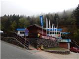 2
2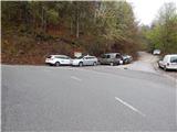 3
3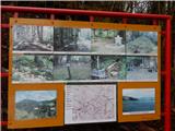 4
4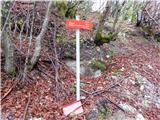 5
5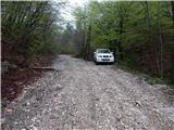 6
6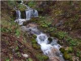 7
7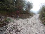 8
8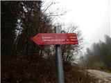 9
9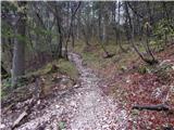 10
10 11
11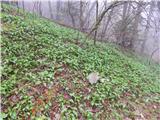 12
12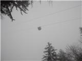 13
13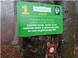 14
14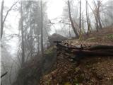 15
15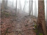 16
16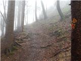 17
17 18
18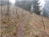 19
19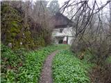 20
20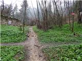 21
21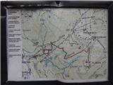 22
22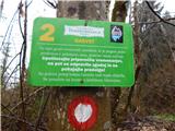 23
23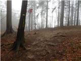 24
24 25
25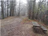 26
26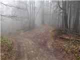 27
27 28
28 29
29 30
30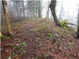 31
31 32
32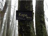 33
33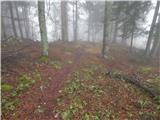 34
34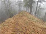 35
35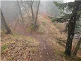 36
36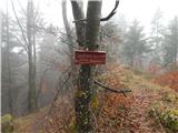 37
37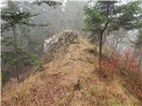 38
38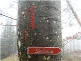 39
39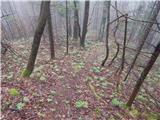 40
40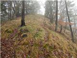 41
41 42
42
Discussion about the trip Spodnja postaja žičnice na Krvavec - Skutman (via Kopa)
To post a comment you must log in:
If you do not yet have a username, you must first
register.