 | Vidrga - Zasavska Sveta gora (on forest footpath)
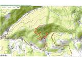
Zasavska Sveta Gora is a popular excursion destination located between Litija and Izlake. From the summit, where the parish church of the Nativit...
1 h 30 min |
| Vidrga - Zasavska Sveta gora (on a cart track)
Zasavska Sveta Gora is a popular excursion destination located between Litija and Izlake. From the summit, where the parish church of the Nativit...
1 h 30 min |
 | Planina - Petričev hrib
Petričev hrib is a peak north of Postojna and west of Planina. From the summit, which has a logbook box, there is a nice view of the Notranjska h...
1 h 30 min |
| Planina (Dolnja Planina) - Petričev hrib (via Zavrtniki)
Petričev hrib is a peak north of Postojna and west of Planina. From the summit, which has a logbook box, there is a nice view of the Notranjska h...
1 h 35 min |
| Planina (Dolnja Planina) - Petričev hrib (via Sv. Duh)
Petričev hrib is a peak north of Postojna and west of Planina. From the summit, which has a logbook box, there is a nice view of the Notranjska h...
1 h 35 min |
 | Gorenje - Gora (Sveti Lovrenc) (gentle path)
Gora, or Sveti Lovrenc, is a peak above Studeno, a village north of Postojna that serves as a suitable starting point for the ascent to this pano...
1 h 45 min |
 | Jablance - Skalica (Bohor) (via Travni laz)
Skalica is a lesser-known peak on the western part of Bohor. From the summit, which has a logbook box, there is a nice view to the south and west...
2 h |
 | Jablance - Veliki Javornik (Bohor) (via Travni laz)
Veliki Javornik, at 1023 meters, is the highest peak of Bohor. Although the summit is unvegetated and there are no higher hills nearby, there is ...
1 h 40 min |
 | Bač - Kršičevec
Kršičevec is a lesser-known mountain located east of Jurišče village in the Pivka basin. From its grassy summit, which has a logbook box with a s...
2 h 15 min |
 | Selca - Miklavška gora (by road)
Miklavška gora is a panoramic hill situated south of Železniki and Selca. From the summit, where the Church of St. Nicholas stands, a beautiful v...
1 h 45 min |
 | Prešnica - Grmada at Slavnik
Grmada is a 1,001-meter-high peak located northwest of Slavnik. The summit hosts a fire watchtower, offering fine views over much of Primorska....
1 h 50 min |
| Povžane - Grmada at Slavnik
Grmada is a 1,001-meter-high peak located northwest of Slavnik. The summit hosts a fire watchtower, offering fine views over much of Primorska....
2 h 15 min |
| Skadanščina - Grmada at Slavnik (via planina Jegno)
Grmada is a 1,001-meter-high peak located northwest of Slavnik. The summit hosts a fire watchtower, offering fine views over much of Primorska....
2 h 15 min |
| Skadanščina - Grmada at Slavnik (via Planina Jegno)
Grmada is a 1,001-meter-high peak located northwest of Slavnik. The summit hosts a fire watchtower, offering fine views over much of Primorska....
2 h 10 min |
 | Podpeč - Grmada on Mala gora
Grmada (also Grmada above Ortnek) is an 887-meter-high peak located above the village of Vrh pri Poljanah in the Mala Gora range. Just a few mete...
1 h 35 min |
 | Preddvor - Štefanja gora (on footpath)
Štefanja gora, where the Church of St. Stephen stands, is located above Cerklje na Gorenjskem. Just a few tens of meters below the summit lies th...
1 h 20 min |
 | Poljana - Smolnik
Smolnik is a steep 1075-meter-high peak a solitary summit below Valvasorjev dom hut rising above the Zavrh (Završnica) valley, with views of St...
1 h 15 min |
 | Smrečje - Goli vrh
Goli vrh (also Golni vrh on maps) is an indistinct, forest-covered peak above the dispersed settlement of Goli Vrh. There is no view from the sum...
1 h 30 min |
 | Bohinjska Češnjica - Rudnica
Rudnica is a panoramic mountain located between the Lower and Upper Bohinj Valleys. From the summit, where there is a register box with a stamp a...
1 h 30 min |
| Srednja vas (Senožeta) - Rudnica
Rudnica is a panoramic mountain located between the Lower and Upper Bohinj Valleys. From the summit, where there is a register box with a stamp a...
1 h 30 min |
 | Nemilje - Sveti Mohor (Zabrekve)
The Church of St. Mohor is located on a 952 m high hill between Zgornja Besnica and Selci. From the church or its nearby surroundings, there is a...
1 h 20 min |
 | Selca - Sveti Mohor (Zabrekve)
The Church of St. Mohor is located on a 952 m high hill between Zgornja Besnica and Selci. From the church or its nearby surroundings, there is a...
1 h 40 min |
 | Knape - Sveti Mohor (Zabrekve) (via Hudi Laz, Flandrova pot)
The Church of St. Mohor is located on a 952 m high hill between Zgornja Besnica and Selci. From the church or its nearby surroundings, there is a...
1 h 40 min |
 | Nemilje - Sveti Mohor (Zabrekve) (via Prevoje)
The Church of St. Mohor is located on a 952 m high hill between Zgornja Besnica and Selci. From the church or its nearby surroundings, there is a...
1 h 35 min |
 | Brezovica - Sveti Primož in Felicijan (Jamnik)
The Church of St. Primož and Felicijan at Jamnik is located on a scenic grassy ridge rising between Kropa and Podblica. From the church or its ne...
1 h 20 min |
| Češnjica pri Kropi - Sveti Primož in Felicijan (Jamnik) (via Berigla)
The Church of St. Primož and Felicijan at Jamnik is located on a scenic grassy ridge rising between Kropa and Podblica. From the church or its ne...
1 h 20 min |
 | Ribenski most - Tolsti vrh (Talež)
Tolsti vrh is an 883 m high hill located south of Bled, more precisely above the Talež hunting lodge. From the summit, which descends steeply tow...
1 h 15 min |
 | Selski most - Tolsti vrh (Talež)
Tolsti vrh is an 883 m high hill located south of Bled, more precisely above the Talež hunting lodge. From the summit, which descends steeply tow...
1 h 15 min |
 | Trojane - Lipovec
Lipovec is an 848-meter-high peak located above the pastures of Lipovec. On clear days, the summit offers views of the Posavsko hribovje, Kum, Me...
1 h 30 min |
 | Tržič - Veliki vrh above Završnik (Milanova pot)
Veliki vrh above Završnik is a 968 m high mountain located in the Pirmance ridge, north to northeast of Tržič. From the grassy summit, which feat...
1 h 40 min |
 | Tržič (Čegelše) - Veliki vrh above Završnik
Veliki vrh above Završnik is a 968 m high mountain located in the Pirmance ridge, north to northeast of Tržič. From the grassy summit, which feat...
1 h 20 min |
 | Žiri - Javorč
Javorč is a 901-meter-high peak located northeast of Žiri. The summit, featuring a logbox with a logbook, lies at the edge of a larger clearing, ...
1 h 15 min |
 | Blejska Dobrava (cemetery) - Hom at Bled (via Katarina)
Hom is an 834-meter-high hill rising north above the villages of Zasip and Podhom near Bled, or south of the village Blejska Dobrava near Jesenic...
1 h 25 min |
 | Ukova (Jesenice) - Mirca (via Pekova plan'ca)
Mirca (Merca in dialect) is one of the peaks in the southern Karawanks at an elevation of 1025 meters. It rises north above the center of Jesenic...
1 h 20 min |
 | Jeršiče - Baba (at Javorniki)
Baba is a 1,085-meter-high peak located between the Javorniki ridge and Sveta Trojica. From its grassy summit, nice views open up to the Javornik...
1 h 30 min |
 | Možjanca - Kopa (Partizanski vrh)
Kopa, also known as Partizanski vrh, is a 1,024-meter-high mountain located west of the Davovec saddle, which itself lies west to southwest of Kr...
1 h 30 min |
| Kokra (resting place Kokra-sotočje) - Kopa (Partizanski vrh)
Kopa, also known as Partizanski vrh, is a 1,024-meter-high mountain located west of the Davovec saddle, which itself lies west to southwest of Kr...
1 h 45 min |
 | Mežica - Andrejev vrh (by cart track)
Andrejev vrh is a forest-covered peak located between Mežica and Leše. On the summit there is a bench and a summit register box with a logbook....
1 h 15 min |
| Mežica - Andrejev vrh (past the chapel)
Andrejev vrh is a forest-covered peak located between Mežica and Leše. On the summit there is a bench and a summit register box with a logbook....
1 h 20 min |
| Poljana - Andrejev vrh (over Volinjak and on cart track)
Andrejev vrh is a forest-covered peak located between Mežica and Leše. On the summit there is a bench and a summit register box with a logbook....
1 h 50 min |
| Poljana - Andrejev vrh (via Volinjak and past the chapel)
Andrejev vrh is a forest-covered peak located between Mežica and Leše. On the summit there is a bench and a summit register box with a logbook....
1 h 55 min |
| Poljana - Andrejev vrh (past Leše churches and on cart track)
Andrejev vrh is a forest-covered peak located between Mežica and Leše. On the summit there is a bench and a summit register box with a logbook....
1 h 50 min |
| Poljana - Andrejev vrh (via Leše churches and via chapel)
Andrejev vrh is a forest-covered peak located between Mežica and Leše. On the summit there is a bench and a summit register box with a logbook....
1 h 55 min |
| Leše - Andrejev vrh (via Leše churches and via chapel)
Andrejev vrh is a forest-covered peak located between Mežica and Leše. On the summit there is a bench and a summit register box with a logbook....
1 h 35 min |
| Leše - Andrejev vrh (past Leše churches and on cart track)
Andrejev vrh is a forest-covered peak located between Mežica and Leše. On the summit there is a bench and a summit register box with a logbook....
1 h 30 min |
 | Selca - Sleme (Površnica)
Sleme is a panoramic peak located between Rudno, Dražgoše, and Lajše. From the summit, where transmitters are located, there is a nice view of th...
1 h 35 min |
| Železniki - Sleme (Površnica) (via Štalca)
Sleme is a panoramic peak located between Rudno, Dražgoše, and Lajše. From the summit, where transmitters are located, there is a nice view of th...
1 h 35 min |
| Nemilje - Sleme (Površnica) (via Prevoje)
Sleme is a panoramic peak located between Rudno, Dražgoše, and Lajše. From the summit, where transmitters are located, there is a nice view of th...
2 h 5 min |
 | Selca - Sveti Križ above Selca
The Church of the Holy Cross above Selca is situated on a panoramic hill from which a beautiful view opens up over part of the Škofjeloško hribov...
1 h 15 min |
| Železniki - Sveti Križ above Selca (via Štalca)
The Church of the Holy Cross above Selca is situated on a panoramic hill from which a beautiful view opens up over part of the Škofjeloško hribov...
1 h 15 min |
 | Senično - Planica (Paragliding site Gozd) (gentle path)
Planica is a 926-meter peak located above the village of Gozd. From the summit, where the JPK Kriška gora cottage stands, a nice view opens up ov...
1 h 15 min |
| Pristava - Planica (Paragliding site Gozd)
Planica is a 926-meter peak located above the village of Gozd. From the summit, where the JPK Kriška gora cottage stands, a nice view opens up ov...
1 h 20 min |
 | Libeliče - Pokeržnikov vrh
Pokeržnikov vrh is a 1,055-meter-high peak situated above the settlement of Strojna in the Municipality of Ravne na Koroškem. From the summit, wh...
2 h 15 min |
 | Bukovo - Črvov vrh
Črvov Vrh, also known as Črvov Grič, is the highest peak of the Šentviška Planota at 974 metres. The plateau rises above the right bank of the Id...
1 h 30 min |
| Grahovo ob Bači (Brelih) - Črvov vrh (via Žrelo)
Črvov Vrh, also known as Črvov Grič, is the highest peak of the Šentviška Planota at 974 metres. The plateau rises above the right bank of the Id...
1 h 50 min |
| Grahovo ob Bači (Brelih) - Črvov vrh (via homestead Pušnik)
Črvov Vrh, also known as Črvov Grič, is the highest peak of the Šentviška Planota at 974 metres. The plateau rises above the right bank of the Id...
1 h 40 min |
 | Grahovo ob Bači (Brelih) - Bukovski vrh (via Žrelo)
Bukovski Vrh (918 m) lies above the settlement of Bukovski Vrh, more precisely above the Pri Pircu homestead. From the grassy summit there is a f...
1 h 40 min |
 | Podgora - Vrh Slajke
Vrh Slajke is a 790-metre hill above Hotavlje, specifically above the right bank of the Kopačnica. From the summit, where an antenna tower stands...
1 h 25 min |
 | Ledinica - Krog (Ledinski grič)
Krog is a 940-metre-high peak on the western part of the Ledinski grič ridge, between the streams Jerešča and Ledinščicaboth left tributaries of ...
1 h 15 min |
 | Žiri - Krog (Ledinski grič)
Krog is a 940-metre-high peak on the western part of the Ledinski grič ridge, between the streams Jerešča and Ledinščicaboth left tributaries of ...
1 h 50 min |
| Govejk - Krog (Ledinski grič)
Krog is a 940-metre-high peak on the western part of the Ledinski grič ridge, between the streams Jerešča and Ledinščicaboth left tributaries of ...
1 h 45 min |
| Sovodenj - Krog (Ledinski grič)
Krog is a 940-metre-high peak on the western part of the Ledinski grič ridge, between the streams Jerešča and Ledinščicaboth left tributaries of ...
2 h 5 min |
 | Podgora - Špik (Vranškov grič)
Špik (also marked as Vranškov grič on maps) is a 908 m high mountain west of Hotavlje. The summit lies in forest, but a grassy subpeak offers fin...
1 h 45 min |
 | Hotavlje - Kucelj (above Kopačnica) (via village Studor)
Kucelj is a 920-meter-high peak located above the left bank of Kopačnica and the settlement of the same name. At the summit there is a bench, a t...
2 h 10 min |
| Hotavlje - Kucelj (above Kopačnica) (via Srednje Brdo)
Kucelj is a 920-meter-high peak located above the left bank of Kopačnica and the settlement of the same name. At the summit there is a bench, a t...
1 h 55 min |
 | Veliki Boč (Zgornji Kovač) - Možičev vrh (via Žavcarjev vrh)
Možičev vrh is a 926-meter-high peak located west of the more famous but slightly lower Žavcarjev vrh. A cart track leads to the summit, but due ...
1 h 40 min |
 | Veliko Tinje - Repnikov vrh
Repnikov vrh is a 988-meter-high peak on Pohorje, located between Planina pod Šumikom and Urh. The summit is in the middle of the forest, along a...
1 h 25 min |
 | Schrems/Frohnleiten (Hautabauer) - Harterberg (Hoaterberg)
Harterberg, also known as Hoaterberg, is a 1,036 m high hill above the settlement of Schrems/Frohnleiten in the northern part of the Graz Mountai...
2 h |
 | Übelbach - Schankkogel
Schankkogel is, with its 1049 meters, the highest peak of the Notberg hill near the settlement of Guggenbach (close to Übelbach) in Steiermark.Be...
1 h 30 min |
 | Übelbach - Schankkogel (steep path)
Schankkogel is, with its 1049 meters, the highest peak of the Notberg hill near the settlement of Guggenbach (close to Übelbach) in Steiermark.Be...
1 h 30 min |