Breginj - Punta di Montemaggiore
Starting point: Breginj (550 m)
| Latitude/Longitude: | 46,26200°N 13,42590°E |
| |
Walking time: 5 h
Difficulty: partly demanding marked way
Elevation gain: 1063 m
Elevation difference along the route: 1300 m
Map: Julijske Alpe - zahodni del 1:50.000
Recommended equipment (summer):
Recommended equipment (winter): ice axe, crampons
Views: 10.432
 | 2 people like this post |
Access to starting point:
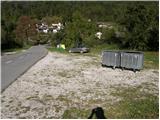
First, we drive to the center of Kobarid, then continue driving towards the Robič border crossing. Near the village of Staro Selo, we leave the main road leading to the Robič border crossing and continue right towards Breginj. We follow the mainly ascending road to Breginj, where we park on the parking lot near the church.
Route description:
From the parking lot, we continue past the church (bypassing it on the right side) and continue the ascent on the asphalted road towards Stol and Muzca. The road first ascends through the village, and we follow it at intersections in the known direction. Higher up, the road loses its asphalt surface and takes us past an old mill to a marked intersection, where we continue slightly right (left Church of Mary of the Snows). The road, which continues to ascend moderately, soon brings us to a marked junction, where a marked hiking trail to Muzec (Musc) branches left.
We head onto the mentioned trail, which ascends moderately through the forest. Further on, the trail takes us to a small spring (source of drinking water), then turns slightly left and begins to ascend more steeply. Higher up, the trail levels out and brings us to a small junction, where we continue right (straight Plazi). The trail then begins to ascend steeply again through the forest, taking us to a sharp and crumbly ridge. An exposed path leads over this ridge, which we cross in a few minutes into the forest belt. When we exit the forest, the trail takes us to grassy slopes, where after a few minutes of further walking we reach a marked junction.
We continue left (slightly right Klatnica - drinking water spring) on an increasingly steep mountain path. Higher up, the path moves onto an exposed and very steep side ridge, which we ascend for quite some time. Higher up, we reach a small unmarked junction, where we continue on the left less steep path (right extremely steep path leads directly to Muzec). The left path then ascends transversely and takes us past a small chasm to the main ridge of Muzcev. Here we continue left (right Muzec) and after a few dozen steps of further walking, we reach the bivouac under Muzec.
From the bivouac, we continue west along the scenic ridge path, which gradually becomes steeper. We follow this increasingly scenic path, which is quite steep in the upper part, all the way to the summit of Gabrovec, which we reach after 15 minutes of further walking.
From the summit, we continue along the ridge westwards and first descend a bit. There follow some short ascents over a few indistinct summits. Later, we move to the right side of the ridge from a smaller grassy summit and then cross the slope under the summit through the forest. When we emerge from the forest, there follows a crossing of a short somewhat steeper slope, then we ascend more steeply along the ridge. After a few more short ascents along the ridge, the trail takes us to an indistinct grassy summit Nad Ohojami.
From the summit, we continue along the ridge where we descend a bit again. The path moves away from the steeper parts of the ridge to the northern forested side and then crosses the slopes westwards. Such a path takes us past the indistinct summit Nizki vrh to a marked junction. Left downwards leads the path through Plazi, we continue straight along the ridge following the signs “Br. Jalovec 1h”. The path continues along the ridge and occasionally through the forest on the northern side of the ridge. There follows a short ascent along the ridge, which takes us to the grassy summit Gnjilica.
From the summit, we continue west and after the descent, the path takes us back into the forest. After crossing through the forest, we reach a grassy ridge again, which is already on the Italian side of the border. From here, we have only a few steps to a marked junction.
At the junction, we continue straight along the ridge, right leads the path to the saddle Tanamea / Tam na meji, left downwards to the village Brezje.
We therefore continue straight along the scenic grassy ridge westwards. The ridge becomes somewhat narrower in the last part and there follows only a short somewhat steeper ascent to the summit of Breški Jalovec.

Photos:
 1
1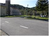 2
2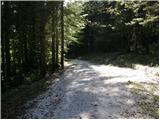 3
3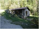 4
4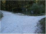 5
5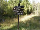 6
6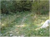 7
7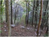 8
8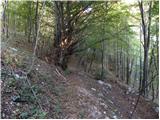 9
9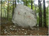 10
10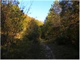 11
11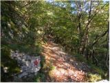 12
12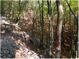 13
13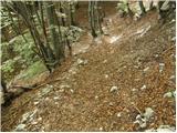 14
14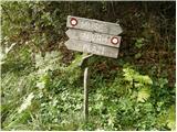 15
15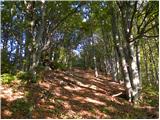 16
16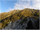 17
17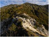 18
18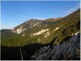 19
19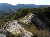 20
20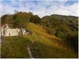 21
21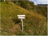 22
22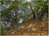 23
23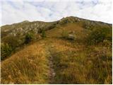 24
24 25
25 26
26 27
27 28
28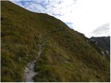 29
29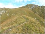 30
30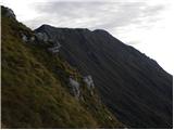 31
31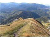 32
32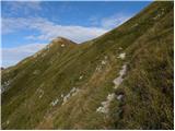 33
33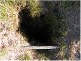 34
34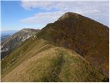 35
35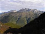 36
36 37
37 38
38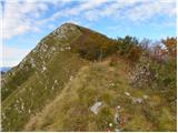 39
39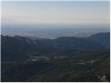 40
40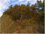 41
41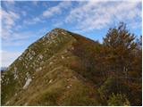 42
42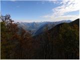 43
43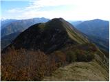 44
44 45
45 46
46 47
47 48
48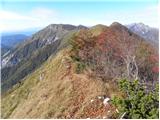 49
49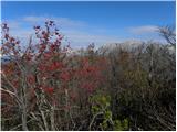 50
50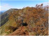 51
51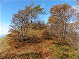 52
52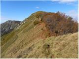 53
53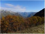 54
54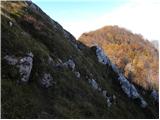 55
55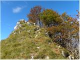 56
56 57
57 58
58 59
59 60
60 61
61 62
62 63
63 64
64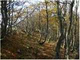 65
65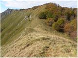 66
66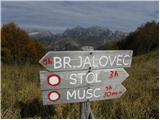 67
67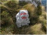 68
68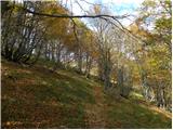 69
69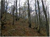 70
70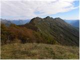 71
71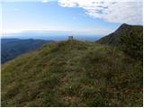 72
72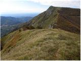 73
73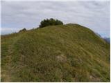 74
74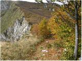 75
75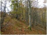 76
76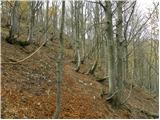 77
77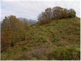 78
78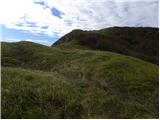 79
79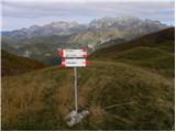 80
80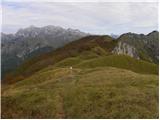 81
81 82
82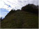 83
83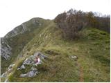 84
84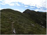 85
85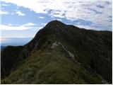 86
86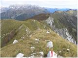 87
87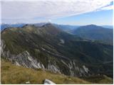 88
88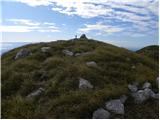 89
89 90
90 91
91
Discussion about the trip Breginj - Punta di Montemaggiore
|
| darinka45. 05. 2019 |
Has anyone hiked from Breginj? Can you arrive in less than five hours? Is the walking time realistic?
|
|
|
|
| darinka421. 06. 2019 |
Yesterday we hiked this tour, but in reverse order. From Breginj to Nizki vrh and then to Breški Jalovec. It took us 4 hours 35 min. We continued along the ridge to V. Muzec. But the times on the signboard didn't match our path at all, because this ridge one is quite demanding and I think we took more than two hours to Muzec. It says half less. The little path is poorly visible. Few people go here.
|
|
|
|
| ločanka22. 06. 2019 |
I also checked on the rest of the Stol ridge that the estimated times on the signs are quite exaggerated, more for runners
|
|
|
|
| turbo22. 06. 2019 |
You know that one: "How much further to the top?" Depends how fast you step. 
|
|
|
|
| ločanka22. 06. 2019 |
Yes, but it's not meant for racing
|
|
|
|
| darinka422. 06. 2019 |
And something else is interesting. From Breški Jalovec you cross quite a few peaks. Before you reach V. Muzec. Not all are like it. When you already think it's the right one, you find out there's still quite a way to go, even through scree. That's how it is when you go the first time.
|
|
|
|
| darinka47. 02. 2021 |
I really hope we manage the summer ascent to Breški Jalovec from Breginj. But in better weather than two years ago. Because there were no views from the top. We traversed the ridge in poor visibility and rain from the bivouac under Muzec to the starting point.
|
|
|
|
| darinka421. 04. 2022 08:03:12 |
Yesterday's ascent from Breginj to Nizki vrh and continuation to Breški Jalovec was in wind, sun and snow. At the top there were two Italian hikers. Otherwise no one anywhere on the path. We continued along the ridge to the bivouac below Muzec and descended to Breginj.
|
|
|
|
| bo_zl1. 05. 2025 21:28:54 |
Me too today on the path from Breginj to Nizki vrh, then to Breški Jalovec (4 hours), then on the way back along the ridge all the way to Mali Muzec (3 hours) and descent from the bivouac to Breginj (2 hours). Peace and solitude guaranteed, only three visitors on Breški Jalovec, otherwise no living souls anywhere.
|
|
|
|
| darinka47. 10. 2025 18:34:49 |
Has anyone hiked to Breški Jalovec from Tamnameji? Last time we saw a sign there by the road.
|
|
|
|
| darinka48. 10. 2025 20:12:48 |
Thanks to Simon and Bojan.
|
|
|
|
| ločanka9. 10. 2025 07:38:52 |
Darinka, about a week ago they rescued two Italian hikers there, who got lost above a steep torrent during descent and couldn't get themselves out.
|
|
|
|
| darinka49. 10. 2025 08:14:20 |
Yes, many unpredictable things happen, especially when you don't know the terrain. I won't forget the descent from Ušja, when we got stuck around 3 pm on pathless terrain. Wherever we tried to go, we reached sheer cliffs. Then we somehow managed to find a hunting trail. We arrived at the starting point in the dark. It's good to have flashlights with you, even if you don't think you'll be searching for passages.
|
|
|
To post a comment you must log in:
If you do not yet have a username, you must first
register.