Bresternica (Šiker) - Koča na Žavcarjevem vrhu (zaprta pot!)
Starting point: Bresternica (Šiker) (456 m)
Route name: zaprta pot!
Walking time: 1 h 50 min
Difficulty: easy marked way
Elevation gain: 407 m
Elevation difference along the route: 450 m
Map: Pohorje 1:50.000
Recommended equipment (summer):
Recommended equipment (winter):
Views: 8.196
 | 2 people like this post |
Access to starting point:
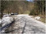
From the road Maribor - Dravograd, we will, in the settlement Bresternica (on maps Brestrnica), notice signs for the village Gaj, which point us to the right (from the direction Dravograd, left). After a few meters, at a poorly marked crossroad, we continue left and follow the road which leads us through the village to the chapel, where we continue left. The mostly ascending road brings us higher to a crossroad by which we notice mountain signposts for Tojzlov vrh. Here, we continue left and follow the road which continues gradually ascending to the road sign 7.5 km. Only a few meters before the mentioned sign we will notice by the road a parking lot and hiking signposts.
Route description:
A warning! Due to passage through private property, the path is no longer passable and is closed. Data from the year 2024.
From the parking lot, we return a few meters back, cross a small bridge, and then proceed on a footpath in the direction of Žavcarjev vrh. The marked path which runs on a cart track soon goes into the forest, where it then moderately ascends. Higher, the cart track turns to the left, comes out of the forest and only a little after that brings us to a hamlet with a few houses.
We for some time continue the ascent on the road, and then blazes point us to the left on a footpath which ascends by the edge of the forest. The path soon goes into the forest, where we soon come to the chapel, where the path turns a little towards the left. Further, we ascend on at first a gently sloping path, which higher ascends a little more steeply and then brings us to a forest road which we only cross (right Sveti Duh na Ostrem vrhu).
We continue in the direction of Žavcarjev vrh on the path which continues with some shorter ascents and descents. The path from which occasionally a view opens up soon brings us to a forest road which we then follow to the mountain hut.

Photos:
 1
1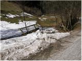 2
2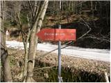 3
3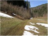 4
4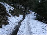 5
5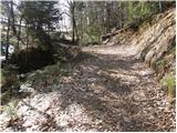 6
6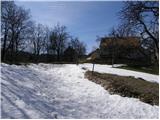 7
7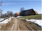 8
8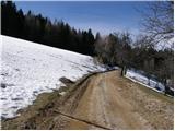 9
9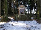 10
10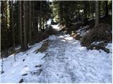 11
11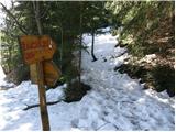 12
12 13
13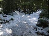 14
14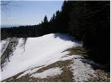 15
15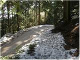 16
16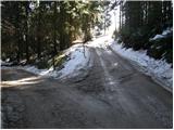 17
17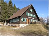 18
18
Discussion about the trip Bresternica (Šiker) - Koča na Žavcarjevem vrhu (zaprta pot!)
|
| Mašika17. 05. 2025 19:35:23 |
This path is blocked under the houses in picture no.7, i.e. an electric fence is strung across the path and a sign stating it is private property is posted. There are no more direction signs at the starting point either.
|
|
|
To post a comment you must log in:
If you do not yet have a username, you must first
register.