Bresternica (Šiker) - Tojzlov vrh
Starting point: Bresternica (Šiker) (456 m)
Walking time: 50 min
Difficulty: easy marked way
Elevation gain: 247 m
Elevation difference along the route: 247 m
Map: Pohorje 1:50.000
Recommended equipment (summer):
Recommended equipment (winter):
Views: 16.551
 | 1 person like this post |
Access to starting point:
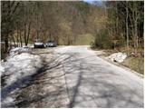
From the road Maribor - Dravograd, in the settlement Bresternica (on maps Brestrnica) we will notice signs for the village Gaj, which direct us to the right (from the direction of Dravograd, to the left). After a few meters, at a poorly marked junction, we continue left and follow the road which leads us through the village to the chapel, where we continue left. The mostly ascending road brings us higher to a junction by which we notice mountain signposts for Tojzlov vrh. Here, we continue left and follow the road for approximately 1 km to the next mountain signposts (this time for Žavcarjev vrh) by which we park on one of the smaller parking lots by the road.
Route description:
From the parking lot, we head onto the macadam road in the direction of Tojzlov vrh and hunting lodge. After 5 minutes of gentle walking on the road we come to the hunting cottage, where the path turns sharply left and changes from the road into a cart track.
We continue the ascent on the mentioned cart track, which becomes steeper and steeper as it ascends through the forest. The path brings us higher out of the forest, where it then continues along its slopes. In moderate ascent along the edge of the forest, the path brings us to the road.
We can continue the ascent on the marked road, or on the parallel cart track. In both cases, after a few minutes of additional walking, we will come to the mountain hut.
From the hut, we continue on the cart track, which slightly ascends and after a few steps goes into the forest. We follow this gently sloping path all the way to Tojzlov vrh, which we reach after less than 5 minutes of additional walking.
Photos:
 1
1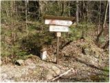 2
2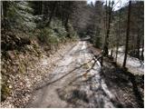 3
3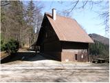 4
4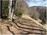 5
5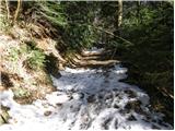 6
6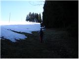 7
7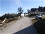 8
8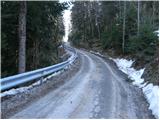 9
9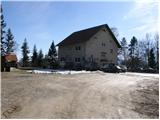 10
10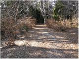 11
11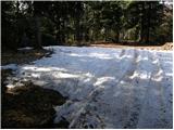 12
12 13
13
Discussion about the trip Bresternica (Šiker) - Tojzlov vrh
|
| godlike5. 06. 2011 |
I would like to point out that the path does not start at the first signs for Žavcarjev vrh, but at the second signs.
|
|
|
|
| flandrijec30. 08. 2015 |
Those markers are right after the Žavcarjev vrh markers further at the red bridge to the right. Now the marker for - Dremljeva pot to Tojzlov vrh - is covered with branches and barely visible. Otherwise the path through the forest and along the top of the slope is beautiful with a very nice view of the slopes of Kozjak and other hills in NE Slovenia. Today was a beautiful day for a family short hike with a very nice view at the top of the slope by the chapel... about 10 min. below the summit. At the summit pleasant service with new caretakers - a young family that showed great interest in reviving the currently lonely summit.
|
|
|
|
| planika7729. 11. 2015 |
Yes, these new caretakers are really great, friendly and very good food! 
|
|
|
To post a comment you must log in:
If you do not yet have a username, you must first
register.