Brezje pri Tržiču - Dobrča (via koča na Dobrči)
Starting point: Brezje pri Tržiču (677 m)
| Latitude/Longitude: | 46,35890°N 14,27870°E |
| |
Route name: via koča na Dobrči
Walking time: 3 h
Difficulty: easy marked way
Elevation gain: 957 m
Elevation difference along the route: 1000 m
Map: Karavanke - osrednji del 1:50.000
Recommended equipment (summer):
Recommended equipment (winter):
Views: 28.983
 | 2 people like this post |
Access to starting point:
From the Ljubljana–Jesenice highway, take the Ljubelj exit and follow the road ahead towards Tržič. Just before the gas station at Tržič, turn right (direction Tržič) and then immediately left (direction Begunje) and drive on to the village Brezje pri Tržiču, where we park in the parking lot near the church.
Route description:
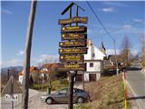
From the parking lot, we continue on the road towards Begunje, but only to the spot where it starts descending. Here the road which leads to the mountain pasture Bistriška planina branches off to the right (by the crossroad there are also signposts for Dobrča), we walk along it only for a few minutes, and then at the crossroad we go left in the direction of Dobrča (right road leads to the mountain pasture Bistriška planina).
From the crossroad ahead we continue on a somewhat rougher road, on which we walk approximately 1 minute, and then blazes lead us to the right on a footpath which continues along the fence. For some time we moderately ascend along the fence, and then after approximately 20 minutes of walking from the starting point we arrive at a wide but steep cart track. On the cart track we ascend to a somewhat thinner forest, where blazes direct us sharply right upward. Further we ascend steeply through the forest and after 15 minutes of additional walking we arrive at an abandoned watering place for animals. Here the path turns to the left and ascends gently below the indistinct peak Vaško. A little further we arrive at a smaller saddle between the already mentioned peak on the right and the slopes of Dobrča on the left.
Next follows a short ascent and the path brings us to the spot where we cross the nearby forest road (we cross the road right at the spot where it ends). Further we ascend for some time on a wide and forested ridge, on which we walk all the way to the paragliding take-off point, which is located on the southern slopes of Dobrča.
Here a wide path branches off to the right, which continues towards the mountain pastures Lešanska and Bistriška planina, and we continue straight and at first walk along the edge of the forest. Quickly we return into the forest and then ascend relatively steeply in switchbacks. At an altitude of approximately 1400 meters above sea level we arrive at a cart track, which we only cross, then only a little higher we arrive at a marked junction, where the path from Lešanska planina joins from the right, straight ahead the path continues towards the summit Dobrča, and we continue left in the direction of the mountain hut Koča na Dobrči. Next follows a short descent and the path returns to the previously mentioned cart track (the cart track which we only crossed), on which we walk only for a short time, since then blazes lead us a little to the left. Further without major changes in elevation we cross the slopes of Dobrča towards the west, and then we step out of the forest onto the panoramic mountain pasture Podgorska planina.
From the mountain pasture, from which we already see the mountain hut Koča na Dobrči, we first slightly descend and then ascend to the nearby mountain hut.
Near the mountain hut Koča na Dobrči signs for the peak Dobrča direct us onto the forest road, on which we start slightly descending towards the north. After a short descent we notice signposts which direct us right to Podgorska planina, whose cottages we bypass on the right side. Next we ascend over a panoramic grassy slope, and then the path enters initially sparse, higher up increasingly dense forest. When the steepness eases, two paths join us from the right, and we continue straight in both cases. The path ahead rises more steeply again and after a few minutes of additional walking brings us to the summit of Dobrča.

The trip can be extended to the following destinations: Šentanski vrh
Photos:
 1
1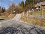 2
2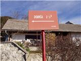 3
3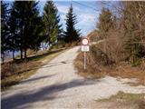 4
4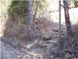 5
5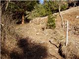 6
6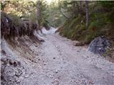 7
7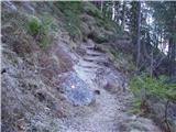 8
8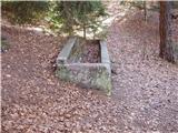 9
9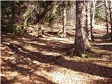 10
10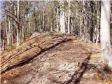 11
11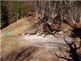 12
12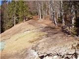 13
13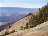 14
14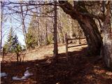 15
15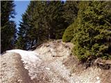 16
16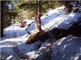 17
17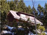 18
18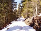 19
19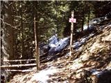 20
20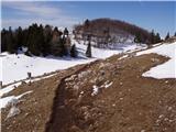 21
21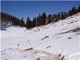 22
22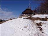 23
23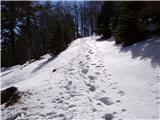 24
24 25
25 26
26 27
27 28
28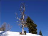 29
29 30
30 31
31
Discussion about the trip Brezje pri Tržiču - Dobrča (via koča na Dobrči)
|
| andrej jerina27. 09. 2008 |
Today my son Jošt and I did the mentioned trail. The trail description is very nicely written. It was quite windy at the top, also cloudy, so no views, but definitely a nice conditioning hike. We extended the trail to Šentanski vrh, where light snowfall greeted us. Best regards Andrej and Jošt
|
|
|
|
| majamaja9. 04. 2009 |
Question for regular visitors of Dobrča (I'm planning my first visit ) ... how much snow is there currently on the path, does it greatly hinder walking (sinking etc.)? ) ... how much snow is there currently on the path, does it greatly hinder walking (sinking etc.)?
Thanks in advance to whoever replies!
best
Maja
|
|
|
|
| anč9. 04. 2009 |
On Saturday I was on Dobrča. Snow starts approx. 100 meters before the hut, wet and sinking. Otherwise super.
|
|
|
|
| lan9. 04. 2009 |
On Dobrča I was yesterday, snow has mostly melted since Saturday, so (if going from Hibja I can tell you) still some under the hut in the last steep forest section here and there a bit, and that will surely be gone by Saturday. Recommend visit, great view.
|
|
|
|
| urskaa17. 05. 2009 |
We were on Dobrča today, great trip, very nice path, not strenuous to walk, great views, lots of flowers, highly recommend-SUPER!!!
|
|
|
|
| Brinova_Sara14. 08. 2009 |
Hi! Just one question - is the path properly marked, or do you need to switch on some "special navigation systems"?
Thanks
Sara
|
|
|
|
| Bojan_A14. 08. 2009 |
The path is well marked. Perhaps the path is least visible from Koča na Dobrči across the meadow to the top of Dobrča. In the forest, however, the path is crossed by mountain running shortcuts.
They have just slightly repaired it.
|
|
|
|
| Bojan_A14. 08. 2009 |
No need to park at Sv. Neža, but at the intersection of the road towards Bistriška planina.
In Koča na Dobrči there is now a logbook for mountain runners and cyclists -"Kampeljce".
As for mountain running training, this mountain is excellent because it has almost a ton of elevation gain. The descent is fast due to the good path. And the mountain is very safe and can be visited practically in any weather.
I recommend it to runners and beginner hikers.
And also to avoid the highway to the top via hunting paths and enjoy the alpine flowers, of which there are plenty here.
|
|
|
|
| wolphgang10. 10. 2011 |
can someone tell me what it means on the pzs website, the info that the hut on Dobrča is open? does that mean every day or what? thanks
|
|
|
|
| robter10. 10. 2011 |
wolphgang, check the website www.dobrca.net there you have the contact and ask the hut warden
|
|
|
To post a comment you must log in:
If you do not yet have a username, you must first
register.