Brinje - Planica (via Vrse)
Starting point: Brinje (1040 m)
| Latitude/Longitude: | 46,47490°N 13,95660°E |
| |
Route name: via Vrse
Walking time: 1 h 45 min
Difficulty: partly demanding unmarked way
Elevation gain: 468 m
Elevation difference along the route: 500 m
Map: Kranjska Gora 1:30.000
Recommended equipment (summer):
Recommended equipment (winter): ice axe, crampons
Views: 8.297
 | 5 people like this post |
Access to starting point:
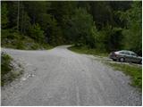
We leave the Gorenjska highway at exit Jesenice - west (Hrušica) and continue driving towards Kranjska Gora. After approximately 5 km of driving from the spot when we left the highway, signs for Dovje point us to the right. We drive into the mentioned settlement, through which we follow the signs for Kepa and Dovška Baba. Soon above Dovje the asphalt ends, and the road only about 100 meters ahead brings us to the marked crossroads, where signs for Kepa point us sharply left (straight Dovška Baba). Ahead we drive for quite some time, and in doing so "we ignore" all smaller crossroads. Higher, we arrive at a somewhat larger crossroads, where a road branches off to the left towards Rovt Vrse, and straight the road continues towards Erjavčev rovt (signs by the road for Kepa). We park on the parking lot by the mentioned crossroads, or we can also continue driving on the left road for some time.
Route description:
From the parking lot, we head onto the left road, which first starts to ascend moderately, then flattens completely and crosses the slopes to the left. The road, from which nice views of the Julian Alps occasionally open up, brings us after approximately 15 to 20 minutes to the spot where we will notice a smaller cairn on the right side, from which a footpath branches off that leads to Borovje (Borovje along the ridge).
We continue straight and follow the road for a few more minutes, then only about 100 m above the sharp right turn, we notice a wide cart track that turns right from the road. We head onto the mentioned cart track, which is also indicated by an arrow on a nearby tree. The path ahead quickly takes us out of the forest, and along the edge of the forest, we ascend to the cottages on Rovt Vrse.
Here we continue straight, i.e., along the left side of both cottages, where above the meadow we notice a somewhat poorly trodden footpath that higher turns into a cart track, which ascends through initially sparse forest. The cart track soon ends, and we continue the ascent first along the torrent gully, higher the footpath enters the gully, which is no longer so pronounced. Along the mentioned gully, we ascend to the saddle between Planica on the left and Borovje on the right in a few minutes.
When we reach the saddle, we continue sharply left upwards (left Kepa via Kurejeke, straight downwards Erjavčev rovt via pathless terrain (very demanding), right Borovje) along the path that begins to ascend along the side ridge. For a short time we ascend along the mentioned ridge, then the path turns slightly left and brings us to the main ridge of Planica. Here we continue left and proceed with the ascent on and along the ridge, from which views towards Kepa and surrounding peaks initially open up only rarely. Somewhat higher, the path flattens and moves to the left side of the ridge, where it occasionally crosses a few panoramic slopes. Higher, the path returns to the ridge, which narrows and becomes exposed in places. After crossing the exposed ridge, the path temporarily returns to the forest, then in a gentle descent crosses another slightly exposed gully. A short steep ascent follows, and the increasingly panoramic path brings us to the summit of Planica.

Photos:
 1
1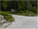 2
2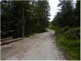 3
3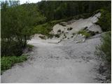 4
4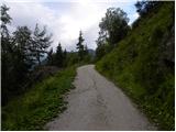 5
5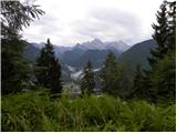 6
6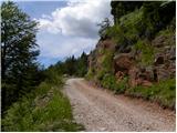 7
7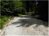 8
8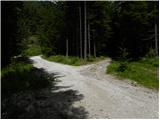 9
9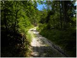 10
10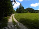 11
11 12
12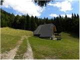 13
13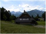 14
14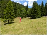 15
15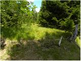 16
16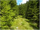 17
17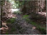 18
18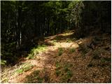 19
19 20
20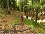 21
21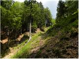 22
22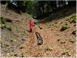 23
23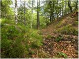 24
24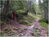 25
25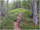 26
26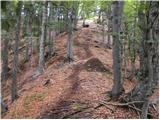 27
27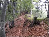 28
28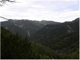 29
29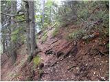 30
30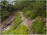 31
31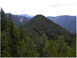 32
32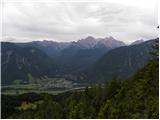 33
33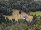 34
34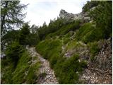 35
35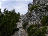 36
36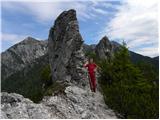 37
37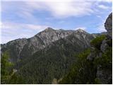 38
38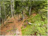 39
39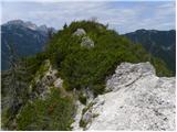 40
40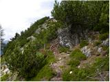 41
41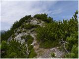 42
42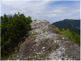 43
43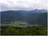 44
44
Discussion about the trip Brinje - Planica (via Vrse)
|
| krošelj15. 04. 2007 |
Nicer view than from Borovje.
I recommend visiting both peaks (Borovje and
Planica) at once.
If the path is bare and dry there are no problems, nevertheless be careful below the peaks.
|
|
|
|
| Gost16. 04. 2007 |
I think from Borovje there are beautiful views, wonderfully romantic ramble.
|
|
|
|
| Gost24. 05. 2007 |
Beautiful solitary path with a very nice view. On one side you observe hikers on Kepa, on the other side the Julian Alps, below you see cars driving on the road.
|
|
|
|
| Biser gora15. 03. 2008 |
Planica and Borovje also surprised me with a nice view. One doesn't expect such a view from a hill outside the main Karavanke chain, but you get it anyway. Excellent
|
|
|
|
| grega_p27. 11. 2009 |
Right below the summit, just watch your step and sensible orientation, as the path is quite dispersed. In any case, you'll reach the highest point, but not through the bushes in the fog like I did today. Unfortunately no view.
|
|
|
|
| heinz27. 11. 2009 |
Is it sensible to take a dog with you?
A while ago we were already at Borovje..
Thanks for the opinion!
|
|
|
|
| Tadej27. 11. 2009 |
There are some short steep sections on the path where the dog might have some trouble. Otherwise, the path is not overly difficult.
|
|
|
|
| grega_p27. 11. 2009 |
True, but I think Heinz (judging by the pictures), your cocker spaniel already has a decent mountaineering resume..
|
|
|
|
| Darxta7. 10. 2013 |
I would also point out that you need to be a bit more careful on the descent back to the saddle, because if you follow the ridge, you end up on the path towards Kepa via Kurejeke - just like I did this weekend  You need to remember where you stepped from the side onto the main ridge, and on the return follow that path. You need to remember where you stepped from the side onto the main ridge, and on the return follow that path.
|
|
|
To post a comment you must log in:
If you do not yet have a username, you must first
register.