Bučan - Koča na Ljubelju (by road)
Starting point: Bučan (1010 m)
| Latitude/Longitude: | 46,44630°N 14,25640°E |
| |
Route name: by road
Walking time: 1 h
Difficulty: easy marked way
Elevation gain: 360 m
Elevation difference along the route: 360 m
Map: Karavanke - osrednji del 1:50.000
Recommended equipment (summer):
Recommended equipment (winter): ice axe, crampons
Views: 10.496
 | 1 person like this post |
Access to starting point:
From the highway Ljubljana - Jesenice we go to the exit Ljubelj (Tržič), and then we continue driving in the direction of Celovec / Klagenfurt. After the Ljubelj tunnel the road starts descending, and on the Austrian side we follow it to the first left turn, where the old Ljubelj road branches off to the right. We park at an appropriate place by the junction, or we can also park higher on the Austrian side of the former border crossing Ljubelj.
Route description:
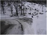
From the starting point, we head onto the old Ljubelj road, which is closed to public traffic by a traffic sign. The road first climbs moderately through two hairpin turns, then continues along the stream to the ruins of the former church of St. Lenart, by which stands a somewhat larger sign. Here the road turns left and gradually distances itself from the valley. From the road, fine views then start opening up onto Palec and other surrounding peaks. The road further leads past a smaller junction, where we continue sharply right along the "main" road, then in a moderate ascent cross steep slopes (danger of falling rocks, or in winter snow avalanches and slips). Higher, the road makes a few more hairpin turns, then brings us to a marked junction, where a marked footpath branches off to the left towards Košutica / Loibler Baba. We continue along the wider road and in 10 minutes of further walking arrive at the old border crossing, behind which stands the Koča na Ljubelju.

Along the route: Šent Lenart (1119m)
The trip can be extended to the following destinations: Žerjavov Praprotnik / Loibler Prapotnik,
Polna peč ( 30 min),
Dom na Zelenici (2 h 5 min),
Planina Korošica,
Hajnževo sedlo,
Vrh Ljubeljščice (Triangel) (1 h 45 min),
Hajnžev Praprotnik / Zeller Prapotnik,
Lokovnikov Grintovec / Grintoutz (1 h 45 min),
Ferlacher Horn / Grlovec,
Loibler Baba/Košutica (1 h 45 min),
Veliki vrh (Košuta)
Photos:
 1
1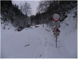 2
2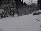 3
3 4
4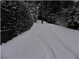 5
5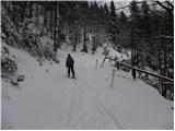 6
6 7
7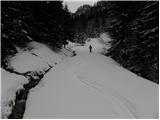 8
8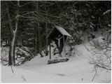 9
9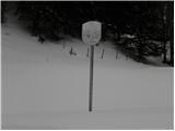 10
10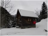 11
11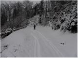 12
12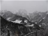 13
13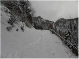 14
14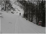 15
15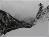 16
16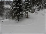 17
17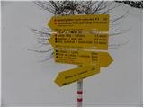 18
18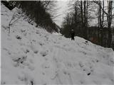 19
19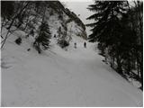 20
20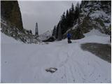 21
21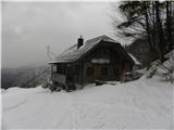 22
22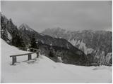 23
23
Discussion about the trip Bučan - Koča na Ljubelju (by road)
To post a comment you must log in:
If you do not yet have a username, you must first
register.