Bukovnik - Velika Raduha (climbing way)
Starting point: Bukovnik (1327 m)
| Latitude/Longitude: | 46,43400°N 14,73710°E |
| |
Route name: climbing way
Walking time: 2 h 25 min
Difficulty: very difficult marked way
Elevation gain: 735 m
Elevation difference along the route: 755 m
Map: Kamniške in Savinjske Alpe 1:50.000
Recommended equipment (summer): helmet, self belay set
Recommended equipment (winter): helmet, self belay set, ice axe, crampons
Views: 139.672
 | 6 people like this post |
Access to starting point:
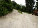
A) We drive to Luče (to here from Mozirje or from Kamnik over the mountain pass Volovljek (Kranjski Rak)), and then we continue driving towards Logarska dolina. In the village Solčava we leave the main road towards Logarska dolina and continue driving right in the direction of Podolševa, the mountain pass Spodnje Sleme and Črna na Koroškem. Further, the road loses the asphalt covering, and after a few kilometers at the crossroad in Podolševa we turn right towards Črna na Koroškem. The road, which further mainly ascends transversely, brings us after some time to the mountain pass Spodnje Sleme. Here we turn right in the direction of the mountain hut Koča na Grohatu and the farm Bukovnik (the farm Bukovnik is located at an altitude of 1327 meters and is considered the highest-lying farm in Slovenia) and continue the ascent on a macadam road, which a few hundred meters higher brings us to the next crossroad. At the mentioned crossroad, a forest road closed to public traffic branches off slightly to the left, which leads towards Koča na Grohatu, and straight ahead the road continues towards the aforementioned farm. We park at an appropriate place near the crossroad.
B) We drive to Črna na Koroškem (to here from Ravne na Koroškem or from Šoštanj over the mountain pass Spodnje Sleme), and then we continue driving towards Luče. Initially still an asphalt road, higher it becomes macadam and brings us to the crossroad of several roads at the mountain pass Spodnje Sleme. Here we turn left in the direction of Koča na Grohatu and the farm Bukovnik (the farm Bukovnik is located at an altitude of 1327 meters and is considered the highest-lying farm in Slovenia) and continue the ascent on a macadam road, which a few hundred meters higher brings us to the next crossroad. At the mentioned crossroad, a forest road closed to public traffic branches off slightly to the left, which leads towards Koča na Grohatu, and straight ahead the road continues towards the aforementioned farm. We park at an appropriate place near the crossroad.
Route description:
From the starting point we head onto the upper left road (the lower road leads towards the farm Bukovnik), which leads us only a few tens of meters ahead over a barrier. A little after the barrier, which prevents further driving, we arrive at the spot where the blazes lead us left onto a marked footpath, which initially ascends somewhat more steeply, then quickly flattens. The path further slightly ascends towards the south, thereby crossing a large number of gullies and some steeper slopes. At a few places wooden bridges assist us, and on one section even a steel cable (undemanding). After approximately half an hour of walking we step out of the forest and the path brings us to a forest road, which then leads us across the alpine pasture Grohat. From here only a few steps of gentle ascent follow, and the path, from which a nice view opens onto the northern slopes of Raduha, quickly brings us to the Koča na Grohatu.
From the hut we continue on the marked path in the direction of Raduha. The path first leads us across pastures to the nearby shepherds' huts, where we turn left. From here the path begins to ascend somewhat more steeply, then brings us in a few minutes to a marked junction, where we continue right in the direction of the very demanding path to Raduha (left the path over Durce).
Further the path ascends through sparse forest and soon turns somewhat to the left, where it crosses steep slopes below Mala Raduha. A little further the path turns left again and brings us to the first steel cables. The well-secured path across the northern wall of Raduha further first leads on the left side of the steep gully, crosses it higher up, then follows a somewhat exposed but well-secured ascent towards the ridge of Raduha. Higher the path flattens and brings us to the ridge, where we join the path over Durce and the path from Koča na Loki pod Raduho.
At the junction we continue right and in a few minutes of moderate ascent reach the panoramic summit.
We can descend via the easier path over Durce.
Bukovnik - Koča na Grohatu 40 minutes, Koča na Grohatu - Raduha 1:45.

Photos:
 1
1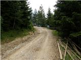 2
2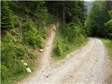 3
3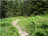 4
4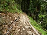 5
5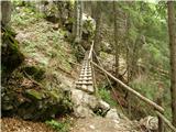 6
6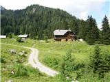 7
7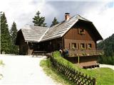 8
8 9
9 10
10 11
11 12
12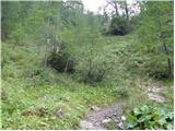 13
13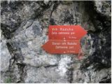 14
14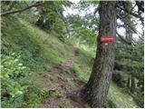 15
15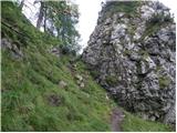 16
16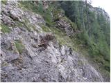 17
17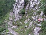 18
18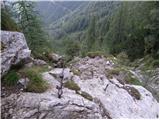 19
19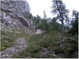 20
20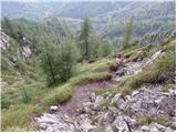 21
21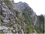 22
22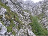 23
23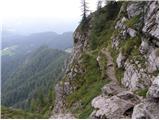 24
24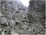 25
25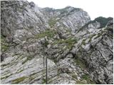 26
26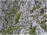 27
27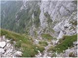 28
28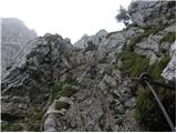 29
29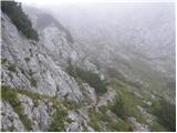 30
30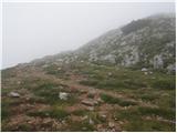 31
31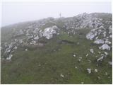 32
32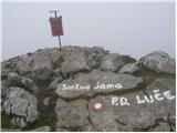 33
33
Discussion about the trip Bukovnik - Velika Raduha (climbing way)
Show older messages
|
| Gost27. 08. 2007 |
The climbing route is exposed and quite demanding in the middle section. Difficulty comparable to the Slovenian route on Mangart or Skuta via Streža, though shorter. Over the short wall some free climbing is needed.
|
|
|
|
| Gost27. 08. 2007 |
In my opinion, this trail is much easier than the Slovenska on Mangart. Of course, I still classify it as very demanding, but nowhere is it so exposed, and besides, it is well secured.
|
|
|
|
| Gost24. 10. 2007 |
Very nice is the path over Lanez to the top, back via the climbing path to Grohot FRANC
|
|
|
|
| Gost25. 10. 2007 |
The climbing path to Raduha cannot be compared to the Slovenska on Mangart. To my taste it's a bit demanding, without special difficulties. This is just further proof that we all have our own standards. Good thing there are books, in 50 Insured Climbing Paths Andrej Mašera defines it as a bit demanding and I believe him. Lp, Tadeja
|
|
|
|
| gasilec15. 06. 2008 |
Due to the high starting point and the resulting short length of the trail, this excursion as a standalone goal is suitable for introductory tours, but offers plenty of mountaineering pleasures. The climbing path is well secured, cables and pegs are in excellent condition (status 14.06.08), in terms of difficulty I would place it in the middle group of very demanding paths, nevertheless it must be taken seriously. For descent I recommend the path via Durce.
|
|
|
|
| nekdo115. 06. 2008 |
Is there still any snow on the mentioned path? 
|
|
|
|
| gasilec15. 06. 2008 |
Apart from remnants of snow in one gully, the path is dry.
|
|
|
|
| capin16. 06. 2008 |
The climbing path has been mostly rainy lately, I call it short and sweet, no snow anymore.
|
|
|
|
| capin16. 06. 2008 |
In terms of difficulty, it's a bit harder than the secured one on Peca, just right for warming up, back along the ridge over Lanež, then to Grohat, Betki and Žikiju to check out Pisker (right bandit)
|
|
|
|
| David Vrečko26. 05. 2009 |
Hi,
the climbing path is great, and in dry conditions it's not difficult. But since there are still some snow patches left, ice axe use and ingenuity are necessary in places.
Best regards
|
|
|
|
| obscurity24. 08. 2009 |
Hi!
I'm interested if a via ferrata set is recommended/necessary on this climbing path? I hike a lot in the mountains, but I haven't encountered secured climbing paths yet (well, there I had to climb a bit but nothing serious)... And since I want to go to Triglav I think it would be better to try such a secured path variant first (Peca, Raduha, Planjava, Skuta...) 
LP
|
|
|
|
| vv24. 08. 2009 |
Helmet is especially recommended, the via ferrata set is not necessary.
|
|
|
|
| mirccar24. 08. 2009 |
Yesterday we went up the climbing path to Raduha and because it was quite slippery due to rain, in such conditions I would recommend using the via ferrata set too, all for your safety.
Good luck!
|
|
|
|
| novinsekp24. 08. 2009 |
I also recommend a helmet. I climbed the route recently and didn't meet anyone with a via ferrata set. Personally, I didn't find the route difficult and think it's suitable for introducing to longer and more demanding routes. Go ahead boldly and good luck!
|
|
|
|
| obscurity24. 08. 2009 |
Thanks a lot for the information! I always have my helmet with me. You never know...
|
|
|
|
| MBrando28. 11. 2009 |
On Monday, Rok and I went up. Super conditions. Enough snow for cramponing and enjoyment. Windless and foggy at the top. So warm for this time of year. Descent through mud and rocks (nothing new ), below the wall we inspected the wall and made plans for what we would climb and concluded it could easily be done since the rock is dry, just a bit cold. Then quickly down to the car and by 4 p.m. we were in Mbju.
Arrivederci 
|
|
|
|
| damijanp30. 06. 2010 |
The path is nice, the safety gear impeccable. More caution required in wet conditions! I returned via Durce, where they will be maintaining the path for a few more days. Therefore, some extra caution is needed so as not to trigger rocks.
Some snapshots from today's trip are at:
Raduha
|
|
|
|
| neph23. 08. 2010 |
The secured path to Raduha is well secured. Yesterday's ascent was excellent, but care is needed as the rock is quite wet and slippery in places. Overall the ascent is not demanding and can be done by practically anyone except those overly afraid of heights. I descended the new path past Durc, which I personally don't like as it feels too touristy with those steps and similar aids (but apparently no other way).
|
|
|
|
| jprim23. 08. 2010 |
neph
practically anyone can do it - you probably didn't mean that seriously here, since it's a very demanding path.
|
|
|
|
| neph24. 08. 2010 |
Right, I was completely serious, but I expressed myself a bit awkwardly. When quoting part of my message you didn't add the part that follows the comma -"except for people who (excessively) fear heights". In addition, I assumed that the person choosing the path likes well-secured climbing paths and is moreover reasonably well-conditioned physically. I apologize for the incomplete argumentation at this point.
|
|
|
|
| mazime25. 08. 2010 |
I'm also heading to Raduha via the "secured route"! On Friday, 27.8.2010, specifically from Bukovnik. If anyone else has such plans, they can join me at Bukovnik
|
|
|
|
| jprim25. 08. 2010 |
I've hiked it already 3 times, but I still don't agree with the previous comment,
... that's true, those who like pegs and cables, some don't have vertigo but don't like this iron.
|
|
|
|
| neph25. 08. 2010 |
I allow the possibility that I was mistaken in my (subjective) assessment of the path and provided disinformation to others. What is so demanding about this path in your opinion, that an average hiker without vertigo couldn't manage it (considering all the criteria I listed)?
|
|
|
|
| Paintball9. 02. 2011 |
I agree with "jprim". Personally, it seems to me one of the easier secured paths in KS Alps, I'd even say the name climbing path is misleading, because then I don't know how to name the paths on Mrzla Gora, V. Baba, Kopinškova path on Ojstrica, paths to Grintavec and Kočno from Češka Koča, Križ,...
I also think that any average hiker can conquer it with a bit of courage and will, and it can be a very suitable introductory path for more demanding routes.
|
|
|
|
| Paintball9. 02. 2011 |
Sorry, I meant to say that I agree with "neph"'s statements.
|
|
|
|
| Fiona7. 05. 2011 |
Today my dog and I were at Raduha... For the path to the summit we took a very demanding path, where there is still quite a lot of snow in certain sections and in one part it's not possible to reach the belay because the snow is too high, similarly we had to go a bit sideways in certain sections because the path is covered with snow.
We returned via Durce, because we definitely didn't want to go back the same way we came up.
It was great though
|
|
|
|
| simon.sircelj30. 07. 2011 |
simon
26.7.2011, with Grohat. Friend is preparing for Triglav, this climbing path to Raduha is already more than ideal for that. And a bit of rain for variety.... Recommend, nice tour.
|
|
|
|
| Marky9. 08. 2011 |
A month ago, we decided with colleagues to go to Raduha. We started a little below the hut (Bukovnik) and headed to the summit via the climbing path. The path itself was ideal, especially since it's the northern side and we walked nicely in the shade. The climbing path is quite unpleasant in one section, especially if you choose it without a helmet and via ferrata set. If you have even a little fitness, you're at the top in less than two hours. The path is well marked and secured.
You can see pictures from my trip at M-foto.si
|
|
|
|
| neph9. 08. 2011 |
On Raduha most people don't use a helmet, let alone a via ferrata set. At least that's the impression I've got in recent years, maybe I'm wrong. On Saturday I first saw some hikers with via ferrata sets... Helmet in my opinion is mandatory on all such paths, via ferrata set at the discretion of the individual...
|
|
|
|
| jurakjernej9. 08. 2011 |
I think you really don't need a via ferrata set, at least if you've been in the mountains a bit.lp
|
|
|
|
| neph9. 08. 2011 |
I fully agree, but still it's not superfluous if someone is overly scared...
|
|
|
|
| muzikant AT31. 08. 2011 |
hey. let me say that I'm more or less a beginner and I always carry a helmet and self-belay kit everywhere. Personally, regarding self-belaying, if there are cables on the path, it's good to at least practice clipping in, so later on a more demanding tour you don't cause excessive congestion. Let's watch our feet and enjoy SAFE hiking and mountaineering. I'm speaking mainly to us-beginners. It costs us nothing to put on a helmet and clip in.
Good luck
|
|
|
|
| savinjcan6531. 08. 2011 |
I pretty much agree, helmet should be on the head, and about the self-belay kit everyone should decide for themselves, but there's nothing wrong if one clips in for a better feeling.
|
|
|
|
| Sam.volk31. 08. 2011 |
Muzikant, I like your thinking.Best regards
|
|
|
|
| PLEZALEC 12311. 09. 2011 |
April 2, 2011, my brother and I climbed the climbing route, there was still quite a bit of snow. Very careful steps.
And yesterday 10.9.11, along the Durce route with the younger cousin. Nice weather, new path to Durce beautiful, super for the new path to Durce. The old one was already a bit risky for small children
|
|
|
|
| gorskiplezalec11. 09. 2011 |
RADUHA IS BEAUTIFUL, ALL HONOR TO THE NEW PATH TO DURCE
ANDREJ MUTA
|
|
|
|
| mary15. 10. 2011 |
Has anyone climbed this route at this time and can say what the conditions are?? Thanks
|
|
|
|
| lidja18. 10. 2011 |
Today I was on Raduha, the climbing path is dry and passable without issues! Only one spot where water flows over the path was icy, so I avoided it and climbed around a bit. The other snow patches below the summit are nicely passable! First time I went on this path and I really enjoyed it! Of course, the day was gorgeous, I even saw chamois and ptarmigans on top, otherwise no human soul! But it's true that the day was already heading to end, so at 6 pm I rather descended from the summit via Durce...
If you want a bit of "disconnect", treat yourself to an escape to the kingdom of Raduha...
Best regards
|
|
|
|
| ana11. 11. 2011 |
This weekend we plan to go along the described path to Raduha. I assume the path is snow-free. Am I wrong? Thanks and happy trails.
|
|
|
|
| geppo11. 11. 2011 |
That one is on the north side and you can still expect some snow remnants. The snow crust is hard and it's hard to make a step with your foot. Yesterday on Krofička the north side was icy and rocks very slippery... even after noon!!
Best regards
|
|
|
|
| Domch14. 11. 2011 |
The climbing trail to Raduha is bare, not icy and dry, so go boldly, no problems. Here and there is still a patch of snow, but it doesn't interfere with the ascent at all. I was up there yesterday, it was a real oasis of peace and warmer up top than in the valley, plus few people up there. The view is splendid.
|
|
|
|
| ana15. 11. 2011 |
Thanks, then we'll go these days.
|
|
|
|
| neph15. 11. 2011 |
Ana, I can also confirm Domch's information, dad and mom were today on Raduha via the secured path and report already almost kitschy conditions. I wish you a pleasant ascent!
|
|
|
|
| Janez Kastrevc19. 03. 2012 |
Has anyone been up there recently? How much snow is there on the path?
|
|
|
|
| CarpeDiem24719. 03. 2012 |
To me personally, the rating of this path to Raduha as very difficult is a bit exaggerated, as it can't be compared at all e.g. to the Jesenice one to Prisank.
|
|
|
|
| garmont19. 03. 2012 |
Somewhere I read a comment by Janez T. on this topic. He says that the difficulty of the path is measured by the most difficult detail on the path, regardless of the length of the path. On the mentioned path there is one fairly "tricky" spot, so I completely agree with such a difficulty rating. Of course, it can't be compared to Kopiščarjeva.
|
|
|
|
| dprapr19. 03. 2012 |
Yes, that "tricky" spot was poorly secured a few years ago! It was quite exposed and steep, although short. Now I think there's a rope there. But I agree that the most difficult spot is the measure for assessing the path's difficulty.
|
|
|
|
| majcen23. 03. 2012 |
I'm also interested, has anyone been up there recently? What's the snow situation?
|
|
|
|
| Kita23. 03. 2012 |
What's so difficult about Raduha??? Raduha and Prisojnik, who compares them, you can tell they don't even go hiking!!!
|
|
|
|
| dprapr23. 03. 2012 |
Prisank and Raduha do have something in common - you can drive very high up to both by car! And if you connect Kopiščarjevo and Hanzovo from Vršič a bit, it's similar to the via ferrata to Raduha, only time-wise a bit more.
Whenever I took someone on a longer via ferrata in the Julian Alps, they had to first do the via ferrata to Raduha or Peč. Then no problems elsewhere.
Although a Styrian, my heart was always around Raduha or Peč! They were my closest two-thousanders and I'll always respect them!
Best
|
|
|
|
| Matjaz_6524. 03. 2012 |
no no no ... comparing the climbing path to Raduha already with Kopiščarjevo is completely inappropriate ... let alone with Hanzova 
can only hope ... that no beginner on climbing paths reads such comments ... who successfully climbed to Raduha ... and will now be emboldened to do Hanzova 
for comparison ... according to Mašeri Raduha is difficulty 2 ... Hanzova and Kopiščarjeva 4 ... which is a fairly realistic comparison
|
|
|
|
| Keko24. 03. 2012 |
And even among those marked difficulty 2, Raduha next to Peč is the easiest.
|
|
|
|
| dprapr24. 03. 2012 |
Yes, I exaggerated a bit because the predecessor's remark "heated" me. It bothers me that only some paths and peaks are glorified. This contributes to them becoming trophies that beginners tackle with even greater enthusiasm. And practically miss much more interesting paths with equally demanding short sections. Consequently, crowds on these "ah and oh" paths and increasing danger for visitors.
About Hanzova I meant crossing from Vršič via part of Kopiščarjeva and switch to Hanzova to Prisank summit! This variant interests me a lot, especially with the last window and return on the south side of the mountain to Vršič.
But I'm convinced no beginner will tackle such paths alone without an experienced mountaineer escort, even with "notorious" Raduha via ferrata behind.
Best
|
|
|
|
| Keko24. 03. 2012 |
Nevertheless, both Raduha and Peca are very suitable as introductory paths to more difficult challenges, as they are just demanding and exposed enough for a person to realize for themselves whether they will tackle more demanding ones or rather stick to easier and partially demanding paths. Many people have already turned back before the summit even on the climbing path to Raduha or Peca. Seen it with my own eyes. People perceive these things very differently.
|
|
|
|
| Domch26. 03. 2012 |
I completely agree with Keka. Both paths are exemplarily secured, but nevertheless have their pitfalls. The path to Peca is mostly on the sunny side, to Raduha in the shady. In no case should one play around on wet and slippery terrain, especially not on Raduha, which is more airy and has some short free climbing in between, where there is danger of slipping. Definitely not to be underestimated, but they do not belong to the more difficult secured paths.
|
|
|
|
| Domch26. 03. 2012 |
Realistically speaking, both paths rank somewhere around the climbing path to Velika vrh on Košuta and through Žrelo to Storžič.
|
|
|
|
| SaNcY5. 05. 2012 |
Is there still any snow on the path?
|
|
|
|
| Suzana_K5. 05. 2012 |
Today we went up the climbing path to Velika Raduha. Better via the climbing path than "durce". Otherwise there is still some snow on the climbing path but all cables and pegs are dry. The "durce" path is snowy at the start and sinks deeply. Otherwise the summit and path to Loka are dry.
|
|
|
|
| Becar4. 06. 2012 |
On 3.6.2012 we were on Raduha. We first went via the climbing path. In places the path is a bit slippery, so caution is needed, especially where there are no fixed protections. There is no snow directly on the path, but right next to it. The path is interesting and I would recommend it to all who are preparing or testing for some slightly harder ascents. The protection is well arranged except for a few short awkward slabs. Biggest hazard: falling rocks (although we didn't meet anyone with a helmet).
|
|
|
|
| matdra4. 06. 2012 |
We too were on 3.6.2012 on Raduha (loop to Loka). The path is good preparation for other ascents and I recommend it to all who are a bit afraid of heights, as it is good practice for other ascents. In short, good training
|
|
|
|
| Domch27. 08. 2012 |
On Tuesday I hiked this path again. Nice sunny day with great views of KSA and parts of Karavanke. The protections are impeccable and the path very nice. There wasn't too much crowd at the top, and no heat either, just right. Let me say that the most problematic part of the climbing path has changed, apparently the rock or part of it was washed away. Now it's completely flowing there with nice holds and no longer causes any problems. Praise to the people who masterfully repaired it. The climbing path is suitable for descent in normal dry conditions. This time I descended via Durce on the old path, since there was no one in the climbing wall + helmet on the head. And I indulged a bit in nostalgia on the old path. It is normally passable and was entirely in the shade. However, I don't recommend it when there are climbers in the wall, and the marked new path goes more to the right and is impeccably maintained.
|
|
|
|
| augustus3327. 08. 2012 |
Well, last year on Raduha I carried a harness and rope for the five-year-old - completely unnecessary, as it turned out.
Well, the so-called Italian on Mangrt is even one grade easier according to the classification on hribi.net, and the kid is a year older, I said, again up without rope, but this time it would have come in quite handy.
Only professor Mašera should classify.
|
|
|
|
| Tatana10. 09. 2012 |
It's a shame it's not mentioned anywhere that on the way to Bukovnik there are about 10 km of gravel road with quite a few potholes. If I had known, I probably wouldn't have set off on this path with my partner. Otherwise, the path past Grohot and onwards is very nice, the climbing one is great to practice a bit - we didn't have a via ferrata set, nor did I feel we needed it. But it really can be a good introductory path for more demanding tours to practice bridging... We then continued the path to Koča na Loki and back via Durce to Grohota. Great trip, recommend...
|
|
|
|
| Laščan10. 09. 2012 |
Thank goodness there's no asphalt road to every meadow (read starting point)!
|
|
|
|
| Tatana10. 09. 2012 |
Yes, I agree, but if you don't know that and your car doesn't have very high ground clearance, it might scratch it a bit Otherwise, as I wrote, super trail
|
|
|
|
| Kriška10. 09. 2012 |
I agree with Tatana - nowhere in the descriptions for various tours from this area is it written that the "beautiful panoramic road" is actually not the best gravel (forest road?) path. But it's true that we've driven on worse ones too.
|
|
|
|
| B.Smart5. 10. 2012 |
Hi. Does anyone know if the huts are still open over the weekend. On Saturday I'd like to hike the circular route. Thanks.
|
|
|
|
| Domch5. 10. 2012 |
Grohat is probably closed, unless a larger group is announced, Koča na Loki might be open. Check on TTX.
|
|
|
|
| B.Smart5. 10. 2012 |
Thanks for the link. This weekend both huts are open
|
|
|
|
| pohodnik3817. 10. 2012 |
Some time ago (6.10) I walked this trail, over which I am very enthusiastic as it is exceptionally beautiful with great views, and on Raduha it's always great anyway.
And one more thing-PHOTOS and IMPRESSIONS
|
|
|
|
| Sini9. 06. 2013 |
Today I went up the climbing path to Raduha, then down through Durce. Although I'm even more of a beginner, the climbing path was more pleasant than the descent through Durce. Almost no snow left. Nice. Recommended.
|
|
|
|
| MBrando3. 06. 2014 |
What are the conditions like? Would anyone from Styria go to Raduha early Saturday morning? I don't have a car...
|
|
|
|
| Peter - GRS Koroške10. 06. 2014 |
On the very demanding path to Raduha, there is still a snowfield in the summit section of the path. The fixed protections are under snow for about 30 meters. Markings are not visible. For crossing and ascending the snowfield, use the recommended equipment. At the end of the snow tongue (looking down) there is about ten meters of scree, followed by a steep rocky step 20 meters high. In case of a slip, the consequences can be fatal. Be careful!!!
|
|
|
|
| Domch10. 06. 2014 |
That is picture 25, path and protections in snow, right after the most exposed part of the path.
|
|
|
|
| ifo26. 06. 2014 |
Has the snow melted at all yet?
|
|
|
|
| makarenko8885. 07. 2014 |
Here, I was up there today. The path is normally passable.
|
|
|
|
| drdivx31. 08. 2014 |
One simple question
I'm preparing for the ascent to Raduha via the climbing path. I've already been to Turska gora via Kotliče, Peči via climbing path, Krofički, Planjava.
Is there anything that might worry me on this path?
Thanks for the answer
|
|
|
|
| neyo31. 08. 2014 |
My wife and I went to Raduha yesterday 30.08. I think there's nothing to worry you. Caution is not superfluous, as nowhere in the mountains. The path is indeed climbing, but I can hardly say if that's the right name. At one spot the cable is a bit awkwardly tensioned, but poses no problem. If you were on Krofički, I wasn't on the rest, I think it won't be a problem for you. But it's good to wear a helmet, as the path goes under the wall. Rocks can trigger...
For me one of the easiest paths bearing the climbing name.
|
|
|
|
| VanSims31. 08. 2014 |
I also think you shouldn't have major problems. I can provide a comparison with Kotliči and the climbing path to Peč (from our side, of course). Both are in my opinion a shade harder.
|
|
|
|
| drdivx28. 09. 2014 |
Yesterday, 27.9 I was up there. Wonderful weather and a very nice path. neyo, thanks for the pictures
|
|
|
|
| marinka6728. 09. 2014 |
We also first time via the climbing path, it squeezed me a bit at a couple of spots, but it went! Down via Durce and to Grohat for jota, sausage and pleasant chat in the sun.
|
|
|
|
| vrtnik27. 02. 2015 |
Hi
Tomorrow we plan for Veliki Rogatec
What are the conditions like on the climbing path past Bukovnik
Please comment.
|
|
|
|
| vrtnik27. 02. 2015 |
Velika Raduha not Rogatec.
Sorry.
|
|
|
|
| mosovnik27. 02. 2015 |
Hey my @vrtnik, if you mistake Rogatec for Raduha, you probably don't know these areas much, otherwise you'd know that at this time the secured path is not accessible for "ordinary mortals". No hard feelings, it's well-intentioned!
|
|
|
|
| andrej7827. 02. 2015 |
Hehe dude... it can be done even now...
|
|
|
|
| Kozlo10. 05. 2015 |
Hello!
Can someone advise what the current conditions are on this climbing path?
The mountain hut doesn't answer phone calls currently.
With the group we plan ascent next weekend (if weather ok) or in 2 weeks.
We are more of an amateur nature, we did similar ascent (according to comments) to Peč last year.
Do you recommend any special equipment?
|
|
|
|
| jprim10. 05. 2015 |
Regarding current conditions I can't advise you, but I think there will be no more snow in 2 weeks, if you know the path to Peč, nothing special here, both paths are of the same difficulty - maybe helmet on head.
lp!
|
|
|
|
| Saš196731. 08. 2015 |
On Saturday we hiked (climbed) this beautiful path with my son. It is secured at key points. The entry part is quite damp, otherwise dry and in the shade. The protections are in good condition. The markings are also OK, only in the summit part could some markings be renewed.
|
|
|
|
| alesar29. 05. 2016 |
Has anyone gone along the difficult path with a child?? Planning... please for some advice
|
|
|
|
| dprapr29. 05. 2016 |
Yes, with my 14-month-old. He really enjoyed it. But it was a nice October day with pleasant sun.
Giving advice for such a hike... is very difficult. Everyone best knows their own child and his abilities. On such a trail with a child, protection is also needed. And not just technical, but also from sun, cold, wind,...
|
|
|
|
| Janezs29. 05. 2016 |
Go there and try what you're capable of, have enough reserve so if it doesn't go, you return healthy, but if you reach the summit, you've won.
But others telling you how and what is not acceptable. Only you two know yourselves. Best regards.
|
|
|
|
| Becar29. 05. 2016 |
14 months? In a backpack carrier? At 14 months a child isn't stable even on flat terrain.
|
|
|
|
| VanSims29. 05. 2016 |
I believe many such children have already been carried to Triglav, considering what all they've dragged up there. This trail is a bit easier than the easiest to Triglav, so no worries!
|
|
|
|
| dprapr29. 05. 2016 |
I mentioned my example mainly to show that such advice is nonsensical. If we need such advice on this forum from strangers who don't know our child at all, then such a trip with a child on a demanding trail is inappropriate and dangerous.
But you can go to Raduha from the other side, from Loka. There the kids will really enjoy it. Just watch them at the summit.
|
|
|
|
| anak4. 08. 2016 |
On 30.7.2016 we took a group of hikers from PD Mengeš camp in Koprivna up this path to the summit. We used helmets and self-belay sets, but hikers in sneakers without helmets and with poles overtook us. In my opinion, on days when more people are expected on the path, a helmet is essential! Due to slippery rocks, the most annoying parts were where there is no protection. We descended via Durce.
|
|
|
|
| daver1. 05. 2018 |
Hi. What's the situation on this trail? Is it mostly dry, or is there still some snow? Thanks and good luck..
|
|
|
|
| Swety1322. 02. 2019 |
Hello, I'm interested in what the path is like and how much snow there is?
|
|
|
|
| Hribolazec8114. 07. 2019 |
The road to the starting point below the highest farm in Slovenia - Bukovnik is super, it went great even with a very low car. The path itself depends on the individual, the climbing path is not particularly difficult for me, maybe for someone it is, today I met a family going down this climbing path, all without helmets and self-belay, two children about 5 years old also without helmets and self-belay, a bit irresponsible in my opinion because stones are already falling down, in my opinion helmet is mandatory.
Otherwise, compared to the climbing path on Peč it's about the same, maybe one section slightly harder.
Happy mountaineering greetings to all hikers and safe steps
Gregor
|
|
|
|
| anica.zu@gmail.com25. 09. 2019 |
An accident happened. One section about 5 m is really very dangerous, especially when wet, because there's nowhere to step. It would really be good to make just one foothold for the shoe or one peg at one spot.
|
|
|
|
| čara26. 09. 2019 |
That day it was really wet, it was raining. 
|
|
|
|
| m3pisnik19. 05. 2020 |
Nice weather forecast for the weekend and a hike to Raduha planned. Has anyone been recently? Conditions?
|
|
|
|
| Smilodon22. 06. 2020 |
Hi, has anyone gone on this trail in the last few days? Is there still any snow, what are the conditions? Thanks and happy trails.
|
|
|
|
| mornar22. 06. 2020 |
Last weekend the trail was normally passable, so happily on the trail. L.P.
|
|
|
|
| Enka22. 06. 2020 |
Hi, was there on Saturday, trail is super, no sign of snow anymore, all safety gear ok, in short, pure enjoyment!
|
|
|
|
| Lisica28. 07. 2020 |
This trail is pure mountain poetry to me. Just enough safety gear on the path and climbing. Short and sweet.
|
|
|
|
| alenkaj21. 03. 2021 |
Hello, I'm curious how long it takes you to climb it. And also, which other climbing routes would be approximately as difficult as this Radua except Pece? I'm a beginner at climbing. Thank you for the answer.
|
|
|
|
| alenkaj21. 03. 2021 |
Hello, I'm curious how long it takes you to climb it. And also, which other climbing routes would be approximately as difficult as this Radua except Pece? I'm a beginner at climbing. Thank you for the answer.
|
|
|
|
| zokipoki21. 03. 2021 |
@alenkaj, if you're a beginner, take your time and climb it slowly, don't watch the time. The route is varied and picturesque. Morning and forenoon in shade with moisture, afternoon the opposite. If you're from nearby, I recommend Veliki Rogatec along the ridge, there it'll be dry first to get at least a little feel for the rock. There are quite a few nice climbing routes in KSA . Lp
|
|
|
|
| alenkaj21. 03. 2021 |
Thanks for the reply zokipoki, interesting route, but unfortunately I didn't find any good photo from this path to visualize it better. From which starting point do I start though, I checked and there are quite a few variants, in descriptions of some routes I read that it's: easy unmarked trail, very demanding marked path. And that one section of the path is very exposed and unprotected. What should I watch out for, I'd go of course after there's no more snow. Is the path crumbly, enough cables, pegs, are there also steps? Thanks.
|
|
|
|
| garmont21. 03. 2021 |
@alenkaj, I don't want to be rude, but if you read the comments above yours, you'll find out everything about the route you're interested in.
Or you can use “List of mountains” and search for “Raduha” and approaches to it.
|
|
|
|
| alenkaj21. 03. 2021 |
Hello "garmont", I understand about Velika Raduha, I've read the above comments, but zokipoki gave me an interesting suggestion for an equally interesting climbing route not too demanding on Veliki Rogatec, so this is my question in response to him.
|
|
|
|
| zokipoki21. 03. 2021 |
@alenkaj, to avoid misunderstanding, the climbing route on Veliki Rogatec is very demanding, just shorter than the one on Raduha!
|
|
|
|
| bongo22. 03. 2021 |
Alenkaj: for Rogatec you also have an open thread on hribi.net, check it out. The path to Rogatec via the ridge starts at the bivouac on Kal, approach to it e.g. from the church of Sv. Lenart. The ridge path is not harmless, same as on Raduha, of course it's impossible to assess your view on the whole, since we don't know you or what experiences you have and where.
If you're a complete beginner, I'd save both for when you have some mileage already. On Raduha it's mostly secured path, on Rogatec not.
Since I don't know where you're from, hard to suggest some "training" variant. (For Gorenjska I'd say Mojstrana blue, for Primorska Furlanova etc.) Easiest is to take first steps with someone experienced who knows you. Good luck
|
|
|
|
| mirank22. 03. 2021 |
Jesus Christ and general Maister; equating Furlanovo on Turo with so-called "climbing" on Raduha or ridge on Rogatec. On Rogatec comfortably and slowly from below Lenart via Lepenatka to Kal (warm-up) and then along the ridge nicely carefully to the top. Down past Špeh and it's a nice circular tour done. For Raduha Garmont's advice is spot on; of course you must realize that if vertigo and similar inhibitions are present such paths are not yet for you. In any case, I agree that overcoming more demanding paths in the company of more experienced ones is always highly recommended.
Good luck and courage
|
|
|
|
| alenkaj22. 03. 2021 |
Bongo and Mirank thanks for the detailed comments. I have already been on Furlanova ferrata and in Mojstrana the easier variant, I'm not afraid of heights, I use SVK, now onwards, I'm looking for well-secured paths with lots of cables, pegs and pitons. OK for Raduha you wrote it's a well-secured path, Rogatec less so. That tells me a lot. Would there be in Kamniške Alpe any other such really well-secured climbing path? I see you're all "pros" here, hope you reply. Thanks.
|
|
|
|
| bongo22. 03. 2021 |
@mirank Functional illiteracy is quite characteristic for Slovenes, they just reluctantly admit it. I'd invite you to read my note once more, but we'd clash with yet another Slovenian trait: inability to admit mistakes and excuses. So be cool and say hi in church.
@alenkaj In KSA there are some secured (climbing) paths.. Turski zleb, Križ, Skuta, Grintovec from Mlinarskega, through Zrelo (closed), Velika Baba via Rudijeva vertikala.. Also to Boč and Lišca leads a secured climbing path, some bits of iron are also on Skala, ultimately on Grmada. Use the search on hribi.net. If you're looking for (harder) via ferratas, that's a different story.
|
|
|
|
| jax22. 03. 2021 |
@alenkaj In KSA there are some secured (climbing) paths.. Turski zleb, Križ, Skuta, Grintovec from Mlinarskega, through Zrelo (closed), Velika Baba via Rudijeva vertikala.. Also to Boč and Lišca leads a secured climbing path, some bits of iron are also on Skala, ultimately on Grmada. Use the search on hribi.net. If you're looking for (harder) via ferratas, that's a different story.
To be honest, for most of the mentioned paths, they are not overly secured. Exceptions might be Velika Baba and partially Storžič through Žrelo. The rest is rather makeshift - secured where necessary, occasionally even there not. Sure, when you have some mileage, it's no longer such a problem, but there's no real abundance of protections. The Julian Alps are generally better secured.
|
|
|
|
| bongo22. 03. 2021 |
@jax You know it's hard to advise someone you don't know. Especially today, when "learning hours" and "getting to know" mountain paths (and ferratas) happen via Instagram and Facebook (someone posts a "nice pic" and off we go).
It's wise to approach these things gradually, to see where you stand a bit. For many, from Kredarica to Triglav is "nothing", but I've seen all sorts there. Even if you have no issues with height, you might with an overhanging section, or the length of the path might "destroy" you etc. The mountains aren't going anywhere, and even if you don't climb somewhere, nothing wrong. Good luck
|
|
|
|
| mirank22. 03. 2021 |
Even though they've already told me I mislead with the difficulty rating, I can't get past listing Raduha in the range of Furlanova. I didn't even take the poles out of my hands there. If you do Tura once without issues, Raduha is a little thing, you don't even need SVk there. The order of learning variants confused me, but it turned out Alenka isn't a total beginner after all.
|
|
|
|
| bongo22. 03. 2021 |
Hm, underestimating the difficulty of mountain paths is in my opinion the worst thing you can (unintentionally) convey to someone. There's quite a difference between Furlanova and the climbing path to Raduha, since Furlanova is secured everywhere or allows it, Raduha is not.
For some (less) experienced hikers, this can be an important or key piece of info, and I believe you can go up it with hands in pockets, but such an approach can unintentionally put someone in danger. The chance of a fatal slip is smaller on Furlanova precisely because of the ample securing possibilities, compared to Raduha, so the difficulty rating isn't necessarily the primary factor.
|
|
|
|
| alenkaj23. 03. 2021 |
Jax, bongo and mirank, biggest thanks for the suggestions and your opinions. I'll definitely opt for one of the paths. Super.
|
|
|
|
| alenkaj23. 03. 2021 |
Jax, which climbing path is usually the first to be snow-free of those you listed for me :and in which month, if you possibly know, because I wouldn't climb in snow, I might slip. Thanks.
|
|
|
|
| jax23. 03. 2021 |
OK, Boč, Lisca, Skala and Grmada are valley ones, you can go there basically anytime, but probably those don't interest you, I didn't even have them in mind.
As for the previously mentioned ones, those are high alpine ascents. Definitely paths for the summer season. When they'll be OK, I wouldn't dare predict, because it varies from season to season. Which first? Off the cuff, I'd say Velika Baba or Storžič through Žrelo. But really, not that soon. At least until end of June wait, this winter is a total nightmare and it might be even later. But we'll think and ask about conditions then.
|
|
|
|
| alenkaj23. 03. 2021 |
jax, thanks for the tips, yeah, I was interested in those in the high mountains. It'll have to wait a bit longer ok.
|
|
|
|
| blaboj9. 06. 2021 11:40:18 |
Hello. Does anyone have information on whether it's now possible to go to Raduha from Bukovnik via the climbing path? Thanks.
|
|
|
|
| redbull10. 06. 2021 09:59:35 |
Don't forget that the prečenja are still snowy! But everything is possible with appropriate knowledge or how to react to mixed conditions.
Good luck
|
|
|
|
| blaboj22. 06. 2021 21:21:27 |
We were today on Raduha via the climbing trail. On the path two snowfields - first one to cross about 5 meters but no winter gear needed, second near the top - cable along the rock so can bypass from side without issue. Trail beautiful with even better views. Recommend.
|
|
|
|
| seinfeld15. 06. 2022 09:37:30 |
Although I've been to Raduha many times already, yesterday for the first time via the climbing path. Some might underestimate it, I used a self-belay harness and will next time too. Especially on that vertical part there are no solid holds, shoe soles are greasy, make a mistake and you'll end up straight with GRS at Grohat. Otherwise a wonderful path, at the top two chamois awaited me, I was completely alone on the mountain, from Raduha to Jelovec I didn't meet anyone.
|
|
|
|
| trdi6. 08. 2022 14:23:41 |
Interesting path that still shouldn't be underestimated, especially in wet it can be dangerous. The key spot is higher up, as the predecessor already wrote, where you climb about 2-3 meters of rock along the fixed cable, but there are no proper footholds, barely for a fraction of the sole and even that on the most exposed part... There in wet SVK might really come in handy...
|
|
|
|
| balon17. 08. 2022 11:12:50 |
Hello,
one part of the family are ferrata climbers and would like to take this path, while the other part chose the path to Raduha via Snežna jama. Please advise how to coordinate the access route. We only have one car. Should they drop the two of us off first and then... to the parking spot for Snežna jama or ?
Thanks for the reply.
Alen
|
|
|
|
| dprapr17. 08. 2022 11:17:29 |
The distances are short here. Everyone can start from the south side, with you two going over Durce, descending below the wall of Mala Raduha and turning onto the climbing path.
If you're faster, they won't have to wait long for you at the top.
|
|
|
|
| balon17. 08. 2022 11:33:01 |
Great. Thanks for the reply.
Alen
|
|
|
|
| balon17. 08. 2022 11:33:18 |
Great. Thanks for the reply.
Alen
|
|
|
|
| balon29. 03. 2023 10:20:28 |
Bor, I don't understand, copied?
|
|
|
|
| garmont29. 03. 2023 16:19:01 |
You thanked twice above for the same thing.
|
|
|
|
| balon5. 04. 2023 09:52:30 |
aha, garmont thanks for the explanation. Maybe better this way than without thanks? Thanks everyone.
|
|
|
|
| balon5. 04. 2023 09:52:43 |
aha, garmont thanks for the explanation. Maybe better this way than without thanks? Thanks everyone.
|
|
|
|
| turbo5. 04. 2023 11:01:14 |
|
|
|
|
| turbo5. 04. 2023 11:01:21 |
|
|
|
|
| Rostfrei13. 07. 2023 16:06:13 |
Hi, I'm interested if the climbing path is already completely dry? Thanks and best regards!
|
|
|
|
| garmont13. 07. 2023 16:30:11 |
Dry, for quite some time now.
|
|
|
|
| Nehodimvhribe29. 04. 2025 11:55:20 |
Hi,
if by chance someone has been to Velika Raduha in the last few days via this very demanding trail, can they provide info on the trail condition itself. Planning to go on Thursday. Thanks
|
|
|
|
| primozg30. 04. 2025 08:09:47 |
Hello!
Almost certainly there are still winter conditions on the secured path. It's the north side, for example on Saturday there was about 10cm of fresh snow on Grohot.
|
|
|
To post a comment you must log in:
If you do not yet have a username, you must first
register.