Starting point: Casa da Monthana (1200 m)
| Latitude/Longitude: | 38,47063°N -28,42648°E |
| |
Walking time: 3 h
Difficulty: partly demanding marked way
Elevation gain: 1151 m
Elevation difference along the route: 1150 m
Map:
Recommended equipment (summer):
Recommended equipment (winter): crampons
Views: 1.970
 | 4 people like this post |
Access to starting point:
The starting point is Casa da Monthana. Access to the starting point is possible from several directions. There are two ports on the island: Madalena and Sao Rogue.
1. Access from Sao Rogue (25km/29 min) - follow the direction R. do Alves towards road EN2, after 9 km on road EN2, turn right onto road EN3, drive 10 km on it to the section where we turn left towards Casa da Monthana, drive approximately 3 km on this road and at the unmarked junction turn left, after 1.5 km we reach the starting point.
2. Access to the starting point from Madalena (17 km/23min) - head north to road EN3, after 12 km at the section turn towards Casa Da Monthania, after 3 km at the unmarked junction turn left, after 1.8 km we reach the starting point.
Route description:
At Casa da Monthana we register, pay the entrance fee (15 eur to the crater, 20 eur to the summit, children under 6 years free) and get a GPS device. Pico has a visitor limit, namely max 160 people at the same time on it. Per day the number is limited to 320 people. When we get permission we set off on the trail. The trail is well marked with 44 wooden numbered posts to the volcano crater. The posts are variously spaced from each other but always well visible. At the beginning their distance is greater, later it decreases. They are also well visible in fog. The first 15 min. of the trail is soil or mud, depending on the weather. Then the trail starts to change. There are more and more volcanic rocks of various shapes (difficult walking) and various formations of solidified lava. These lava formations are very slippery in bad weather. Such trail continues to the summit with intermediate short flat sections where the feet rest a bit. After approximately half an hour of walking we reach a cave that provides shelter in case of strong wind. The weather changes very quickly here. The summit can be bathed in sunlight, after 5 min it can be completely covered with clouds. The temperature difference between the starting point and the summit is on average 10 degrees. After approximately 2.5h of walking we reach the post with number 44, where the volcano crater is located. The crater diameter measures 500 m, depth is 30 m. Here stone shelters are placed. It is possible to overnight in the crater with tents. They say that if at night you strain your eyes hard you can see the lights of New York. We continue the trail towards Pico Piquinho (small summit), which is the hardest part of the trail, 70 m and approximately half an hour of almost vertical trail. Markings continue on the rocks. Here begins a very steep section of the trail where we use hands. It is recommended to have gloves, as the rocks are very sharp, some also hot, as hot steam emanates from them. Due to the steam the surroundings are also hot and climbing is quite strenuous. Volcanic rocks are not solid and crumble quickly, so one must be very careful when gripping.
At the summit we are greeted by breathtaking views and the feeling of standing at the highest point in the middle of the ocean is indescribable. With good visibility all nine islands of the Azores archipelago are visible. We rest our feet on the heated rocks.
The trail downhill is more strenuous than uphill, as we have to watch the crumbling rocks and slippery lava formations.
Upon return to the Casa da Monthana hut we get a certificate for conquering Pico.

Along the route: Vulkanski krater (2281m)
Photos:
 1
1 2
2 3
3 4
4 5
5 6
6 7
7 8
8 9
9 10
10 11
11 12
12 13
13 14
14 15
15 16
16 17
17 18
18 19
19 20
20 21
21 22
22 23
23 24
24 25
25 26
26 27
27 28
28 29
29 30
30 31
31 32
32 33
33 34
34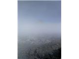 35
35
Discussion about the trip Casa da Monthana - Pico
To post a comment you must log in:
If you do not yet have a username, you must first
register.