Cima Sappada - Creton di Tul
Starting point: Cima Sappada (1283 m)
| Latitude/Longitude: | 45,55600°N 12,71969°E |
| |
Walking time: 3 h 30 min
Difficulty: difficult marked way
Elevation gain: 1005 m
Elevation difference along the route: 1020 m
Map: Tabacco 01
Recommended equipment (summer):
Recommended equipment (winter):
Views: 1.060
 | 1 person like this post |
Access to starting point:
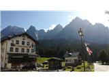
From the motorway Trbiž/Tarvisio - Videm/Udine take the Tolmezzo exit and follow the road further towards the mentioned place. Near Tolmezzo leave the main road which leads towards the pass Pso di Croce Carnico/Plockenpass and head towards the places Villa Santina and Ampezzo. In the place Villa Santina at the roundabout go straight following the signs Raveo, Rigolato. Follow this road past the places Comeglians and Forni Avoltri all the way to the place Cima Sappada. Parking is at the lower chairlift station in the last bend before the settlement.
Route description:
The path starts right below the chairlift, where there are also signposts. Follow the track or path 321 towards the west. Soon to the left a less visible path branches off through the forest (somewhat poorly marked and somewhat overgrown), but it is better to continue following the scenic track, which at the ski area makes a 180° bend and soon joins the path. The track then gently ascends and finally heads west again. Here to the left the path through the forest branches off again (damaged in autumn 2018 in a severe storm, the area also still under restoration in 2019), but it is also nicer to follow the track further to the ski area and steeply up alongside it (with nice views of Sappada in the valley and up to the mountain Piccolo Siera, 2430 m). After the bend, the path along the ski area is also joined by the path through the forest. Then follow the path along the ski area two long turns higher to the hut Monte Siera (it. Rifugio Monte Siera).
From the hut climb to the top of the surface lift on the left side of the ski area. From there the path begins, which initially runs through scree. Then it runs eastwards around the mountain Cima Dieci, 2151 m. On the path there is one technically partly demanding to demanding section equipped with steel cables. When it circles the mountain, the path leads into the mountain valley Vallone della Creta Forata. From here follow the path westwards towards the saddle Forcella Creta Forata. The path is flat for a while, then starts ascending. When the slope really starts, at about 2000 m to the left the path branches off towards the mountains Creta Forata and Creton di Tul (poorly marked).
Then follow about 150 meters of elevation gain, overcome in switchbacks (zig-zag). At the junction turn right (left is the path to the mountain Creta Forata). From here follow the steep path upwards. Relatively soon there is another junction. To the left the path climbs to the saddle Forcella del Foro, 2192 m, from which it is possible to continue to the window of Crete Forate and where the more difficult route to Creta Forato also leads (UIAA II+).
Continue right or straight across steep grassy terrain. Below the walls of the mountain take the passage to the left side of the mountain, from where it is only a short way to the grassy summit.

Along the route: Rifugio Monte Siera (1607m), Vallone della Creta Forata (1850m)
Photos:
 1
1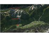 2
2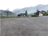 3
3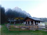 4
4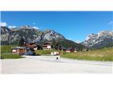 5
5 6
6 7
7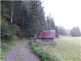 8
8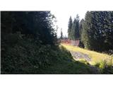 9
9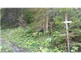 10
10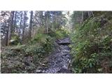 11
11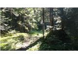 12
12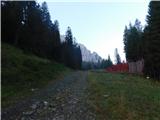 13
13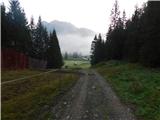 14
14 15
15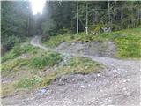 16
16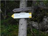 17
17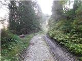 18
18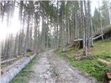 19
19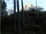 20
20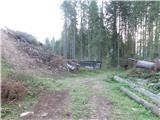 21
21 22
22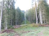 23
23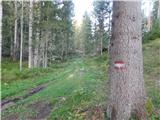 24
24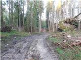 25
25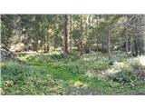 26
26 27
27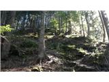 28
28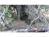 29
29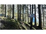 30
30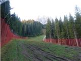 31
31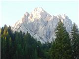 32
32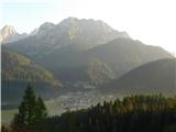 33
33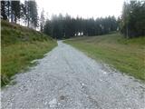 34
34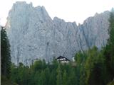 35
35 36
36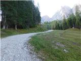 37
37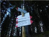 38
38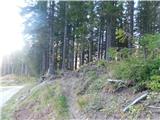 39
39 40
40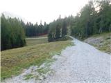 41
41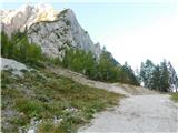 42
42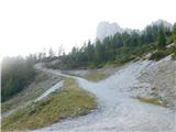 43
43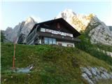 44
44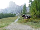 45
45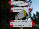 46
46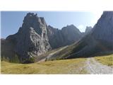 47
47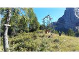 48
48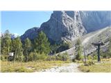 49
49 50
50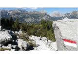 51
51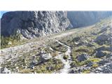 52
52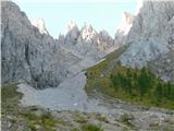 53
53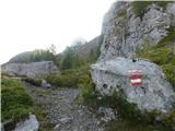 54
54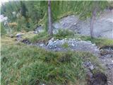 55
55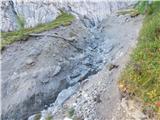 56
56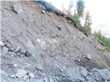 57
57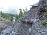 58
58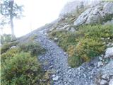 59
59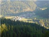 60
60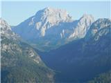 61
61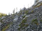 62
62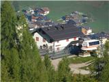 63
63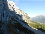 64
64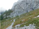 65
65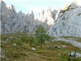 66
66 67
67 68
68 69
69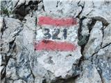 70
70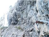 71
71 72
72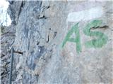 73
73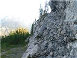 74
74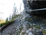 75
75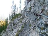 76
76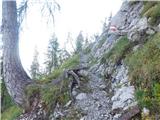 77
77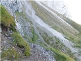 78
78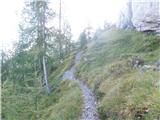 79
79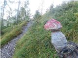 80
80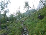 81
81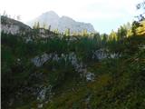 82
82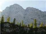 83
83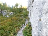 84
84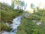 85
85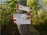 86
86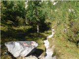 87
87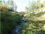 88
88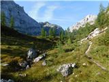 89
89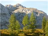 90
90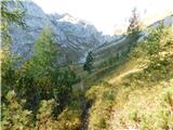 91
91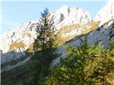 92
92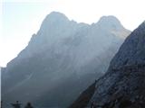 93
93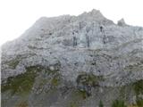 94
94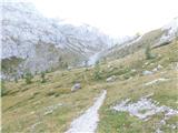 95
95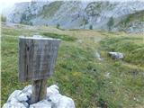 96
96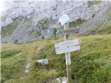 97
97 98
98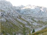 99
99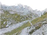 100
100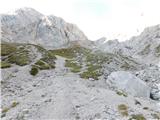 101
101 102
102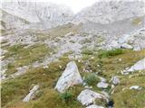 103
103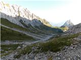 104
104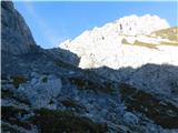 105
105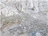 106
106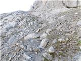 107
107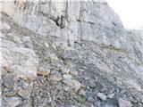 108
108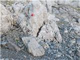 109
109 110
110 111
111 112
112 113
113 114
114 115
115 116
116 117
117 118
118 119
119 120
120 121
121 122
122 123
123 124
124 125
125 126
126 127
127 128
128 129
129 130
130
Discussion about the trip Cima Sappada - Creton di Tul
To post a comment you must log in:
If you do not yet have a username, you must first
register.