Starting point: Colfosco (1581 m)
| Latitude/Longitude: | 46,55071°N 11,85608°E |
| |
Walking time: 3 h 30 min
Difficulty: very difficult marked way
Elevation gain: 1084 m
Elevation difference along the route: 1084 m
Map: Tabacco 07 1:25.000
Recommended equipment (summer): helmet, self belay set
Recommended equipment (winter): helmet, self belay set, ice axe, crampons
Views: 6.666
 | 2 people like this post |
Access to starting point:
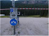
A) From Kranjska Gora over Korensko sedlo into Austria, where at the first larger crossroad we continue left towards Podklošter / Arnoldstein and Trbiž / Tarvisio. At the end of the settlement Podklošter signs for Šmohor / Hermagor point us right onto a regional road, on which past the mentioned settlement we drive to the end of the Gailtal valley, or more precisely to the settlement Kötschach-Mauthen, where we turn right towards the settlement Oberdrauburg. The route ahead leads us over the alpine pass Gailbergsattel (982 m), after which we descend into the mentioned settlement. After we cross the bridge over the river Drau, we continue left towards the settlement Lienz. In the main roundabout in Lienz we continue "left" in the direction of the settlement Sillian and Italy. Further, we cross the border between Austria and Italy, and we follow the main road past settlements Dobbiaco / Toblach, Villabassa / Niederdorf, Monguelfo - Tesido / Welsberg - Taisten, Brunico / Bruneck. Only a little after the last-mentioned settlement, past which a bypass leads, we turn left into the Alta Badia valley. Further, we drive through the mentioned valley and in the settlement La Villa we turn right towards the pass Passo Gardena. Further, we follow the ascending road following signs for Passo Gardena. We follow the road to the settlement Colfosco. One turn before the settlement sign we park on a large paid parking lot on the left side of the road (4€ – June 2012).
B) From Nova Gorica we drive into Italy and further on the motorway to the settlement Portogruaro, where at the motorway junction we turn in the direction of the settlement Belluno. We follow the motorway to its end (we do not turn towards Belluno), then we continue driving towards Cortina d'Ampezzo. When we arrive in Cortina d'Ampezzo, we follow the signs for the alpine pass Passo Falzarego. At the pass Passo Falzarego (2105 m) we turn right in the direction of Alta Badia and first ascend to the neighbouring pass Passo Valparola (2192 m), from there we descend into the mentioned valley. In the settlement La Villa we turn left towards the pass Passo Gardena. Further, we follow the ascending road following signs for Passo Gardena. We follow the road to the settlement Colfosco. One turn before the settlement sign we park on a large paid parking lot on the left side of the road (4€ – June 2012).
Route description:
From the parking lot, we first cross the main road, then by the bus parking lot we notice signposts. We continue following the signs »Sassongher, Utia de Puez« on the path which runs along the main road. The path brings us to a sign marking the settlement Colfosco / Calfosch. We continue on the sidewalk to the first crossroad, then we turn right onto the asphalt road. At the next crossroad we continue left so that we walk towards the church. At the crossroad by the church we will again notice signposts and continue right (northwards) following the signs »Sassongher«. Further, the road turns left towards the ski slope and then begins to ascend quite steeply.
Later when we leave the village the road is closed to traffic. A little further the asphalt also ends and to the right a footpath branches off towards the hut Col Pradat. We continue straight on the gravel road which ascends along the ski slope and pastures. For some time we walk on the road from which there is a nice view of the Sella mountain group and the nearby Sassongher, then soon we reach the Edelweiss hut.
From the hut we continue on the gravel road which soon brings us to a junction where to the left the path to the pass Sella Gardena branches off. We continue right on the road and after a short ascent we are again at a junction. Straight on the road the path leads to the hut Col Pradat, we however continue left uphill on the footpath following the signs »Sassongher«.
From the junction the path first ascends along the bed of a torrent, then a hairpin ascent follows which brings us to a junction where from the right the path from the hut Col Pradat joins.
We continue left and begin to ascend up the valley towards the northwest. The path then leads past a chapel and soon we are again at a junction.
Further up the valley the path leads to the notch Forcella de Ciampei and onwards to the Puez hut, we however continue decidedly right following the signs »Sassongher«.
The path further on the ascent crosses increasingly steep slopes towards the east. At some places the path is also somewhat exposed so some caution is needed. Such a path then brings us to the notch Forcella del Sassongher where a view towards the northeast opens up.
At the notch we continue right and initially ascend for some time on the slope where there is quite a bit of slippery sand, then the path brings us to the start of the secured section.
At the very start there are two entrances to the secured path. Both variants are quite steep at the beginning. When the paths merge the path becomes slightly less steep and a short traverse along the steel cable follows. The quite short secured path then ends and an ascent on the eastern side of the mountain follows. The increasingly scenic path then turns right and ascends towards the ridge. In the final part only a short ascent along the panoramic ridge to the summit follows.

Photos:
 1
1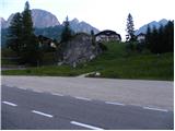 2
2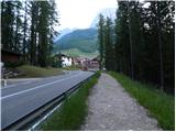 3
3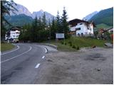 4
4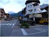 5
5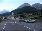 6
6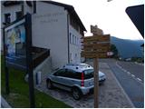 7
7 8
8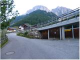 9
9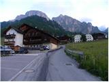 10
10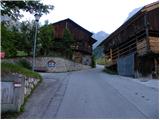 11
11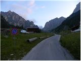 12
12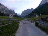 13
13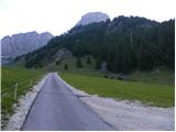 14
14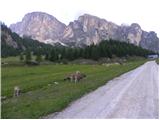 15
15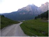 16
16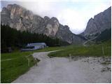 17
17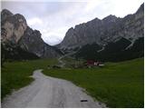 18
18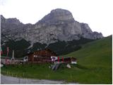 19
19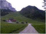 20
20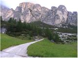 21
21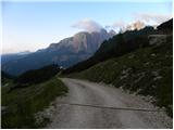 22
22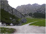 23
23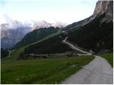 24
24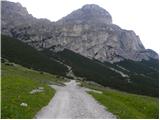 25
25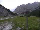 26
26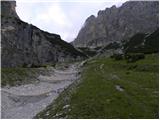 27
27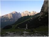 28
28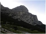 29
29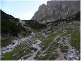 30
30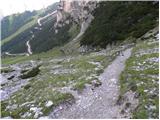 31
31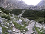 32
32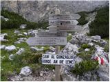 33
33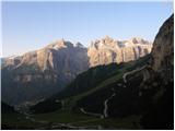 34
34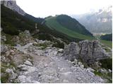 35
35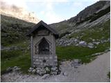 36
36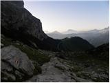 37
37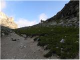 38
38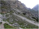 39
39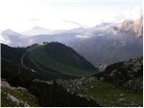 40
40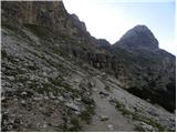 41
41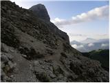 42
42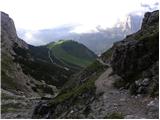 43
43 44
44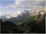 45
45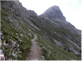 46
46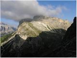 47
47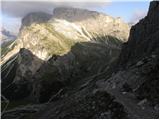 48
48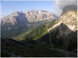 49
49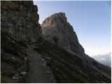 50
50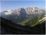 51
51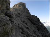 52
52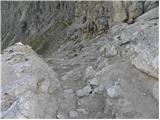 53
53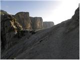 54
54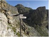 55
55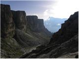 56
56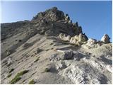 57
57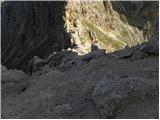 58
58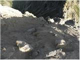 59
59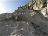 60
60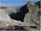 61
61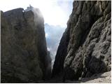 62
62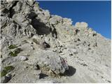 63
63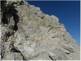 64
64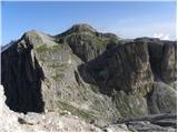 65
65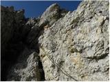 66
66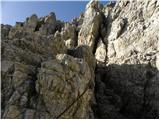 67
67 68
68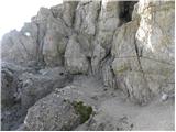 69
69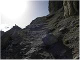 70
70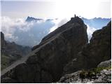 71
71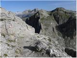 72
72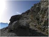 73
73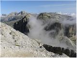 74
74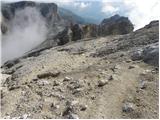 75
75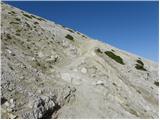 76
76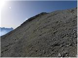 77
77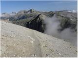 78
78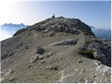 79
79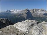 80
80 81
81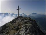 82
82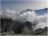 83
83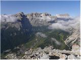 84
84 85
85
Discussion about the trip Colfosco - Sassongher
|
| Savinja1120. 07. 2024 10:11:16 |
Parking is possible at the church in Colfosco, where there is also a sign that it is allowed during the day and free. You can also park higher above the village at the lower station of the Col Pradat gondola, where parking must be paid. The path is quite strenuous in summer heat, but all effort is rewarded with magnificent views in all directions. Considering the altitude, the mountain is quite easily accessible and the ascent is more than worth it. The ascent on sand above the saddle and along the cables should not deter you from choosing it - it's not that bad. Below the mountain is the Edelweiss hut, which offers traditional food and is a bit more expensive. Nevertheless, it is full to the last corner. Service is quick, food tasty.
|
|
|
To post a comment you must log in:
If you do not yet have a username, you must first
register.