Collina - Cima Ombladet (path 141)
Starting point: Collina (1255 m)
| Latitude/Longitude: | 46,58689°N 12,84349°E |
| |
Route name: path 141
Walking time: 3 h 20 min
Difficulty: partly demanding marked way
Elevation gain: 1000 m
Elevation difference along the route: 1050 m
Map: Tabacco 01 1:25.000
Recommended equipment (summer):
Recommended equipment (winter): ice axe, crampons
Views: 1.190
 | 2 people like this post |
Access to starting point:
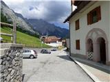
From Trbiž/Tarvisio we head on the highway towards Vidmu/Udine. We leave the highway at the exit for Tolmezzo. At Tolmezzo we then also leave the road which runs towards the mountain pass Passo di Croce Carnico / Plöckenpass and go towards Villa Santina. In Villa Santina at the roundabout, we go straight following the signs Ovaro, Sappada. We follow this road all the way to Forni Avoltri, where we turn right following the signs Collina. We then follow an asphalt road to the settlement Collina. In the settlement Collina we then continue on the left upper road which leads towards the center of the village. The road then leads us through the nicely maintained center of the village paved with cobblestones. Immediately after that we turn left upwards on a narrow street Via del Leone. At the first crossroad, we again turn left and continue a few 10 meters more to the parking lot by the retaining wall.
Route description:
From the parking lot, we continue on the road past the last houses, and then the road passes into a cart track. For some time we then walk on the mentioned cart track which crosses panoramic slopes by the pastures, a little before the right turn we come to a crossing.
On the left side, we will notice a bench, and we go right upwards on a worse, slightly overgrown cart track where also a wooden signpost with the caption Forcella Ombladet 141 points us. On the cart track, we ascend past a smaller structure with a transmitter, and then the cart track brings us into the forest. Here the cart track passes into a footpath on which we then for quite some time ascend through the forest. The footpath through the forest is still quite nice, and when a little higher we cross some clearings we will quickly notice that the path is very poorly visited and quite overgrown. While walking through the forest we otherwise follow mostly damaged signposts with the caption »Forcella Ombladet« and wooden signs with the caption »141«.
Higher when we come out of the forest on grassy terrain the footpath starts to lose itself. The path otherwise runs towards the north parallel with the valley of the stream Rio Collinetta, which is situated on our left deep below us. Further, we for some time ascend on grassy slopes on a hardly followable footpath, and from the path increasingly beautiful views begin to open up on surrounding peaks and on the already mentioned valley of the stream Rio Collinetta. At the altitude approximately 1700m then a red sign with the caption »141« points us right towards the mountain pasture Casera Chiampei. Here we walk on overgrown grassy slopes, and at orientation some help is provided by a few wooden stakes with marks. We continue past some ruins on the mountain pasture, and then we will notice in front of us the sign, which again points us left.
Next follows traversing of grassy slopes and the footpath occasionally becomes a little better visible. Here also a better view opens up towards the notch Forcella Ombladet. A relatively flat path further runs towards the north and brings us to the bed of a torrent below steeper rocky slopes. Further, we then start to ascend more steeply up the small valley along the mentioned bed of the torrent. A relatively steep path which runs mostly on grassy terrain then brings us to the notch Forcella Ombladet, where there is also a marked crossing.
To the right leads the path towards the summit Monte Volaia, straight downwards leads the path towards the settlement Pierabech, and we continue left on the path 169 towards the summit Cima Ombladet.
From the crossing, we then continue along the ridge and after a short ascent the path brings us to the left south side of the ridge. Further, we then for some time cross grassy slopes towards the west. Later the slopes become even a little steeper and at the crossing especially when wet some caution is needed. The path then descends a little to a smaller notch, and then in ascent again crosses steep slopes on the left side of the ridge. Further, the slope becomes slightly less steep and from the left an unmarked path joins us. The path then turns a little to the right and ascends the summit grassy slope and brings us to a marked crossing.
Here from the left joins also the path from the settlement Sigilletto, which compared to our path is much better trodden. At the crossing we continue right and then on a panoramic grassy ridge we soon reach the summit.

Along the route: Casera Chiampei (1761m), Forcella Ombladet (2060m)
Photos:
 1
1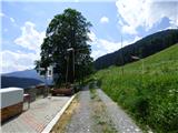 2
2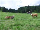 3
3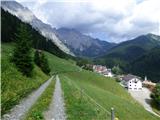 4
4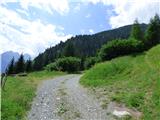 5
5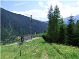 6
6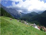 7
7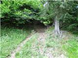 8
8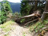 9
9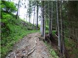 10
10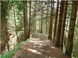 11
11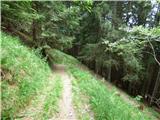 12
12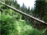 13
13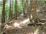 14
14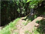 15
15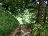 16
16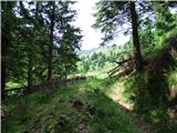 17
17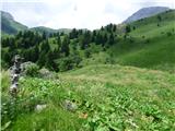 18
18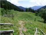 19
19 20
20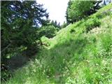 21
21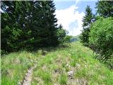 22
22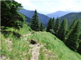 23
23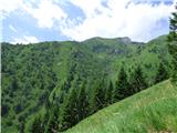 24
24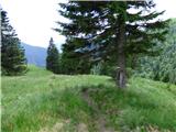 25
25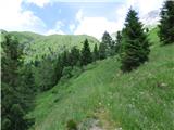 26
26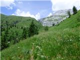 27
27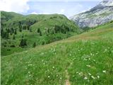 28
28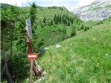 29
29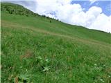 30
30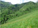 31
31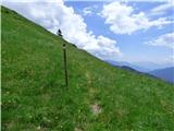 32
32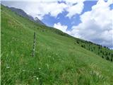 33
33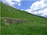 34
34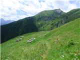 35
35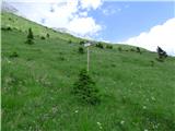 36
36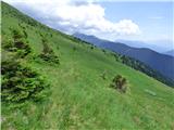 37
37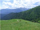 38
38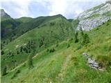 39
39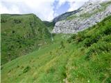 40
40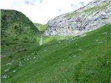 41
41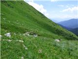 42
42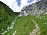 43
43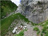 44
44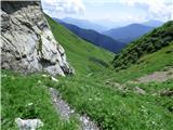 45
45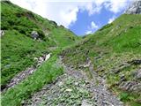 46
46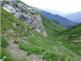 47
47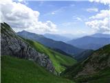 48
48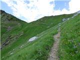 49
49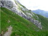 50
50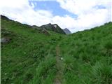 51
51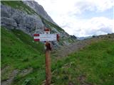 52
52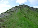 53
53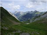 54
54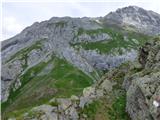 55
55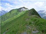 56
56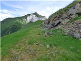 57
57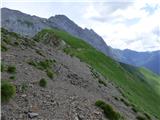 58
58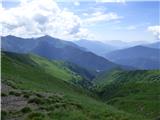 59
59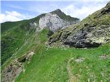 60
60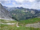 61
61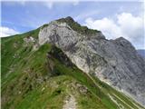 62
62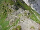 63
63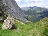 64
64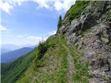 65
65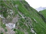 66
66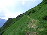 67
67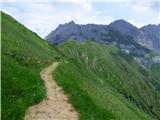 68
68 69
69 70
70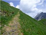 71
71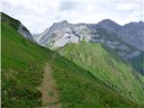 72
72 73
73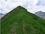 74
74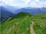 75
75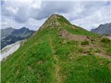 76
76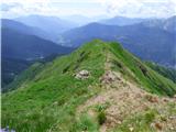 77
77 78
78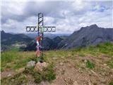 79
79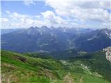 80
80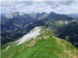 81
81 82
82
Discussion about the trip Collina - Cima Ombladet (path 141)
|
| mirank14. 09. 2025 13:43:59 |
Sl 34-this year the alpine pasture is full of sheep. At the site of the ruins there is an improvised hut and next to it a holiday trailer which could only have been brought by helicopter. Two shepherds live in it - to our surprise, black men
|
|
|
To post a comment you must log in:
If you do not yet have a username, you must first
register.