Črni hribi - Stjenkova koča on Trstelj
Starting point: Črni hribi (400 m)
| Latitude/Longitude: | 45,86430°N 13,66460°E |
| |
Walking time: 2 h 5 min
Difficulty: easy marked way
Elevation gain: 210 m
Elevation difference along the route: 400 m
Map: Goriška 1:50.000
Recommended equipment (summer):
Recommended equipment (winter):
Views: 6.688
 | 1 person like this post |
Access to starting point:
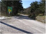
From the Razdrto–Nova Gorica expressway, take the Vogrsko exit and continue driving towards the village of Volčja Draga. From Volčja Draga, continue towards the village of Bilje, but only to the village of Bukovica, where turn left towards Renče. In Renče, behind the church, turn right, and then drive straight towards the village of Temnica. When the road stops ascending, we will notice an information board of the municipality of Miren–Kostanjevica on the left side. Park on the parking lot near the mentioned board.
From the Nova Gorica side, we can also reach the village of Volčja Draga passing Šempeter.
Route description:
From the board near which we have parked, we continue on the asphalt road for approximately 50 m, then the signs for Trstelj direct us to the left into the forest. A quite overgrown path, after the first ascent, brings us to Vrtovka. From the top the path descends, then it leads us partly on footpaths, cart tracks and roads.
A well-marked path that mostly runs through the forest over the already mentioned Vrtovka, Lešenjak, Stolovec and Stol, with a few descents and ascents after two hours of walking brings us to Trstelj, from which a nice view opens up.
From the top we descend along the road, which after a few steps we leave and continue the path right downwards on the footpath, which after two minutes of descent brings us to the hut.
Photos:
 1
1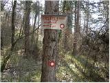 2
2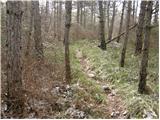 3
3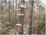 4
4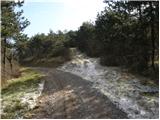 5
5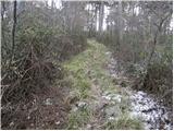 6
6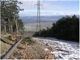 7
7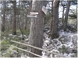 8
8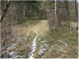 9
9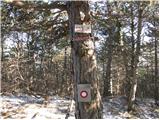 10
10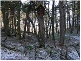 11
11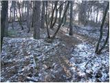 12
12 13
13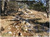 14
14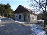 15
15
Discussion about the trip Črni hribi - Stjenkova koča on Trstelj
To post a comment you must log in:
If you do not yet have a username, you must first
register.