Starting point: Dolina (731 m)
| Latitude/Longitude: | 46,39120°N 14,33050°E |
| |
Walking time: 1 h 45 min
Difficulty: easy marked way
Elevation gain: 757 m
Elevation difference along the route: 757 m
Map: Karavanke - osrednji del 1:50.000
Recommended equipment (summer):
Recommended equipment (winter): ice axe, crampons
Views: 60.451
 | 1 person like this post |
Access to starting point:
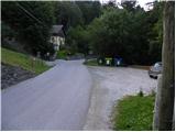
From highway Ljubljana - Jesenice we go to the exit Podnart (Ljubelj), and then we continue driving on the fast road towards Ljubelj and Tržič. When the fast road ends, we will notice a gas station on the right side, in front of which we turn right downwards towards Tržič. Further, we drive through Tržič, and we follow the narrower road towards the gorge Dovžanova soteska and further to the village Dolina, where on a macadam parking lot before the bridge over the river Tržiška Bistrica we also park.
Route description:
From the parking lot, we first cross a bridge, and then on the main road, we walk to the nearby chapel, where we continue left by the garden and older residential house on the forest road. We continue the ascent on always narrower and worse macadam road which leads us by the stream Kališnik moderately upwards. The road soon changes into a cart track, and it starts ascending steeper. Higher, we come to a water catchment, above which narrower cart track turns left and after a few meters ends, and we continue straight over larger grassy meadow, on which we ascend to a somewhat bigger spruce, where blazes point us slightly right on steeper footpath. We continue on the steep path, which crosses a shorter lane of forest, and then brings us on moderately steep grassy slopes, on which with nice views on Storžič and Stegovnik we ascend to saddle Kal, where we also step on the forest road. From the saddle, from which a nice view opens up on Begunjščica, we continue right and in a few steps we get to the shelter Zavetišče na Kalu.
From the shelter we continue on a macadam road, where we quickly get to a marked junction. From the junction, we continue left upwards on a marked footpath (straight Dom na Kofcah past the chapel), which starts ascending steeply. After a few steps the path flattens and brings us into a lane of bushes, where we cross panoramic slopes towards the right. On the other side, the path returns into the forest and starts ascending steeply by the edge of rocky cliffs. The path ahead leads us past some smaller natural caves, and then it flattens and brings us into more plateau-like terrain. The path ahead with a view on the western part of Košuta crosses a worse forest road, and then brings us to the parking lot at the end of the forest road which leads towards Kofce.
From the parking lot, we continue on a wide cart track, on which in 15 minutes we ascend to the mountain pasture Kofce. From the spot, when we stepped on the lower edge of the mountain pasture, only 5 more minutes of increasingly scenic walking over the pastures of the already mentioned mountain pasture separate us to the mountain hut.

The trip can be extended to the following destinations: Planina Spodnja Dolga njiva,
Tegoška planina,
Planina Pungrat,
Planina Ilovica,
Zavetišče na planini Šija,
Planina Zgornja Dolga njiva,
Mala Košuta,
Kofce gora,
Toplar,
Malo Kladivo,
Veliki vrh (Košuta),
Veliko Kladivo
Photos:
 1
1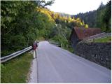 2
2 3
3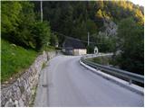 4
4 5
5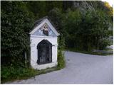 6
6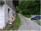 7
7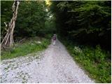 8
8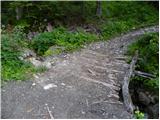 9
9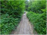 10
10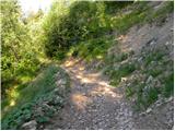 11
11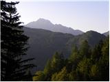 12
12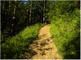 13
13 14
14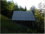 15
15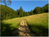 16
16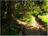 17
17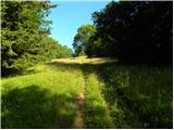 18
18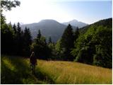 19
19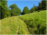 20
20 21
21 22
22 23
23 24
24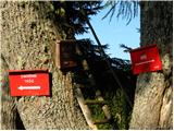 25
25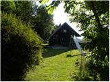 26
26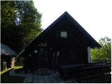 27
27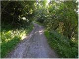 28
28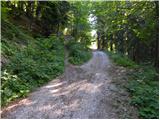 29
29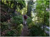 30
30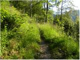 31
31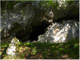 32
32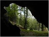 33
33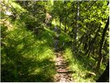 34
34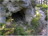 35
35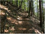 36
36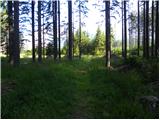 37
37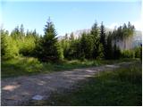 38
38 39
39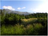 40
40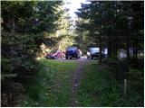 41
41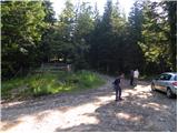 42
42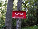 43
43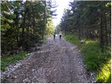 44
44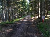 45
45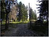 46
46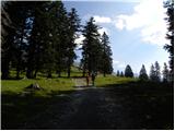 47
47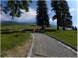 48
48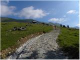 49
49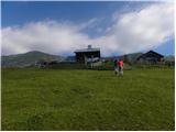 50
50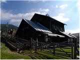 51
51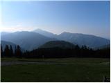 52
52
Discussion about the trip Dolina - Dom na Kofcah
|
| Lunca20. 07. 2011 |
excellently described and pictured path... maybe just one addition... from Kofce the path to the Košuta ridge opens up... and to all its beautiful peaks
|
|
|
|
| nusa28. 10. 2011 |
Along the described path I ascended today past Dom na Kofcah to Veliki vrh.Towards the top there is some snow on the path, but it can be bypassed. V
|
|
|
|
| mpogac18. 05. 2016 |
Hello. Just wondering if there's still any snow on this path or what the path is like. Thanks.
|
|
|
|
| natašag18. 05. 2016 |
@mpogac: 10 days ago everything was snow-free 
|
|
|
|
| Mira.k2. 04. 2018 |
Today my husband and I set off on this path, the path itself is nice but steep. But I'm disappointed with the service at the hut as we waited an hour for the food after ordering. We've eaten in many huts but nowhere was I served so poorly, even though there were many visitors they served very quickly everywhere. We certainly won't eat at Kofcah anymore.
|
|
|
|
| Martin Dercar21. 12. 2024 20:08:21 |
Today I went up and met 2 gentlemen, best company up there, drank black coffee and of course štruklji and slowly down
|
|
|
To post a comment you must log in:
If you do not yet have a username, you must first
register.