Dolina Krma - Dom Valentina Staniča (via Travna dolina)
Starting point: Dolina Krma (944 m)
| Latitude/Longitude: | 46,38510°N 13,90710°E |
| |
Route name: via Travna dolina
Walking time: 5 h
Difficulty: easy unmarked way
Elevation gain: 1388 m
Elevation difference along the route: 1415 m
Map: Triglav 1:25.000
Recommended equipment (summer):
Recommended equipment (winter): ice axe, crampons
Views: 9.553
 | 2 people like this post |
Access to starting point:
We leave the Gorenjska motorway at the Hrušica exit and follow the road ahead in the direction of Kranjska Gora. Just a little before the village of Dovje, the road to Mojstrana (Vrata, Kot and Krma) branches off to the left from the main road. We follow the road ahead in the direction of the village of Radovna and the valleys of Krma and Kot. The relatively steep road then passes the TNP sign, behind which the road soon flattens and brings us to a junction, where a macadam road into the Kot valley branches off to the right. We continue straight on the road, which starts descending. In the middle of the descent, the road into the Krma valley branches off to the right (straight ahead to Radovna). A little further on, we come to the next junction, where we continue right in the direction of Krma. The macadam road then brings us to the Kovinarska koča mountain hut, which we follow further. The occasionally somewhat rougher road then brings us to the parking lot in front of the gate.
Route description:
From the parking lot, we continue on the road past the gate to extensive gravel deposits. This is followed by a few minutes of easy walking on the gravel to a marked but sometimes hard-to-see junction. The walking path continues straight ahead, but the blazes direct us right across the torrent into the forest, where the path starts to ascend gently. Only after about 40 minutes of walking does the path become steeper, but not excessively so. The moderately steep path brings us out of the forest into the dwarf pines at an elevation of 1300 m. Here, fine views begin to open up onto the nearby walls of the peaks above Krma. However, the ascent does not last long, as the path soon descends a few meters and brings us to the beautiful mountain meadow Vrtača. The walk across the beautiful grassy plain is very pleasant and scenic. On the other side, the path starts ascending again, this time through sparse forest. This ascent also does not last long; it is interrupted by the Malo polje plain, where the path turns right.
On Malo polje, we need to pay attention, as just a few dozen meters after the junction where the path to Vodnikov dom branches off to the left, a less noticeable path branches off to the right leading into Travna dolina. When Malo polje begins to narrow, we will notice a poorly trodden path on the right side that continues along the right edge of the valley. Soon we reach the indistinct "head" of the valley, where a poorly visible path starts to ascend. We continue along the grassy path, which was once well constructed but is now overgrown with grass and bushes in places. Somewhere in the middle of the ascent across the grassy slope, the path turns right into the forest and then ascends transversely to the hunting hut.
At the hunting hut, we continue sharply left, continuing the ascent along a path that is initially gentle and then moderately steep, ascending mostly through sparse forest. The poorly trodden but, with a little effort, constantly well-followable path higher up levels out and enters the belt of dwarf pines. From here, a few more minutes of walking through a small valley follow, and we join the marked path leading toward Staničev dom.
We reach the marked path right on a small plain and follow it right uphill. After a short ascent, in the middle of the left bend, an unmarked path into Kravja dolina branches off, but we follow the marked path toward Konta pod Rjavino, which we reach after about a half-hour ascent through increasingly sparse dwarf pines. The path ahead transitions onto the scree below Rjavina, up which we ascend toward Dovška vratca. Before we arrive at the mentioned saddle, the marked path turns left, where it makes a semicircular turn to the left. When the path levels out somewhat, the path from Konjski preval joins from the left, and we continue right in the direction of Staničev dom, arriving after a few minutes of moderate ascent at an indistinct ridge, where the marked path to Rjavina branches off to the right. We continue straight ahead and follow the path, which begins to descend moderately, with views of Triglav, Begunjski vrh, Visoka Vrbanova špica, to Dom Valentina Staniča pod Triglavom, which we reach after about 10 minutes of descent.

Along the route: Vrtača (1430m), Malo polje (1560m), Lovska koča v Travni dolini (1720m)
Photos:
 1
1 2
2 3
3 4
4 5
5 6
6 7
7 8
8 9
9 10
10 11
11 12
12 13
13 14
14 15
15 16
16 17
17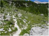 18
18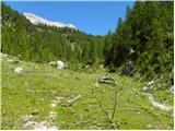 19
19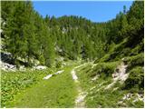 20
20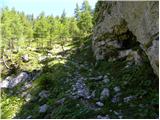 21
21 22
22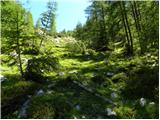 23
23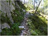 24
24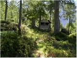 25
25 26
26 27
27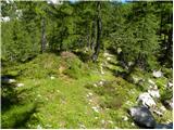 28
28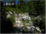 29
29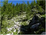 30
30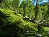 31
31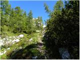 32
32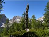 33
33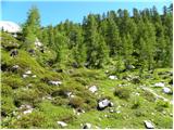 34
34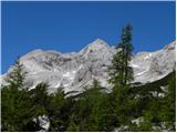 35
35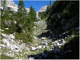 36
36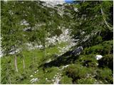 37
37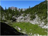 38
38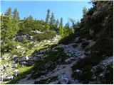 39
39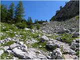 40
40 41
41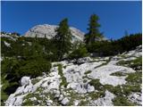 42
42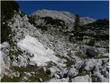 43
43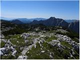 44
44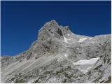 45
45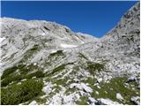 46
46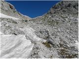 47
47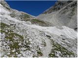 48
48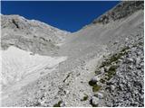 49
49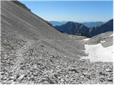 50
50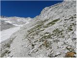 51
51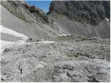 52
52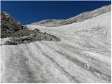 53
53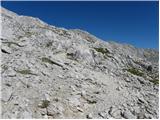 54
54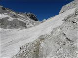 55
55 56
56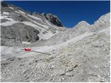 57
57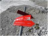 58
58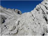 59
59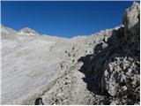 60
60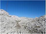 61
61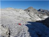 62
62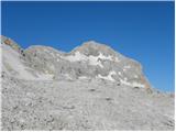 63
63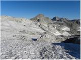 64
64 65
65 66
66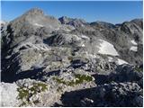 67
67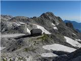 68
68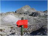 69
69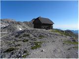 70
70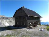 71
71
Discussion about the trip Dolina Krma - Dom Valentina Staniča (via Travna dolina)
|
| velkavrh3. 07. 2011 |
You've given me a wonderful idea for a slightly different way from Krma to Stanič. I've already done the marked route and I really like this approach to the hut even though it's shorter from Kot and Vrata. I still need to do Vrbanove špice for the badge and since Kot isn't to my liking, I'll go from Stanič's there and back.
|
|
|
To post a comment you must log in:
If you do not yet have a username, you must first
register.