Dom Planincev v Logarski dolini - Ojstrica (Kopinškova pot)
Starting point: Dom Planincev v Logarski dolini (837 m)
| Latitude/Longitude: | 46,38360°N 14,62160°E |
| |
Route name: Kopinškova pot
Walking time: 4 h 5 min
Difficulty: very difficult marked way
Via ferrata: B
Elevation gain: 1513 m
Elevation difference along the route: 1513 m
Map: Kamniške in Savinjske Alpe 1:50.000
Recommended equipment (summer): helmet, self belay set
Recommended equipment (winter): helmet, self belay set, ice axe, crampons
Views: 48.154
 | 2 people like this post |
Access to starting point:
A) Over the mountain pass Volovljek (Kranjski Rak) or from Mozirje we drive to Luče, and from there we continue driving towards Logarska dolina. A few kilometers after the settlement Solčava we will arrive at a crossroad, where we turn left in the direction of Logarska dolina (toll payment). Further, we drive through Logarska dolina to the mountain hut Dom Planincev v Logarski dolini. We park on the parking lot on the left side of the road. The parking lot on the right side is intended for guests of the mountain hut Dom Planincev. B) Over the border crossing Jezerski vrh we drive to Austria, there in the valley Bela / Vellach we turn right in the direction of border crossing Pavličev vrh (Pavličevo sedlo) / Paulitchsattel. When we arrive on the Slovenian side we first descend to the valley, then at the crossroad a little before Solčava we turn right towards Logarska dolina (toll payment). Further, we drive through Logarska dolina to the mountain hut Dom Planincev v Logarski dolini. We park on the parking lot on the left side of the road. The parking lot on the right side is intended for guests of the mountain hut Dom Planincev. C) We drive to Črna na Koroškem (to here from Ravne na Koroškem or from Šoštanj over the mountain pass Spodnje Sleme), then we continue driving towards Luče. At first an asphalt road, higher it becomes macadam and brings us to the crossroad of several roads on the mountain pass Spodnje Sleme. We continue on the main road, which starts descending diagonally towards the settlement Podolševa. Lower at the crossroad we turn sharply left (right Solčava panoramic road - to the starting point we can arrive also via this road, in this case we join the road over the mountain pass Pavličev vrh) in the direction of Solčava. When we descend to Solčava, at the crossroad where we join the main road we continue right. A few kilometers after the settlement Solčava we will arrive at a crossroad, where we turn left in the direction of Logarska dolina (toll payment). Further, we drive through Logarska dolina to the mountain hut Dom Planincev v Logarski dolini. We park on the parking lot on the left side of the road. The parking lot on the right side is intended for guests of the mountain hut Dom Planincev.
Route description:
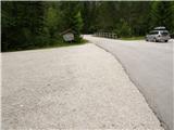
From the parking lot, we continue on the main road which leads us over a bridge, after the bridge signs for Klemenča jama direct us left onto the forest road, along which we continue, and it brings us in a few minutes to a crossroad, where we continue right in the direction of Klemenča jama. From the crossroad we walk on the road only a short time, then we continue left on an initially wide and level mountain path. Only a few steps further the path moves onto the slope and gradually starts to ascend steeper and steeper. The steep path continues ascending on the steep slope, then crosses a torrent gully and a little further a stream. After the stream the path becomes even steeper and ascends on a very steep slope, which is especially when wet dangerous for slipping. After less than an hour of walking from the starting point we arrive at a bench by a spring and only a little further to a junction, where we join the path from the starting point Na razpotju.
Here the steepness eases, and we continue slightly uphill on the wide path, which soon brings us out of the forest. From here only a shorter ascent follows on the grassy slope to the mountain hut Koča na Klemenči jami below Ojstrica.
From the hut, where there is a marked junction, we continue straight in the direction of Ojstrica (left Strelovec and Krofička) on the path which after some 10 meters enters the forest. Through the forest we ascend moderately to steeply, and the path higher brings us below rocky cliffs, which are not too crumbly. The path soon moves away from the cliffs to the right and brings us to a junction, where we continue left in the direction of Ojstrica on the Kopinškova pot (right Ojstrica, Planjava and Korošica over Škarje).
Further we pass from the forest onto panoramic slopes overgrown with dwarf pines, from which a beautiful view opens towards the northern wall of Ojstrica and Rjavčki vrh. The path ahead leads past the branch-off of an unmarked hunting path to Krofička, above which we quickly arrive at the other side of the ridge or to Škrbina 1800 m.
On the saddle, from where there is a nice view of the neighboring Krofička path, it turns right and by crossing steep slopes above Robanov kot brings us to the first protections, where the path along the steel cable ascends relatively steeply, then temporarily levels out and crosses the grassy slope. Some easier climbing with the aid of pegs follows, then we arrive at a short vertical section, over which we ascend with the help of brackets and steel cable. The path ahead ascends very steeply for some time, and we have protections to help most of the time, mainly pegs and steel cables. Higher we arrive at a smaller saddle, where the path turns right. From here onwards we ascend towards the west with easier climbing and some steep traverses, where higher we step onto the ridge. On the ridge a view towards Logarska dolina and the mountains above it opens up again. We continue slightly left on the exposed ridge, where the path ascends steeply again along the steel cable. The path ahead ascends on the right (northern) side of the ridge above precipitous walls. Crossing a steep scree field follows, where snow can still linger in early summer (the snow patch can be safely crossed only using an ice axe and crampons, as the scree ends in a precipice). Above the scree the path turns left and ascends along the steel cable. Only some easier climbing follows and amid wonderful views we reach the summit of the 2350 m high Ojstrica.

Photos:
 1
1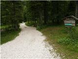 2
2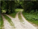 3
3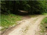 4
4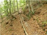 5
5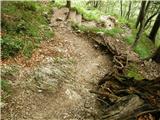 6
6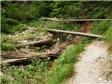 7
7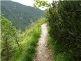 8
8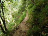 9
9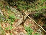 10
10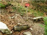 11
11 12
12 13
13 14
14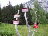 15
15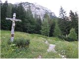 16
16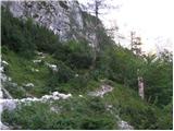 17
17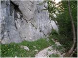 18
18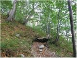 19
19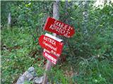 20
20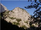 21
21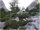 22
22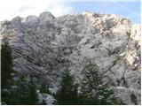 23
23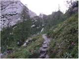 24
24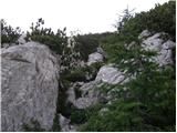 25
25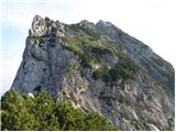 26
26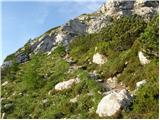 27
27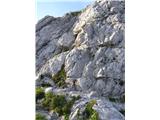 28
28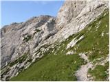 29
29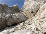 30
30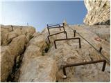 31
31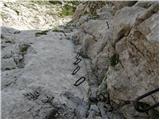 32
32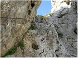 33
33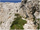 34
34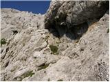 35
35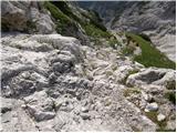 36
36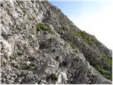 37
37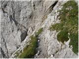 38
38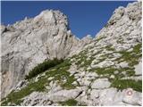 39
39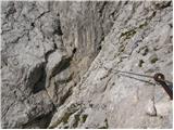 40
40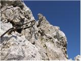 41
41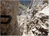 42
42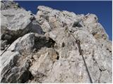 43
43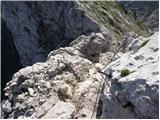 44
44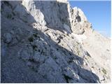 45
45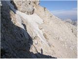 46
46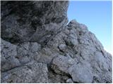 47
47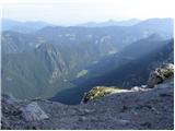 48
48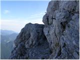 49
49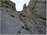 50
50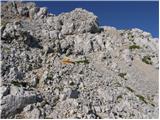 51
51 52
52
Discussion about the trip Dom Planincev v Logarski dolini - Ojstrica (Kopinškova pot)
|
| katja8716. 10. 2014 |
On Sunday (12.10.2014) we were on Ojstrica and Rjavčkem vrh. We did a circular tour: Dom Planincev - Koča na Klemenči jami - Ojstrica via Kopinškova pot - sedlo Škarje - Rjavčki vrh - Koča na Klemenči jami - Dom Planincev.
Since we were early enough, we enjoyed the sunshine on the summit and had nice views. Only Ojstrica and Mrzla gora stayed clear for a long time and were not fogged in, as all surrounding peaks were in clouds, only here and there it opened briefly.
More photos and tour description are published on the website of Planinsko društvo Matica Murska Sobota: http://www.pdmaticams-drustvo.si/
|
|
|
|
| zoranp6829. 06. 2015 |
28.06.2015 Circular tour: Dom planincev Logarska dolina, Koča na Klemenči jami, Kopinškova pot, Ojstrica, Škarje, Koča na Klemenči jami, Dom planincev Logarska dolina. It was wonderful. Thanks everyone for the nice day. Zoran
|
|
|
|
| neyo29. 06. 2015 |
Hello,
What are the conditions on Kopinškova pot to Ojstrica. Especially interested in the snowfield below the summit. Is it possible to bypass it, because I don't have ice axe at least suitable for such snowfield. For now I avoid such paths. I was there years ago, I think about 15 years ago. Then I bypassed the snowfield on the upper part. There was no need to step on it at all. Now too I wish if possible to bypass it. Thanks for the answer
|
|
|
|
| zoranp6829. 06. 2015 |
Hi. Neyo yesterday we crossed this snowfield without problems. The snow is soft and the footprints deep and firm. I think you don't need crampons or ice axe. Good luck. Zoran
|
|
|
|
| stropci9. 07. 2015 |
Hey, how is it with the snow on the Kopinškova path?
Best regards, Stropci
|
|
|
|
| zico109. 07. 2015 |
There's almost none left. Path underfoot...
|
|
|
|
| green19. 06. 2020 |
Hi, what are the conditions like on Kopinškova (anchors, snow)? Thanks and happy trails to all 
|
|
|
|
| mirank15. 08. 2021 13:05:46 |
In picture 20 you can clearly see that on the sign for Kopinškova the time 3h 50min is not written; wonder who added that  . This inscription contributed to the chatter behind me being replaced by dead silence . This inscription contributed to the chatter behind me being replaced by dead silence
|
|
|
|
| Chasethesun6. 07. 2024 11:24:57 |
Hello,
how is it with snow on this path? Are crampons & ice axe needed?
|
|
|
To post a comment you must log in:
If you do not yet have a username, you must first
register.