Dom pod Storžičem - Mala Poljana (by road)
Starting point: Dom pod Storžičem (1123 m)
| Latitude/Longitude: | 46,35860°N 14,39060°E |
| |
Route name: by road
Walking time: 1 h
Difficulty: easy marked way
Elevation gain: 202 m
Elevation difference along the route: 250 m
Map: Karavanke - osrednji del 1:50.000
Recommended equipment (summer):
Recommended equipment (winter): crampons
Views: 12.658
 | 3 people like this post |
Access to starting point:
From the highway Ljubljana - Jesenice we take the exit Ljubelj (Tržič), and then we continue driving towards Ljubelj. Just before the gas station in Bistrica pri Tržiču we leave the main road and continue driving right in the direction of Tržič. Further on, we drive through Tržič in the direction of Dolžanova soteska, and then at the end of the town we continue right in the direction of Lom pod Storžičem and Grahovše. At the end of the village Grahovše the asphalt ends, and we follow the macadam road further in the direction of the mountain hut Dom pod Storžičem. We then follow this macadam road, steeper in the upper part, to the parking lot near the mountain hut Dom pod Storžičem.
Route description:
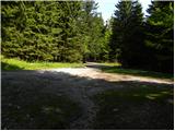
From the parking lot, we continue on the road which continues by the right side of the nearby mountain pasture Jesenje. The road soon turns to the right and starts slightly ascending. A little higher we cross a landslide slope, and then we get to a crossroad, where we go on the left road in the direction of Poljana. The path ahead again starts gently ascending on a macadam road, and it brings us to the next crossroad, where we continue on the right road (direction Mala Poljana). Further, the road gets worse and gradually brings us to a smaller stream, which is situated in the middle of the forest. After the small stream we turn left on a cart track and start ascending steeper. After approximately 20 minutes of ascent on the cart track we come out of the forest and step onto Mala Poljana, from where a nice view opens up towards the south.
Photos:
 1
1 2
2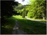 3
3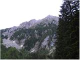 4
4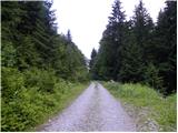 5
5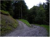 6
6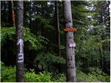 7
7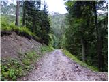 8
8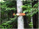 9
9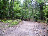 10
10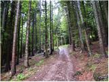 11
11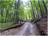 12
12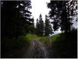 13
13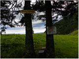 14
14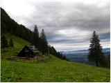 15
15
Discussion about the trip Dom pod Storžičem - Mala Poljana (by road)
|
| Gost2. 08. 2007 |
Brane V.-actually a pleasant walk all the way through cool forest. From Dom pod Storžičem just under an hour walk. Unfortunately today had to go on foot from the valley because the road is being renovated. Unfortunately the footpath is poorly or not marked, poorly maintained, so you need good orientation so as not to get lost at the numerous forks of the forest path. Excellently marked is the path from the hamlet Gojzd above Križe, where you can go to Polane via Kriška planina and Tolsti vrh or from the village via Ježa. But that side path is twice as long, yet beautiful.
|
|
|
|
| Gost13. 09. 2007 |
Brane V. -today was here, when I went to Storžič. Went along the path as I already described on 02.08.2007. Went from Gojzd over Ježa. The path takes two hours. It's a pleasant short tour suitable for one morning or afternoon.
|
|
|
To post a comment you must log in:
If you do not yet have a username, you must first
register.