Dom Pristava v Javorniškem Rovtu - Barentaler Kotschna/Struška (via Dobravske rovte)
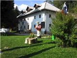
Starting point: Dom Pristava v Javorniškem Rovtu (975 m)
| Latitude/Longitude: | 46,45400°N 14,09210°E |
| |
Route name: via Dobravske rovte
Walking time: 2 h 30 min
Difficulty: easy unmarked way
Elevation gain: 969 m
Elevation difference along the route: 969 m
Map: Karavanke - osrednji del 1 : 50.000
Recommended equipment (summer):
Recommended equipment (winter): ice axe, crampons
Views: 17.545
 | 3 people like this post |
Access to starting point:
From the Ljubljana–Jesenice motorway take the Lipce exit, then turn right towards Jesenice. In the settlement Slovenski Javornik, at the first traffic-light intersection turn right (direction Lj.) towards Koroška Bela. At the next traffic-light intersection turn left, and soon again left towards Javorniški Rovt. After a few kilometres of uphill driving, when we arrive in the mentioned village, follow the Pristava signpost. Dom Pristava mountain hut is located 50 m to the right, above the last bus stop (NOB monument at the intersection, or 250 m before the end of the asphalt). Park at the hut's arranged parking lot, where upon return we can treat ourselves to a drink (recommended, but not obligatory).
Route description:
From the starting point in front of Dom Pristava mountain hut go right along the path through the short forest section behind the hut (Zoisov park), where you come to a wooden bridge over the stream. On its other side go right towards the north across a large pasture along which the path leads (if fenced, bypass it on the right). After crossing the pasture, the path descends slightly and crosses two streams 50 m apart. After the second stream continue straight across the meadow towards the forest (a masonry building on the left). The path takes us through a short forest section and descends slightly, then brings us back to a meadow where our gaze rests on Mt. Srednica. On the other side of the meadow enter another short forest section, where the cart track soon leads to a forest road. Step onto it and turn left. The road soon crosses a bridge over Jezernica stream, ascends to Dobravske Rovte and turns into a cart track. Follow this cart track, which soon forks left towards Mavre. Slightly higher ignore the left fork, a bit further follow the right one (straight to Mavre), and continue briefly eastwards along the cart track. Soon after ignoring another left fork, the path turns left to the final fork. Take the left (right leads to a private cottage), where near a haybarn the path ends, but continue left along the haybarn diagonally across the meadow, not too far. Soon after the mentioned cottage, visible about 50 m to the right above us, behind the overgrown hazel (partly spruce) edge descending left from the cottage, head straight uphill across the meadow, where a barely visible path higher up enters the forest. Here the path becomes easier to follow again, and in the steep mixed forest it first turns left then right. When it brings us into mostly coniferous forest, it turns left again and leads to a spring (yellow pipe) near a forest road. Soon after exiting the forest onto the road, spot a cottage on the other side; behind it find a relatively wide forest path ascending eastwards. Soon reach a sharp left fork and continue straight east. After a while the path turns left, steeper into the slope towards the north, ascending in zigzags for some time. Higher up the well-followable path heads west, ascending diagonally. Entering the dwarf pine belt, you reach a pasture fence; continue along the path, with views opening to Golica, Kepa and the Julian Alps. Soon in 2-3 zigzags it reaches the shepherd hut on Belska Planina.
From the hut continue past the fenced water reservoir, where you meet a marked path which you follow only briefly. Approaching the first small valley or gully, ascend it northwards, higher up meeting sections of the path. Emerging from this gully, head slightly right uphill over partly rocky terrain. When the slope briefly eases, again head slightly right uphill along the southwest slope of Struška, past a somewhat wider valley (gully) on the right. The path becomes more obvious and through the dwarf pines leads to a small hollow, where you turn left to the border ridge (view into Austria opens here). From there continue right along the edge (border) to the summit of Struška, just a few tens of metres higher. At the top is a large border stone with a summit log box.

Photos:
 1
1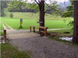 2
2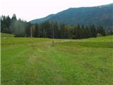 3
3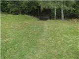 4
4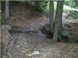 5
5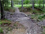 6
6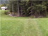 7
7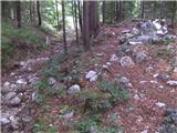 8
8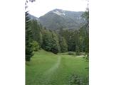 9
9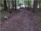 10
10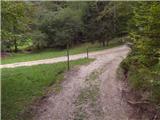 11
11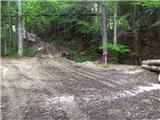 12
12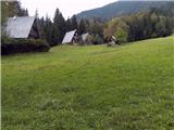 13
13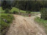 14
14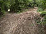 15
15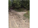 16
16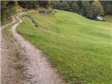 17
17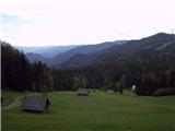 18
18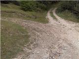 19
19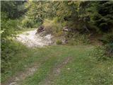 20
20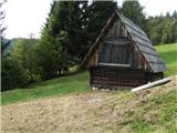 21
21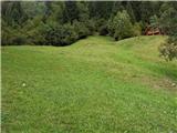 22
22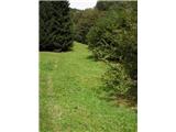 23
23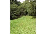 24
24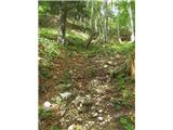 25
25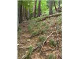 26
26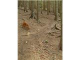 27
27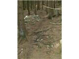 28
28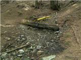 29
29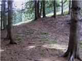 30
30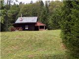 31
31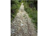 32
32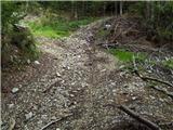 33
33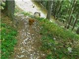 34
34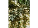 35
35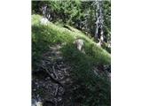 36
36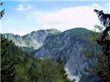 37
37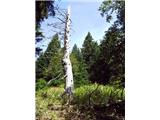 38
38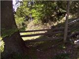 39
39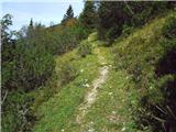 40
40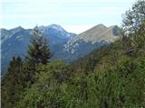 41
41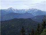 42
42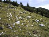 43
43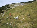 44
44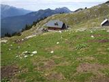 45
45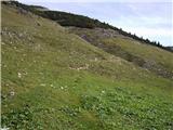 46
46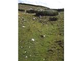 47
47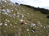 48
48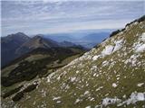 49
49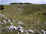 50
50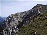 51
51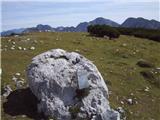 52
52 53
53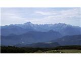 54
54
Discussion about the trip Dom Pristava v Javorniškem Rovtu - Barentaler Kotschna/Struška (via Dobravske rovte)
|
| gorskarozica26. 05. 2012 |
Nice circular hike from Pristava, there are still plenty of narcissus. Please, trail markers, more info boards for hikers who are not from around here. 
|
|
|
|
| Mirena27. 05. 2012 |
I agree with Gorskorozica that there aren't enough markings around there for us who are wandering this area for the first time. Yesterday we wanted to see the last narcissus and locals in Javorniški Rovt directed us towards Golica ("by car: Križovci - Pusti Rovt to the barrier or further if it's open, then continue on foot"). We didn't see the barrier, we drove to the end of the road, then headed uphill (there were no markings or signs anywhere) and arrived at - Belsko planina. We didn't regret missing it, as we discovered a real hiking paradise: lots of primroses, gentians,... and quite a few narcissus too. And we also ate a very tasty and cheap goulash in the hut. Apparently we took a hunting path.
|
|
|
|
| heinz28. 05. 2012 |
The path described above is not a marked (signposted) mountain trail, but merely an interesting approach option from Pristava. It will probably remain so in the future.
Mirena, behind Pusti Rovt you can also find some signs that help you find Golica, or the Svečica alpine pasture (Belska pl.) There are two Rampi.
|
|
|
|
| marezt1. 06. 2012 |
There are at least two signposts for Golica and Belska planina from Pustega rovta onwards. The paths are marked to Belska planina as to Koča na Golici 
|
|
|
|
| darh14. 07. 2012 |
First I must praise the author for the detailed path description, since even though we went on it for the first time today, we were never once in doubt how to continue. Otherwise it was a really pleasant morning ascent before the weather worsened. Only the fog deprived us of better views. More about our path and impressions here.
|
|
|
To post a comment you must log in:
If you do not yet have a username, you must first
register.