Dom Pristava v Javorniškem Rovtu - Koča na Golici
Starting point: Dom Pristava v Javorniškem Rovtu (975 m)
| Latitude/Longitude: | 46,45400°N 14,09210°E |
| |
Walking time: 2 h 10 min
Difficulty: easy marked way
Elevation gain: 607 m
Elevation difference along the route: 620 m
Map: Karavanke - osrednji del 1:50.000
Recommended equipment (summer):
Recommended equipment (winter): ice axe, crampons
Views: 12.472
 | 1 person like this post |
Access to starting point:
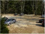
From the highway Ljubljana - Jesenice, we take the exit Lipce and follow the road ahead in the direction of Jesenice. When we come to the traffic-light intersection, where we join the old road, we continue right in the direction of Žirovnica. We follow this road only a short time, since at the next traffic-light intersection we continue left in the direction of Javorniški Rovt. The road then goes through the underpass under the railway and then turns left (right Koroška Bela). We follow the road, which higher up starts ascending steeply, in the direction of Javorniški Rovt all the way to the parking lot near Dom Pristava.
Route description:
From the parking lot we walk to the mountain hut, then we continue the ascent on an initially poorly visible path, which ascends on the left side of the swampy lakelet. A clearly visible and wide path brings us after 5 minutes of walking to the road, where we step onto a junction.
We turn right in the direction of Golica (left Javorniški Rovt, straight ahead Španov vrh and Jelenkamen) and continue along the road. This leads us past a larger pond, then turns right out of the forest. Here a view opens up towards Struška, Medji dol and part of Belščica. The road continues to ascend moderately, higher up returns into the forest and crosses a larger gully, after which we soon arrive at a marked junction.
At this point we leave the road, which turns left towards Križovec, and continue straight on the less used road. After two minutes of walking the markings direct us left onto a cart track, which begins to ascend more steeply through the forest. Higher up the path levels out and brings us to the grassy areas of Pusti Rovt, where we join the road from Križovec. We continue straight on the gentle road and quickly reach the nearby shepherd hut.
From the hut we continue on the road, which in the upper part of the planina turns right into the forest. A little further we arrive at a marked junction, where we turn left (slightly right Sedlo Kočna and Struška) onto the road, which in a gentle ascent crosses the slope to the left. A little further the path from Markljev Rovt joins from the left, and the road quickly brings us to Sedlo Suha.
From the saddle, where a ridge path towards Golica branches off slightly to the right, we continue on the road for a short time, then the signs for Koča na Golici direct us slightly right onto a footpath, which ascends transversely towards the west. The trail soon levels out completely, crosses some scenic slopes and in a gentle descent joins the path from Planina pod Golico (path past Kmečki turizem Betel).
We continue in the direction of Golica along a fairly wide path, which we follow all the way to Koča na Golici, which we reach after a good 10 minutes of further walking.
Starting point - Pusti Rovt 1:00, Pusti Rovt - turnoff for Struška 0:10, turnoff for Struška - Sedlo Suha 0:20, Sedlo Suha - Koča na Golici 0:40.

Along the route: Pusti Rovt (1203m),
Pusti Rovt (1296m), Razpotje nad Pustim Rovtom (1349m), Odcep za Struško (1373m), Razpotje pred Sedlom Suha (1419m), Sedlo Suha (1435m), Razpotje V od Koče na Golici (1496m)
Photos:
 1
1 2
2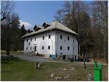 3
3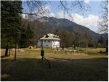 4
4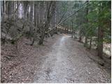 5
5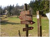 6
6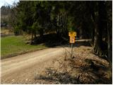 7
7 8
8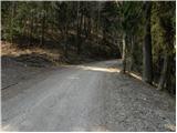 9
9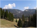 10
10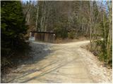 11
11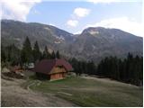 12
12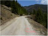 13
13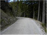 14
14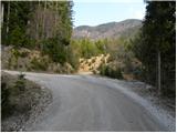 15
15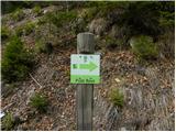 16
16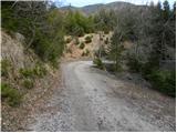 17
17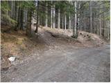 18
18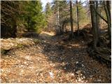 19
19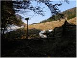 20
20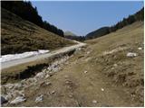 21
21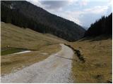 22
22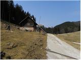 23
23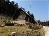 24
24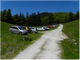 25
25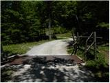 26
26 27
27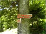 28
28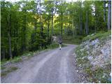 29
29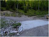 30
30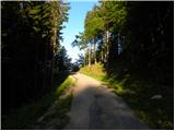 31
31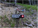 32
32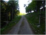 33
33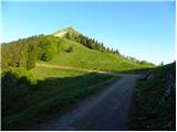 34
34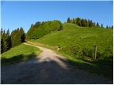 35
35 36
36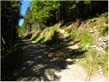 37
37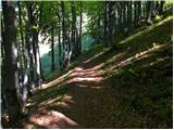 38
38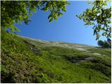 39
39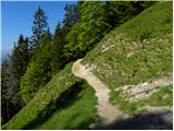 40
40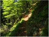 41
41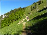 42
42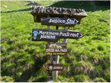 43
43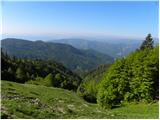 44
44 45
45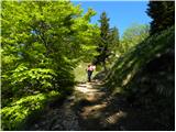 46
46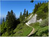 47
47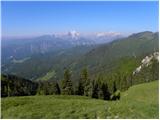 48
48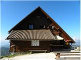 49
49
Discussion about the trip Dom Pristava v Javorniškem Rovtu - Koča na Golici
|
| lucylucy29. 05. 2017 |
We too visited Golica on the recommendation of others. The path itself is very easy, suitable also for the youngest. Considering the crowd, the service was very fast, staff friendly.
Disappointed however in Dom Pristava, where we wanted to drink and eat something. They had a crowd but the serving staff was even less friendly and accommodating than before on Golica. We waited quite a while, called or I waved to her to come to us but even after some time they didn't respond. Both walked past us. In the end we decided we had enough waiting. Work organization was very poor. We will come back to Golica, but they won't see us here anymore.
|
|
|
|
| redbull30. 05. 2017 |
Interesting, some are grumbling how lazy they are at the hut under Golica or that they don't serve
|
|
|
|
| jprim30. 05. 2017 |
Well then we're talking about the same things. Simply nothing from nothing.
Best regards!
|
|
|
To post a comment you must log in:
If you do not yet have a username, you must first
register.