Starting point: Dom v Lepeni (700 m)
| Latitude/Longitude: | 46,30370°N 13,68140°E |
| |
Walking time: 5 h
Difficulty: easy marked way
Elevation gain: 1544 m
Elevation difference along the route: 1575 m
Map: Julijske Alpe - zahodni del 1:50.000
Recommended equipment (summer):
Recommended equipment (winter): ice axe, crampons
Views: 197.127
 | 15 people like this post |
Access to starting point:
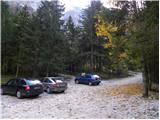
Between Trenta and Bovec, at the village of Soča, a road to Lepena branches off. We follow this fully asphalted road to the parking lot at the Dom v Lepeni mountain hut.
Route description:
From the Dr. Klement Jug Hut in Lepena we continue on a wide marked path in the direction of the Krn Lakes. After a few minutes of walking, the wide and not too steep path splits into two parts. The left one, which is somewhat steeper, is the usual one; the right, gentler and somewhat longer, is suitable for small children and the elderly. Both paths mostly ascend through the forest to the upper station of the cableway and cross each other several times along the way. From the upper station of the cargo cableway we continue on the same path, which gently ascends along the wide transport road that quickly brings us to the snow height measurement (every year in April). From here the road starts to descend and takes us past the turn-off for Velika Baba to the next junction, where we leave the road and continue left downhill on the footpath that brings us to the Dom pri Krnskih jezerih hut in a few minutes (if we continue on the road, we bypass the mountain hut).
From the hut we continue straight in the direction of Krn and Krn Lake on a gentle path to which soon joins the path that bypasses the mountain hut. We continue past the shepherd's hut, behind which we reach the next junction, where we again continue in the direction of Krn (left Bogatin, Mali Šmohor and Dom na Komni).
The gentle path then brings us after a further few minutes to the pearl of the Krn ridge. In front of us we see Krn Lake and inviting meadows alongside it for resting. The marked path then leads us along the left side of the lake at the foot of the scree of Mali Šmohor. On the other side of the lake the path turns slightly left and then ascends a somewhat steeper slope, where somewhat higher an unmarked (upper) path joins, which traverses the screes above Krn Lake in a rising traverse (this path is somewhat shorter but exposed to falling rocks). The path then turns somewhat right and brings us to extensive torrent debris cones that end at Planina na Polju.
With wonderful views of the surrounding peaks we cross the grassy Planina na Polju (on the right side, somewhat off the marked path, we will notice a hunting hut) and behind it we begin to ascend a small valley. The path then ascends somewhat more steeply and soon brings us to a partly marked junction. The marked path leading towards Krnska škrbina turns right here (straight ahead unmarked path towards Prag saddle (2068 m)) and begins to ascend more steeply. The path then moves onto steep slopes across which we ascend in a traverse to Krnska škrbina (on this section we may encounter snow patches in early summer).
From the škrbina we continue right (sharply left Prag, left Batognica and straight ahead Planina Kuhinja) on the path that begins to ascend the grassy slope of the mountain. We then follow this increasingly scenic path to the panoramic summit, which we reach after about 30 minutes of walking from Krnska škrbina.
From the summit we can descend to Gomiščkovo zavetišče in 5 minutes.
Lepena - Dom pri Krnskih jezerih 2:00, Dom pri Krnskih jezerih - Krn 3:00.

Photos:
 1
1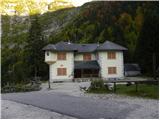 2
2 3
3 4
4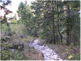 5
5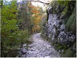 6
6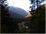 7
7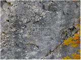 8
8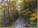 9
9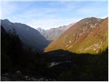 10
10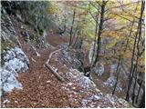 11
11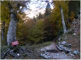 12
12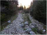 13
13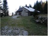 14
14 15
15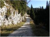 16
16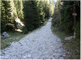 17
17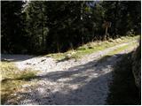 18
18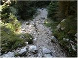 19
19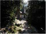 20
20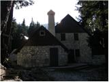 21
21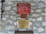 22
22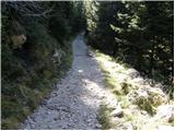 23
23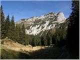 24
24 25
25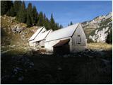 26
26 27
27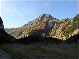 28
28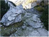 29
29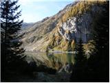 30
30 31
31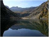 32
32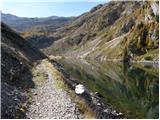 33
33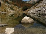 34
34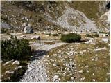 35
35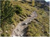 36
36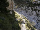 37
37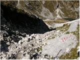 38
38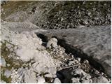 39
39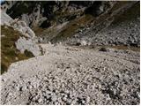 40
40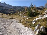 41
41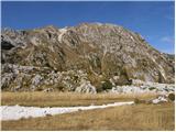 42
42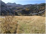 43
43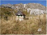 44
44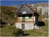 45
45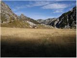 46
46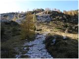 47
47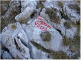 48
48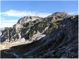 49
49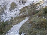 50
50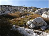 51
51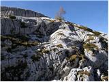 52
52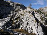 53
53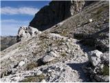 54
54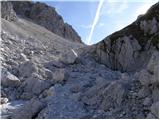 55
55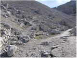 56
56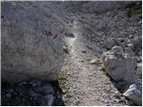 57
57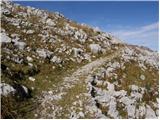 58
58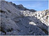 59
59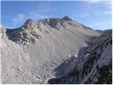 60
60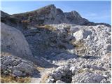 61
61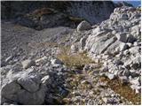 62
62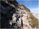 63
63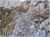 64
64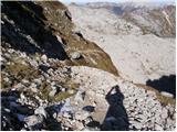 65
65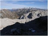 66
66 67
67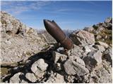 68
68 69
69 70
70 71
71 72
72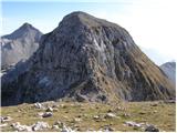 73
73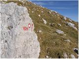 74
74 75
75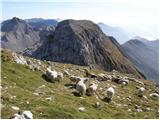 76
76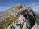 77
77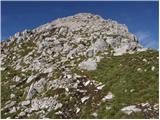 78
78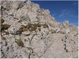 79
79 80
80
Discussion about the trip Dom v Lepeni - Krn
Show older messages
|
| ROBERT18. 08. 2006 |
I CAN'T PROMISE YOU ANYTHING ELSE BUT SWEAT AND TIRED LEGS, BUT IN THE END A WONDERFUL VIEW AND PLEASANT COMPANY. IT'S WORTH IT!!
|
|
|
|
| Gost19. 08. 2006 |
Beautiful two-day tour!!!
|
|
|
|
| Gost22. 08. 2006 |
We did it on 19.08.2006 in one day and it was quite tough, so I agree with the previous one that you get much more out of the trip in two days.
|
|
|
|
| Gost25. 08. 2006 |
Robert, don't promise us anything, because we don't expect anything from you. We went to Krn and got a lot of beauty from the mountain.
|
|
|
|
| Gost25. 08. 2006 |
SUPER TOUR! UNIQUE AND UNFORGETTABLE!
|
|
|
|
| Gost26. 09. 2006 |
Excellent tour. We did it in two days though. Namely, there's nothing better than lounging by the lake and sunbathing. But it's true that we couldn't decide where to sleep, so we'd see only at the top below Krn. Then we got lucky because some canceled, so I recommend reservations. It's nicer to wait for sunset on the top than in the hut by the lake. I'd like to praise the warden who was very friendly and made an effort so that we all could sleep and we didn't have to return to the hut by the lake. I'd also like to mention something else. When you're already in Lepena, go see the Soča rapids too, very nice.
|
|
|
|
| Gost21. 06. 2007 |
Last year we did the trail in one day, so it is feasible without problems if you only have some fitness. We even had bad weather. But Krn is one of my most beautiful peaks.
|
|
|
|
| Gost21. 06. 2007 |
Krn is also the most beautiful mountain for me. I did the ascent in autumn, when visibility was good and calm. I did the tour in one day, but then my legs hurt for two more days.
|
|
|
|
| Gost26. 06. 2007 |
When I went to Krn it was like the day of the nicest dreams.
Wonderful weather, light legs, excellent views.
From Lepena.
|
|
|
|
| Gost26. 06. 2007 |
I warmly recommend this tour also in winter time of course with appropriate knowledge and equipment. Given the short winter day I recommend bivouacking in Gomiškovem zavetišče and the next day back. Unique tour also for ski touring enthusiasts. You won't regret it  Nice day Nice day
|
|
|
|
| Gost14. 08. 2007 |
How about the remains of the Soča front? I heard you can see something, is that true too?
|
|
|
|
| Joža14. 08. 2007 |
I was on Krn for the first time last month and was surprised by what can be seen from the First World War. Especially on the way back, when we went back through Vratca past Rničica and Skutnik to Log along the new peace path, marked with a red and black line, past the monuments of the First World War. The path is correctly called Soča front - Path of Peace.
|
|
|
|
| Gost17. 08. 2007 |
I was first on Krn on 16.08.2007. Wonderful, unique, although for a one-day tour perhaps a bit too strenuous, despite good fitness. Best regards to all mountain lovers.
|
|
|
|
| Gost18. 08. 2007 |
heading to Krn tomorrow with my boyfriend.. full of expectations after all these descriptions.. I believe it's very nice
|
|
|
|
| Gost2. 11. 2007 |
Long not overly demanding hike, but magnificent Fanc
|
|
|
|
| mukica2. 11. 2007 |
Very nice hike, but now almost impossible in one day.
|
|
|
|
| leonbok23. 07. 2008 |
Good, cool and super tour
|
|
|
|
| TinaPRR4. 08. 2008 |
The best is at the top :-)
|
|
|
|
| TinaPRR12. 08. 2008 |
Hi, and here's this information... As a warning. This weekend I found out that the hut keeper at the hut on Krn misled us a bit a week ago. On the PZS website I found the highest allowed prices for overnight stays in category 1 huts, which includes Gomiščkovo zavetišče. The keeper charged us 24 eur per person, but PZS price list says 18 eur Additionally, he charged 3 euros for a 1-liter bottle of plain water, while the max for 1.5l bottle per PZS is 3.5 euros. I checked at PZS too, they said they've warned the keeper and will refund the difference if we want Additionally, he charged 3 euros for a 1-liter bottle of plain water, while the max for 1.5l bottle per PZS is 3.5 euros. I checked at PZS too, they said they've warned the keeper and will refund the difference if we want
|
|
|
|
| ben12. 08. 2008 |
This really interests me, in what way will they refund you the price difference? And for water too?
|
|
|
|
| Stolar14. 08. 2008 |
With the bill, which they usually don't issue to you, you have to come back to the top or to the hut and there they will return the difference to you.
|
|
|
|
| TinaPRR25. 08. 2008 |
Hi mate, I'm also interested how... I wrote to Mr. Sbrizaj (PZS general secretary), who replied to my email, then sent him the contact details for the refund, but no reply yet. For water probably not, as the price is fixed only for 1.5l bottle, for other quantities caretakers/PD can set prices themselves. Lesson for next time, what can I say... I'll report when (if) there's anything new
|
|
|
|
| peterhaf14. 08. 2009 |
Is the path suitable for a dog?
|
|
|
|
| pegas4314. 08. 2009 |
All credit, drag it with you to the mountains!!
|
|
|
|
| katjuša214. 08. 2009 |
peterhaf; from Dom v Lepeni to Koča pri Krnskem jezeru easy, as the path is almost everywhere on the mulattiera.
Those who go further will tell.
|
|
|
|
| kofetarca14. 08. 2009 |
I'm newly registered and reading some comments from last year... interesting, my colleague and I also slept in Gomiščikovo zavetišče on 11.8.2008 and paid that amount despite PD membership... and also for 0.5l of water we paid 3 euros
|
|
|
|
| peterhaf21. 08. 2009 |
The dog already has quite a few two-thousanders behind it.
|
|
|
|
| Pinto24. 08. 2010 |
I hope this weekend at Koča pri Krnskih jezerih repeats as little as possible. After a full day of hiking you finally reach the hut, where instead of a smile and relief you're greeted by a rude and agitated hut warden and too few staff in service. I understand there was a crowd, but they could have been a bit better prepared for it. It was known that the weather would be nice. The last thing hikers need in the mountains is BAD MOOD!!!
|
|
|
|
| skalar5024. 08. 2010 |
so, when I read the above entry, apparently we are not the only ones with bad experiences with the team at Koča pri Krnskih jezerih... Do people from mountaineering associations who place the wardens read this? Maybe it would be worth opening a special subforum "experiences with wardens in Slovenian mountain huts"...
|
|
|
|
| Pinto24. 08. 2010 |
I agree! Tired and modest (we just need good mood!) hikers really deserve a bit more than bad karma and eye-rolling!
|
|
|
|
| Bajtur2. 09. 2010 |
Unfortunately I have the same experience with unfriendly staff
|
|
|
|
| joža x2. 09. 2010 |
Probably it's hard to be in a good mood towards a tired hiker if you've been serving various difficult and exhausted hikers (patients) for 12 hours already. I wouldn't expect pampering from a person who works all day just because I'm tired from a whole day of strolling in the mountains. I have good experiences with the team at Krn Lakes, they were friendly and immediately ready to describe paths in the area and lend a map that they normally sell. Put yourself in the shoes of the hut keepers and you'll see things differently.
|
|
|
|
| swix262. 09. 2010 |
That you work is no excuse to be grumpy 24 hours a day. If you're grumpy non-stop, then find a job where you don't interact with people.
|
|
|
|
| Bajtur3. 09. 2010 |
Exactly, Swix26. Then the staff in every well-visited inn could be grumpy, but we all know that's not true. A good guest is a satisfied guest who will come back.
|
|
|
|
| turbo3. 09. 2010 |
What was that ad some time ago:
"Tourism is people"
|
|
|
|
| dore3. 09. 2010 |
Pinto,skalar50,... come on people, did you go to the mountains or to a village festival? For example, I don't go to the mountains because of mountain huts, but to enjoy myself, even without them. Gentlemen "hikers", put a thermos with tea, a kilo of bread, salami in your backpack, and there won't be a problem with PROBLEMATIC WARDENS.
|
|
|
|
| Tomažke3. 09. 2010 |
dore, sorry, but yours was a typical Gorenjska one. Why village festival? Mountain huts are an integral part of our mountains, I see no reason why not to sit comfortably for a couple of minutes and drink a beer in peace. Even if you pay 4.5 € for a Gösser in the Brazza hut under Montaž.
|
|
|
|
| arko3. 09. 2010 |
In July this year, my wife and I spent two days as guests in the hut at Krn Lakes. We hiked the surrounding hills and enjoyed the beautiful surroundings. The hut staff was very friendly and the service very good. We returned to the valley with very nice impressions and the intention to return.
|
|
|
|
| arnika5. 09. 2010 |
We were also at Krn Lakes on August 23rd. The wonderful nature was enhanced by the nice weather. But all that was spoiled for us by the bad mood of the hut staff when we wanted something from their offer. The lady (I don't know if it's an appropriate term for her), said in an unwilling voice that we should wait because they have lunch. Politely and understandingly we left the room and waited over 15 minutes and then returned. But this time we got exactly the same answer, with an angry look, although we saw that she had served some guests in the meantime. Only when we said that we had already waited 15 minutes, did she serve us. We think that such people who are angry at us and the whole world are not suitable for working with people, especially not in the mountains, where complete strangers greet each other friendly and share the beauties of our mountains together.
This staff is the complete opposite of the reception of visitors on Velika Planina among the shepherds. There the guest is first, even if lunch is being prepared. Because satisfied guests like to return there precisely because of the friendly and warm reception, which we cannot say for the hut at Krn Lakes.
Good word travels..., bad one even faster...
|
|
|
|
| Justina Erčulj5. 09. 2010 |
We also encountered unfriendliness in the hut today, so I join Arniki.
|
|
|
|
| Bohor6. 09. 2010 |
I would like to praise the excellent team at Kriški podi.
|
|
|
|
| darh19. 10. 2010 |
On election Sunday, the last really nice weekend before the recent cold snaps, we set off on the path described here to Krn. We completed the tour pleasantly tired without major difficulties in one day. It was quite lively at the top of Krn, but most of the numerous visitors climbed up from the Tolmin side, as we met far fewer hikers on the path past Krn Lake. More about our impressions here.
|
|
|
|
| tincelj4. 07. 2011 |
Just yesterday we returned with a colleague from a two-day hike to Krn from the Lepena direction, via Krnsko jezero. Really nice path, very well marked and not too strenuous. We were lucky because it was cloudy and the sun didn't scorch too much. We stayed overnight in Gomiščikovo zavetišče. And I have no other words but pure praise for both caretakers. The gentleman and lady are in their first year as caretakers of this shelter, very friendly and obliging. The hut is very well maintained and clean. So, once again I can only say all the best about the entire trip! Highly recommended!
|
|
|
|
| plejade4511. 07. 2011 |
These comments are really sad.... apparently in the hut at Krni it depends a bit on the day. I go there every year and so far had good experiences. I hope it will be the same this year and that the experiences other hikers describe won't repeat 
I just can't imagine what annoys people like that, especially since hill walkers are generally not demanding and are satisfied with little...
Despite the above experiences, I recommend this path to everyone and wish you the most beautiful experiences.
|
|
|
|
| Pinto25. 07. 2011 |
That's the problem; hikers are not demanding and are satisfied with little, but I was still very disappointed. I don't need service like in the valley, but let the keepers leave the bad karma somewhere lower down too. If this happened to me somewhere lower, I wouldn't tolerate it for a second and would pack up and leave immediately.
|
|
|
|
| lepenatka26. 07. 2011 |
In Gomiščikovo zavetišče the caretakers are from Lovrenc na Pohorju. Mrs. Hilda bakes good strudel and makes ashtrays from pebbles and weaves baskets.... when there's no rush. They are really pleasant.
|
|
|
|
| krasovc26. 07. 2011 |
At the hut by Krn Lakes my son and I were there for 3 days last year and it was fine, the caretaker and everyone were helpful and friendly. This year I've already been there too, although I didn't overnight, no problems. I think the flies are more among hikers, especially those who come with nagging questions that you'd want to smack them on the head, and in that I understand every caretaker who gets upset and has my full support. 
|
|
|
|
| Janiel7428. 07. 2011 |
Does anyone know if this trail has accumulated snow in the last days? Is it OK to go normally?
|
|
|
|
| IgorZlodej28. 07. 2011 |
No new snow to be seen on Krn. Not normal though, as it's too cold for this time of year, but nice to hike because not too hot, so almost normal.
|
|
|
|
| Janiel7428. 07. 2011 |
OK. Thanks. I'd go up on Saturday or Monday. Whatever.
|
|
|
|
| skalar5028. 07. 2011 |
"to bash their heads in" ... it says a bit higher "krasovc" ... ???
even Filipčič's legendary "butnskalarji" would grab their heads at such a tone of writing...
|
|
|
|
| velkavrh29. 07. 2011 |
I was here two days ago on a trip to Baba. Lots of visitors, especially a huge number of foreigners. I ordered an apple strudel, my guide lady two coffees, which arrived immediately. But for the strudel I had to wait quite a while at the counter. The older gentleman who served was silently waiting behind the counter with me for that strudel of mine. Unusual, so taciturn. Usually they are more talkative in huts. I don't know, no comment. The coffee cooled down while waiting for the strudel. During the rush of guests it probably can't be otherwise. I wouldn't polemicize too much, just stated my experience.
|
|
|
|
| GregorC29. 07. 2011 |
I was at the hut by the Krn Lakes last August during the weekend. It was full both outside and inside and we with the group (5 people) were served (drinks and strudel) very quickly. And the lady at the counter was in a very good mood. So I got a pretty good impression from the visit. Obviously we each have our own experience, but that's almost everywhere. Someone will be very satisfied, another won't even want to hear about that place, hut anymore... Best regards
|
|
|
|
| alenkar8. 08. 2011 |
I also went at the end of July from the Dom v Lepeni, past the Krn Lakes to Krn.
Very nice path with beautiful views. The caretakers at the shelter under Krn are friendly and very helpful. Commendable. The shelter has shared bunks, but we slept well. The next morning a beautiful day awaited us.
|
|
|
|
| ales508. 08. 2011 |
Yesterday there was fog and windy with rain, I think winter is at the doorstep, if you see a black olm on the path just turn around and back to the valley, because it will rain, otherwise there was super service at the homestead on the way back and excellent cheese.
|
|
|
|
| lakkon10. 08. 2011 |
Which trail gets you to Dom v Lepeni from LJ the fastest? My colleague and I would like to arrive at the starting point as early as possible in the morning. Since it will take us quite a lot of time altogether, we will of course choose the day when our 'weather forecasters' predict no rain. The operation will be done in one day.
I myself was two weeks ago for the first time since 1994 on a 2-thousander. 'Fell' Stol. http://www.hribi.net/izlet/poljana_valvasorjev_dom_pod_stolom_skozi_gozd/11/382/2380 + http://www.hribi.net/izlet/valvasorjev_dom_pod_stolom_stol_zirovniska_pot/11/53/139 and back via Zabreška pot.
Given that I already have one experience without, I'm interested: what's the hike to Krn (http://www.hribi.net/izlet/dom_v_lepeni_krn_/1/150/281) generally like compared to the mentioned one on Stol? Time-wise – ascent only, clearly - estimated: Krn 5h, Stol 4h10min. Height difference is approximately the same.
This time I am and will be (I hope) physically much better prepared. Only on the fourth day after Stol did my legs stop hurting, and honestly, back then I didn't do anything to make the soreness go away sooner. Now I have more information on hiking and mountaineering and I practice them.
Unfortunately, we won't have too much time for other detours off the trail, but still: is there anything nearby that we really shouldn't miss?
Thanks for the help.
|
|
|
|
| GregorC10. 08. 2011 |
From LJ to Lepena, the fastest is via Kranjska Gora over Vršič.
|
|
|
|
| lakkon10. 08. 2011 |
GregorC,
is that true? Somewhere - unbelievably, on a foreign forum - I read.
From Kranjska Gora you have two options.
- via Vršič pass (1640m) - very twisty road, but also scenic. You can stop at several places and have great views.
- via Predel pass (1100m) - faster, less twisty, you have to go into Italy for about 20km.
Predel pass is not as pretty but definitely quicker, so if in a hurry take Predel.
If you don't want to drive over alpine passes, you could take the road from Ljubljana via Logatec, Idrija, Most na Soči, Tolmin and Kobarid to Bovec. It's an average regional road, well maintained, drive takes approx. 2 hours.
Via Nova Gorica --- 155km LJ Bovec...
so what: Predel - Vršič - Idrija - Nova Gorica? The routes seem very similar time-wise to me.
yeah, best to call someone in Bovec, a local, for first-hand info, right?
|
|
|
|
| GregorC10. 08. 2011 |
I usually go from Železniki to Bovec via this route, or also via Predel. Maybe it's really faster here, or no big difference. I don't know what the Logatec - Idrija road is like. For me, the alternative through Baška grapa (Podbrdo - Hudajužna - Bača - Most na Soči), but there the road is narrow, twisty and always up and down. But it's shorter in kilometers, longer time-wise. However, the Idrija - Most na Soči road is much nicer (wider) than via Baška grapa. Time-wise all are about the same. Via Vršič or Predel you gain a lot with the highway to Jesenice (provided no traffic jam at Perčačica)
Probably there are also quite a few here on the forum who can provide more info. Anyway, as you wrote. All routes are very similar time-wise. LP
|
|
|
|
| janezjanez22. 08. 2011 |
On 21.08.2011 I was on Krn and I have to admit that the total walking time was about 11 hours (walking + rest at Krn lake). I recommend to everyone who feels physically capable to go on a pleasant but long walk. Best regards.
|
|
|
|
| Gorazda31. 08. 2011 |
On 23.8.2011 we started from Lepena to Krn. At normal pace it's 5 hours hike to the summit. We returned the same way and arrived back at the car in 3 hours with short breaks and rest at the hut by Krn lake and Gomilškov shelter. On the way we also met 2 chamois from very close. On the way there are also no pitons, maybe info for those afraid of them. Good tour and very nice view of other mountains and especially the lake. We were lucky because the weather was great (almost too hot) - sunny without a cloud. Highly recommend!
|
|
|
|
| Gorazda31. 08. 2011 |
On 23.8.2011 we started from Lepena to Krn. With a normal pace, it takes 5 hours to the summit. We returned the same way and arrived back at the car in 3 hours with short breaks and rest at the hut by Krn lake and Gomilškov bivouac. Along the way we also encountered 2 chamois from very close up. There are no pitons on the path either, maybe info for those who fear them. Good tour and very nice view of the other mountains and especially the lake. We were lucky, the weather was great (almost too hot) - sunny without a cloud. Highly recommend!
|
|
|
|
| Janiel741. 09. 2011 |
So @Gorazda: did you two start up 3 times and meet 6 chamois or what?))
|
|
|
|
| danicak1. 09. 2011 |
regarding the road to Bovec, Lakkon was asking where it's suitable to "drive". In August I decided to go to Bovec (goal Krnska jezera or further Krn) via Logatec-Idrija road.... I probably won't drive this road again because it was veeery long, road quite solid but never ending- Otherwise quite decently wide, but up,down,up,down,...narrowing, wider again, then from the start again. My experience, don't recommend.
|
|
|
|
| ales501. 09. 2011 |
Batognica is nicer than Krn, you have lots interesting to see, Krn summit itself isn't interesting but wonderful view, Walk of Peace is everywhere the Soča front ran, through Šrbina, over Batognica and around,
|
|
|
|
| slamca5. 10. 2011 |
On Saturday, an incredibly beautiful day spent between Lepena - Krn - Lepena. Exceptionally nice, real summer temperatures. Just a shame that Gomiščkovo zavetišče was closed - the earnings went bye-bye. At the summit and around the shelter, there was quite a crowd and beautiful views far around.
|
|
|
|
| Hammer18. 02. 2012 |
Group of 3 went to Krn today. It was sup, even triplesuprdupr tired we were after the tour. Snow sinks in places (up to knees max), in places none. Access to Škrbina via the classic (summer) path seems quite dangerous to me, we went rather "direct" from below straight up. It was like on contra moving stairs, 2 steps up, 1 down (slightly frozen snow on top, some soft snow inside, hard frozen underneath) but it went. Ice axe at least mandatory for this part, for the cautious also rope for descent due to almost icy surface in places. Approx 6 hours up, 4 down. Ultra tired, ultra nice tour.
|
|
|
|
| pohodnikR14. 05. 2012 |
I'm wondering if there's any transport from Soča to Lepena for overnighting?
How far on foot?
Best regards!
Rajko
|
|
|
|
| B214. 05. 2012 |
From the junction off the main road to the Dom in Lepena is about five kilometers. Just the right hike for good sleep... Otherwise, Dom Klementa Juga in Lepena opens in June (June 9). To the hut at Krn Lakes is another two and a half hours from there. There is an equipped winter room available - and electricity...
|
|
|
|
| dvince15. 05. 2012 |
on Saturday 19.5. I start around 11 (unfortunately can't earlier because tied to transport) from Lepena past Krnsko jezero towards Krn and around Prehodovci back to Lepena. Depending on snow conditions I can also skip Krn and make a loop just past Prehodovci.
Pace a bit faster, if possible
Anyone joining me?
|
|
|
|
| ales5015. 05. 2012 |
I went at 11 from home to Rombon, if the weather is nice you can reach the top, otherwise there's quite a lot to walk and intermediate stops take quite some time, especially if you explore the surroundings a bit, I was at Kluže around 13, then went straight to the path so I wouldn't be late, arrived only at half past three a bit below the summit and another good 40 minutes to the top, for Krn I'd rather go in the morning, because then I'd descend to Batognica and to the top above Peski, Jezera Lužnice to the monument and back to Krn and to the valley, that's my advice, if you're tied to other transport it's different, but still you can reach the top, just take a flashlight with you,
|
|
|
|
| Nimrod25. 06. 2012 |
For starters I'll say 'thank God for the holidays'. I spent the weekend at the hut by Krnsko jezero and in the surrounding hills, so today I'll lounge all day although I don't feel tired but I feel I need to give my body a chance to recover.
From Lepena we went past the hut at Krnsko jezero to Velika Baba - nice ascent - first completely easy through meadows, then a bit harder and below the summit, as it should be, quite a bit hard all by the rules, with a fast pace it can be done in 1 hour 15 min. We returned to the hut where we refueled and rested.. Actually I'm posting here because of the hut and the complaints I read, probably from people who haven't seen many mountains. The hut itself is clean and tidy, food is excellent, prices appropriate for the location, the people there to do their job and they do it well. Those expecting the same service as in Ljubljana when ordering their Latte Macchiato don't realize that in these huts work people who are primarily mountain lovers, who spend several months there or hike 2 hours uphill to work. A bit different from the sugared service down in the valley, don't you think?
Anyway after a longer rest we headed towards Krn, easy but long ascent. The reward is top-notch, everything you see on the way and from the summit hard to trade for anything. the worst part of the whole weekend was the descent back to the hut, when we were already so tired that the already long path dragged even more. After a slept night we headed in the morning to Mahavšček, really nice trip, already because we treated ourselves to a tourist journey without any pace, lounging on sunlit meadows also on the top of that wonderful mountain pasture. Really nice.
Happy steps to everyone.
|
|
|
|
| ko2. 07. 2012 |
bivouac on Krn a few years ago now I'll have to go again to see how to reserve the hut
|
|
|
|
| el rocco3. 08. 2012 |
With my wife and daughter, on 31.7. and 1.8.2012, we did a two-day trip to Krn. The first part of the trail through the forest is similar to going to Komna, but not strenuous. The second part of the trail is somewhat bigger challenge, but not because of the trail which steadily ascends moderately all the time, but because of the heat reflecting off the rocks. If you go up without a head covering, no way, otherwise a slightly strenuous but excellent trip. For the end of the trail, I recommend bathing or at least soaking your feet in the Soča - priceless
|
|
|
|
| lubi13. 08. 2012 |
With a colleague, we did a 1.5-day trip; slept on shared bunks in the Koča ob Krnskem jezeru (this year's team is well coordinated and professional, cooking, service and supply run smoothly. Morning ascent to Krn, continuation to Batognica (you swear at the mountain - how not to, since you practically walk on a battlefield and mortar site). Gomiščkovo zavetišče was supplied this time by a young man with double energy dose (with a backpack he "jumped" to the hut at the lake for "supplies"), the smiling girl served us jota and pancakes right on the "balcony"-PRiceless Cooling feet in the lake does good; El Rocco will have to refresh his elementary school knowledge of sign reading - swimming is namely FORBIDDEN Safe and prudent step to all.
|
|
|
|
| lubi13. 08. 2012 |
El Rocco sorry..... I was too quick in my indignant thoughts. Soča is definitely allowed and recommended, although it "cuts" into the feet
|
|
|
|
| iomejc3. 08. 2012 |
Since I haven't walked these areas yet, I'm interested if the trip is suitable for children (6,4) and where one could sleep?
OK, we probably won't go to the top, but I'm interested if there is any nearby peak or pasture in the area that we could visit?
|
|
|
|
| rjudnic3. 08. 2012 |
About halfway there is Dom pri Krnskih jezerih, on the top of Krn there is another hut. But this trip seems to me a bit too long and strenuous for a 4-year-old child (from Krnske onwards the sun burns non-stop).
|
|
|
|
| el rocco6. 08. 2012 |
For a 4-year-old child, the tour seems a bit long to me. Besides the over 1700m elevation difference from Lepena to Krn summit, the biggest problem is the heat which, as rjudnic said, mercilessly cuts from the hut onwards. Personally, I suggest going to the hut, overnighting, and then the next day as early as possible to the summit. Best at 4:30 or 5:00.... Thanks lubi1 ) I accept the apology )
|
|
|
|
| iomejc6. 08. 2012 |
That's what I thought too, yes... First day to the hut, overnight, then next day to some nearby pasture and descent. To the summit, especially if the sun burns non-stop, we won't go.
|
|
|
|
| el rocco6. 08. 2012 |
Iomejc, you can go to Krn summit without problem, just go early enough. The path takes about 3 hours, below the summit you have Gomiščkovo zavetišče anyway where you can refuel on the way back. But it's good to take enough drinks and sandwiches as prices........ well......
|
|
|
|
| ales506. 08. 2012 |
Iomejc don't carry sandwiches up, better take something light, I tried sandwich on Krn and it's not the right altitude for such food, a bit more veggies and a bit of meat, best in the bivouac, hot food, that's the best, but it's too hot for this time, unless you go very early from home and are at the summit before twelve and return then already.
|
|
|
|
| tiasha10. 08. 2012 |
How's the trail for dogs?
|
|
|
|
| Janiel7410. 08. 2012 |
Tricky... if you go in the sun, it's dog-hot for him too
|
|
|
|
| ales5010. 08. 2012 |
hehe, yeah for dogs you have a dog gondola, but the heat won't be too much for him, hehe
|
|
|
|
| Grega7013. 08. 2012 |
My girlfriend and I were on Krn this weekend and I must praise the friendliness and hospitality of the caretaker Jani and his better half, who with exceptional homeliness take care of every visitor to Gomiščikovo shelter below the summit of Krn. I recommend trying their yummy, yummy strudel!
|
|
|
|
| pirseb243. 07. 2013 |
I'm interested based on your experiences if the path is very demanding if done in one day and approximately how many hours of walking the whole path is
Thanks for answers
|
|
|
|
| Daaam3. 07. 2013 |
Actually it's all written in the description.. The path is not demanding, average hiker reaches the summit in approx. 5 hours. Of course the path can be done in one day, if you have enough fitness that after 5 hours uphill you can still go back normally..
|
|
|
|
| borovnicka3. 07. 2013 |
With partner we did the path two years ago, in October, in one day. Technically not demanding, but long. But if you have solid fitness, there shouldn't be a problem. We started in Lepena at 7 o'clock (in October it dawns only then) and returned to start at 19h - so 12 hours, but we diligently stopped, photographed, took time for snack ...
Take enough liquid with you, especially now when it's already hot, and some headgear. But it's gorgeous, unforgettable!
|
|
|
|
| pirseb248. 07. 2013 |
Finally on Saturday I did the Lepena-Krnska-Krn tour.
Very looooong and strenuous day tour, at least for me personally, but it can be done. Total walking time 8.5 hours
|
|
|
|
| 4polon26. 07. 2013 |
pirseb24, when did you start from Lepena?
|
|
|
|
| vikikrema27. 07. 2013 |
Today from Lepena: just under 1.5 hours to the hut and then another good two hours to the summit. Back: 1.5 hours to the hut and then another good hour to the starting point (without counting stops). With an "early hour" you can avoid walking in scorching sun (at least to the summit) ... Total 8 hours.
|
|
|
|
| 4polon28. 07. 2013 |
Here, I was also on Krn today. Since I wasn't sure when it gets dark, I preferred to leave home a bit earlier. Started from Lepena at 5:10. To the top of Krn it took a good 3 hours 15 min. At the top it was cold, windy and fog thick as pea soup. Within about an hour everything cleared up and the sun peeked out. So on the way back it was scorching. Total 5.5 hours of walking.
It was nice.
|
|
|
|
| otiv28. 07. 2013 |
Was there also a run to Krn today?
|
|
|
|
| Ingrid284. 11. 2013 |
I was with mine on Friday, 01.11. from Lepena to Krn and back. It was a fantastic day! You could see to the Gulf of Trieste, Triglav was visible, Kamnik-Savinja Alps, Dolomites, in short, as far as the eye can see.
We started at 8am from Lepena, at 4pm we were back at the car (with almost an hour stop at the summit).
In short, a wonderful path that we'll return to!
|
|
|
|
| malimiha3. 06. 2014 |
Does anyone know what the current conditions are? Thanks and best regards
|
|
|
|
| panda24. 07. 2014 |
Current conditions: from Lepena the path is without special features, from the lake there are three snowfields, which can be crossed without problems; the snowfield just above the hunter's hut is a bit tricky, to bypass it over scree - strenuous. If you sleep in the bivouac on Krn, in the morning kick steps in the snow (crampons or stamping). From that side very few hikers go up due to considerable snow remnants. Checked 23/24 July. Only four slept in the bivouac.
|
|
|
|
| Jure8728. 08. 2014 |
Does anyone know how occupied the overnight stays are at Dom pri Krnskih jezerih on weekends? I tried calling the hut, but the number is unreachable.
|
|
|
|
| mirank28. 08. 2014 |
try to find out through PD Nova Gorica, which manages the hut
|
|
|
|
| dejan6829. 08. 2014 |
From my own experience it is very crowded. I recommend reservation. The warden's number you have on the PZS website and RTV SLO teletext. But you have to try several times. I got it only on the fifth or sixth attempt. Lp
|
|
|
|
| VandrovecGrega15. 08. 2015 |
A few info from 8.8.2015. Drinking water available at Dom v Lepeni. Coffee and service at the hut is great. Path to Dom pri Krnskih jezerih is ok, for those in shape it's worth shortcutting (partly marked, but hard to miss), otherwise the path zigzags all the time. Water at Dom pri Krnskih jezerih IS DRINKABLE, despite their marketing ploy that it's not. Drinking water available (free) a bit further on the path to Krn, where there's a small farm. There it's obligatory to buy at least homemade cheese (happy cows on the path), and they'll refill your water for the way to Krn. Path is completely dry, few people on the way, but then they gathered at Koča pod Krnom, including Russians in just Adidas shoes and shorts (who before at Dom pri Krnskih jezerih asked passersby what a logbook means). Since a thunderstorm was brewing, we quickly headed back. Stop for jota at Krnskih in between. Great trip.
|
|
|
|
| Ljubljana15. 08. 2015 |
Water at Dom pri Krnskih jezerih IS DRINKABLE, despite their marketing ploy that it's not.
|
|
|
|
| dvince7. 09. 2015 |
what are the conditions like, is there any snow up there already?
|
|
|
|
| Smetar8. 09. 2015 |
In principle, there shouldn't be any (what was there has melted away) or it doesn't present an obstacle. If you need more precise info, call the hut (http://www.pzs.si/koce.php?pid=41)
|
|
|
|
| cdgk1. 07. 2016 |
Hello,
what are the conditions on the path from Dom v Lepeni to Krn? Is there accidentally still some snow and thus greater danger?
Thanks for the reply. Best regards!
|
|
|
|
| janin4. 07. 2016 |
Hello,
I'm interested if anyone has experience with the path to Krn from Lepena and then towards Komna or Savica? Where is the best place to overnight?
Thanks and happy trails
|
|
|
|
| bpavlin820. 07. 2016 |
18.07.2016, with my wife did a two-day trip from Lepena to Velika baba, overnighted in the hut by Krn lake, next day ascent to Krn and return to Lepena. Path to Velika baba freshly marked, grassy part mowed, summit logbook at the top, stamp below in the hut. In the hut high quality of service, cleanliness and friendliness. Second day ascent to Krn, from the top beautiful views towards Triglav, towards the sea occasionally disturbed by mists from planina Kuhinja. Descent to Lepena already with tired legs.
|
|
|
|
| zlatica2. 09. 2017 |
orchidlily, when exactly were these shots taken - I'm curious because of the flowers...? Very nicely presented flowers along the path....
|
|
|
|
| orchidlily25. 11. 2017 |
Zlatica, sorry for replying to the question only now - I didn't follow the correspondence. :-( The recordings are from 27.07.2017. Regards!!!
|
|
|
|
| zlatica26. 11. 2017 |
orchidlily, it's never too late Good thing I noticed
|
|
|
|
| hermannbuhl7. 06. 2018 |
I went on this path today. There's still a lot of snow, weather is nice otherwise, but the snow is icy without crampons from the lake onwards I don't recommend.
|
|
|
|
| Hribolazec815. 08. 2018 |
We would like to go to Krn and also visit Krnska jezera, any idea for starting point (preferably circular tour due to the car), is my idea correct?
Lepena - Krn - Back descent to the valley overnight at the hut at krnskih jezerrih, next day we can stay a bit longer at Krn Lake and in the afternoon back to the valley to Lepena...
Thanks everyone for ideas or help
|
|
|
|
| m965š5. 08. 2018 |
Idea for a circular tour ...
Starting point in Lepeni, continue to Krnska jezera and ascend past planina Na polju over Krnska Škrbina to the bivouac and to the summit of Krn. Return to Škrbina, here decide for the western path to Batognica or bypass it on the eastern path. Continue along the former military gallery below Vrh nad peski towards the monument of the 15th mountain brigade. Descent through scree on the path below the ruins of the barracks in Melenu, then towards Lepoč find the left marked path to Krnska jezera and the hut. If you have an exploratory spirit (pathless, but no exposure) ascend below Melenom to Šmohor (both) and from the saddle descend likewise to the hut at Krnska jezera. Next day return to Lepeno. Good luck on the path.
|
|
|
|
| baro6. 08. 2018 |
This Saturday, 04 August 2018, we arrived at the hut by car at 7 a.m. We entered the hut because it was still quite fresh outside, and we were lightly dressed as we were heading to Krn and usually get hot quickly while hiking. Already upon entering, we noticed that the warden didn't like us sitting inside and immediately asked why we couldn't sit outside. OK, we ignored her bad mood, still had coffee inside, and set off for a full-day hike. We returned to the hut around 19:00, as we had booked accommodation for 3 in a room with 8 shared beds. Of course, after a quite strenuous (mainly long) path, we expected a well-deserved evening relaxation and especially a friendly warden. But her behavior, communication, and attitude are really below any decent level. And it's not just our whim—we've visited countless mountain huts—but even after talking to other guests outside, we saw that her manner doesn't suit anyone. Her curt responses when ordering like "I can't now", when asking for Radenska, or at 20:00 when a guest with small children asks if they can still get something to eat, she replies "No, we serve only until 20", when another guest asks if he can get pancakes, she says "I don't know, I don't know what time it is, maybe" etc. She exudes so much negative energy that we certainly won't return to this otherwise very nice hut. Out of principle, we got up at 5:00 the next day, quickly left Lepena, and had coffee elsewhere. She really sets a very bad example for Slovenian tourism, especially since there were quite a few foreign guests.
Otherwise, the path to Krn is wonderful, the wardens at the other two huts (Planinski dom pri Krnskih jezerih and Gomiščkovo zavetišče) are fantastic. Batognica is also nice to see.
|
|
|
|
| Hribolazec816. 08. 2018 |
m965š full thanks for the idea, I'll take it into account Have a nice day
|
|
|
|
| Lazo14. 07. 2020 |
Another successful mountain trip.
This video shows the entire partially difficult marked trail from Dom v Lepeni (Dom Dr. Klementa Juga) to Batognica and Krn. The trail was without issues. Suitable for all age groups, just needs a bit more fitness if you want to do it all in one day. I definitely recommend the trail, as it rewards us with numerous views and also remnants from the First or Second World War.
Here is the entire trail if anyone is interested in more detail.
https://www.youtube.com/watch?v=VCS8_VWOTCU&list=PLCxvFZAu2k7ZlICujW4asZmxFO7md7THq&index=9&t=0s
|
|
|
|
| darinka429. 06. 2022 19:30:05 |
Yesterday after 40 years on this path from Lepena to Krn. I had no idea what it looks like. Fortunately nice weather held until 17:00. As forecasted. And 5 hours of hiking is quite realistic. Although in yesterday's mugginess it was perhaps a bit harder to walk. Definitely more so in the last part on descent, when thunder and strong wind accompanied us.
|
|
|
|
| amarko8. 06. 2023 08:37:02 |
What are the conditions on the path, is there still a lot of snow?
|
|
|
|
| Tajka6725. 07. 2023 12:04:32 |
Yesterday I finally managed to reach Krn from this direction. For me, the most annoying was returning from Krnsko jezero down to Dom Klementa Juga. Rocks and stones on the path really hurt the soles. Initial part similar to the ascent to Komna, left-right a thousand times . The weather was everything from the sun that burned quite badly, to rain. Most unpleasant was the wind. All effort rewarded with beautiful views. For my age group I recommend afternoon to Dom pri krnskih jezerih, then second day to the summit.
|
|
|
|
| Tbs17. 06. 2024 16:17:06 |
Has anyone been on this trail this year already? Is there still a lot of snow?
|
|
|
|
| Tomaž007. 07. 2024 16:30:37 |
Is this path already completely dry, thanks
|
|
|
|
| NEIC00827. 08. 2024 08:21:13 |
I'm wondering if you can drive by car from Klement Jug hut in Lepena to the hut at Krn Lakes.?
And please no silly comments, because I have a reason why I'm asking.
Thanks
|
|
|
|
| DVas27. 08. 2024 08:28:02 |
No. And if I'm not mistaken you've already got the answer. By car you reach Lepena from where you have a marked 2 hours to the hut at Krn Lakes.
|
|
|
|
| Daaam27. 08. 2024 08:28:56 |
Of course you can have a good reason why you're interested in this, but you don't have a sensible reason to ask because you can answer this question yourself. I'll help you anyway - step 1. Carefully check the above photos and if you think the path is drivable by car then go ahead boldly. If you think not, open one of the countless online maps (the most common is google maps) and search for the starting point and destination and see if there's any other road connecting them besides "the one from the description" and that's it - 2 minutes of research and no need to bother with our "silly" answers. LP
|
|
|
|
| NEIC00827. 08. 2024 09:28:48 |
thanks for the really STUPID answer. There's always some smartass..
|
|
|
|
| _sandra_27. 08. 2024 09:51:27 |
@NEIC008: nobody here is a smartass, we're just surprised by such a question.. if you've looked at the pictures and the route description, it's clear that you can't reach the hut at Krn lakes by car; any further question in this direction is superfluous and the stupid ones here aren't the answers, but your question
|
|
|
|
| aladin27. 08. 2024 10:16:44 |
It would be irresponsible to give a different answer.
|
|
|
|
| turbo27. 08. 2024 10:43:28 |
Maybe you'll get lucky and they'll take you up with a truck
|
|
|
|
| mirank27. 08. 2024 11:04:51 |
If you ask, you're stupid for 5 minutes, if not, for life
|
|
|
|
| Janez5227. 08. 2024 14:30:06 |
Out of curiosity I checked Google Maps, which says it's 2h 40min by car from Ljubljana right to the Mountain Hut at Krn Lakes. So it's worth asking, although it's really visible from the pictures that you can't go by car.
But if you've ever gone up from Lepena to the hut, it's clear you can't go by car.
|
|
|
|
| Evjuna27. 08. 2024 15:32:29 |
Bravo mirank, that's worth remembering .... !
|
|
|
|
| NEIC00828. 08. 2024 09:31:37 |
@sandra
No question is stupid, only the answer can be stupid or the person giving a stupid answer is stupid.
|
|
|
|
| turbo28. 08. 2024 09:41:44 |
There are countless photos of Dom pri Krnskih jezerih on the internet, no less of the path leading to it from Lepena upwards. Tons of path descriptions. And then the one who asks if you can drive to the hut by car is smart, probably the flower of intelligence, and all who answer him are at least not stupid or whatever. Even the person who asks a stupid question isn't exactly bright, right
|
|
|
|
| Daaam28. 08. 2024 10:29:48 |
If an adult has all the information at hand and cannot connect the most basic facts as if adding 1+1, then certain questions can be considered stupid. If a person knows how to log in with a password and username to an online forum, finds in that forum where the hiking path to the desired point is described, and then that person asks if you can drive to the destination by car? Even though after two/three minutes any capable person on the net could connect the information and conclude that you CANNOT drive to the hut by car. And here we're talking about a very well-known hut from our (Slovenian) area, not some trip in the French Alps-which I might understand somehow-And then that person feels offended because someone makes a remark on such a question... And no, the question needed to be asked twice because the person wasn't satisfied with the first answer. Counter-question- Can you drive by car in mid-summer over Vršič from Kranjska Gora to Trento? -do you understand the point now?) Is the person a top "troll" or did they ask a STUPID question.... 2x! Judge for yourself! And once again -this applies to adult business-capable persons- so we don't go to extremes..
|
|
|
|
| NEIC0082. 09. 2024 20:39:18 |
@turbo&Dawn
Both with intelligence at room temperature level. THERE ARE NO STUPID QUESTIONS, ONLY STUPID PEOPLE WITH STUPID ANSWERS. You two are a classic example.
|
|
|
|
| Trobec2. 09. 2024 21:01:47 |
The more information people have at the reach of a few clicks, the less they know how to use the information... A couple of years ago there was a popular question (or maybe a serious one?), if there's Hofer at Kredarica
|
|
|
|
| turbo3. 09. 2024 06:32:32 |
Yes, it seems NEIC008 bought his smarts at a clearance sale, judging by the questions he asks and the behavior evident from his writings. Taliban
|
|
|
|
| djimuzl3. 09. 2024 06:55:57 |
If you reply in the form of a question, then do you meet the criteria?
|
|
|
|
| ljubitelj gora3. 09. 2024 10:06:51 |
@NEIC008: you can reach Dom v Lepeni by car, further on it's a mulatiera/mountain path.
|
|
|
|
| jprim3. 09. 2024 20:03:15 |
In the past, Tadej deleted such offensive comments.
Can you maybe do it now too?
LP!
|
|
|
|
| zavest3. 09. 2024 23:01:28 |
@NEIC008, please explain to us why someone, judging by their posts and photos an experienced mountaineer, would ask if it's possible to drive from Lepena to the hut at Krn Lakes by car. I'm genuinely interested, and probably others are too. You mentioned you have a reason for asking, perhaps there's a compelling argument we've all overlooked?
|
|
|
|
| NEIC0084. 09. 2024 06:05:26 |
@ljubitelj gora
THANKS. That's all I wanted to know
|
|
|
|
| turbo4. 09. 2024 06:45:58 |
Everything is written above, you just need to read it
Access to the starting point:
Between Trenta and Bovec, at the village of Soča, the road branches off to Lepena. We follow this fully asphalted road to the parking lot at the Dom in Lepena.
Route description:
From the Dom dr. Klementa Juga in Lepena we continue on the wide marked path towards Krn Lakes. The wide and not too steep path splits into two parts after a few minutes of walking. The left, somewhat steeper one is the usual, the right flatter and somewhat longer one is suitable for small children and the elderly. Both paths mostly ascend through the forest to the upper cable car station and cross each other several times on the way.
|
|
|
|
| nejcf4. 09. 2024 14:58:00 |
Oh how you all complicate things. Just one NO would have sufficed.
|
|
|
|
| turbo4. 09. 2024 15:17:24 |
Exactly NO was in the first, very correct answer. The first word in the answer!
Everything subsequent is the doing of the one who asked the question.
|
|
|
|
| KorakPoKorak12. 06. 2025 16:48:35 |
Picture 48 says there's water nearby. Does that still hold true, or can you fill a bottle? Is there more than just a trace of water
|
|
|
|
| sh13. 06. 2025 20:07:17 |
We have already unsuccessfully searched for it twice at this spot.
|
|
|
|
| franca13. 06. 2025 20:50:16 |
The water is in a hollow deep under the rock, if it's not very wet weather there's just a trace or none at all. Once we managed to get about 2 deciliters.
|
|
|
|
| KorakPoKorak14. 06. 2025 23:15:39 |
Thanks for the replies. So, better to have enough water than to hope that something will flow
|
|
|
To post a comment you must log in:
If you do not yet have a username, you must first
register.