Draßnitz - Hochkreuz (via Unterdraßnitzer Alm)
Starting point: Draßnitz (1300 m)
Route name: via Unterdraßnitzer Alm
Walking time: 4 h 30 min
Difficulty: easy pathless terrain
Elevation gain: 1409 m
Elevation difference along the route: 1450 m
Map:
Recommended equipment (summer):
Recommended equipment (winter): ice axe, crampons
Views: 2.745
 | 2 people like this post |
Access to starting point:
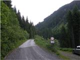
From Spittal we drive towards Lienz or vice versa, but only to the village Dellach. In the middle of the village we notice signs, which direct us to the right (from the direction of Spittal, from Lienz to the left) in the direction of Oberdraßnitzer Alm. At the crossroads we follow the ascending road in the mentioned direction and on it we drive to the gate (approx. 1300 m) from which further driving ahead is also forbidden.
Route description:
From the gate we continue on the road which after two successive sharp turns quickly brings us to a crossroad of two roads. We continue on the left road in the direction of the mountain pasture Untere Draßnitzalm. The road which is for some time still ascending through the forest soon brings us to a nice vantage point, from which a nice view opens up on two alpine waterfalls.
From the vantage point, we continue on the road which higher over a bridge crosses one of the two waterfalls. Soon after the waterfall road brings us out of the forest on the mountain pasture Unterdraßnitzer Alm.
From the mountain pasture, we continue on the right path in the direction of the summit Hochkreuz. The path goes immediately after the mountain pasture in the forest and it is moderately ascending on a cart track. After a few minutes, we get closer to the stream, which we then cross over the bridge. On the other side of the stream, the path steeply ascends and among bushes it brings us on unvegetated swampy slopes. From here on the otherwise marked path vanishes. We have two options to continue. We can continue on the marked pathless terrain (a little right) or we ascend by the stream upwards (slightly left). The latter is, despite not being marked, orientationally easier. Both "paths" at an altitude of approximately 2200 m join (this place we recognize by the high mountain cirque). From here on in both cases we continue sharply left and we follow very rare blazes, which we occasionally see on some of the larger rocks. After a few minutes of crossing, which we do in a moderate ascent, we again start turning a little towards the right. If we are lucky the "path" brings us right to the lake.
From the lake, we continue slightly left and after 15 minutes of ascent on easier pathless terrain we step on Hochleitenk.
From the top, we continue a little right first on the ridge downwards, then on a poorly visible path steeply upwards. After a shorter steep ascent, we step on the fore-summit of Hochkreuz, from which a nice view opens up on it. Ahead the orientation is considerably easier as the path on which we walk is again better visible. After a shorter gentle descent from Little Hochkreuz the path again starts ascending. After approximately 15 minutes of further ascent, which runs on and along the ridge, we step on the summit.
PS: Orientation on the path is difficult, therefore go on the path only in nice weather.

Photos:
 1
1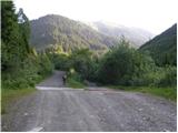 2
2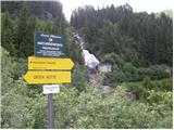 3
3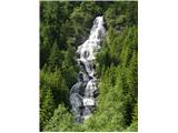 4
4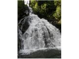 5
5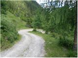 6
6 7
7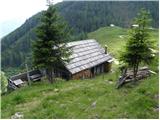 8
8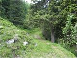 9
9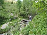 10
10 11
11 12
12 13
13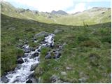 14
14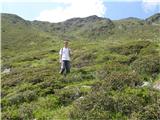 15
15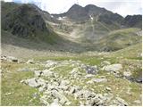 16
16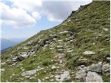 17
17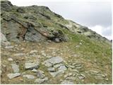 18
18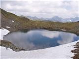 19
19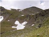 20
20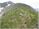 21
21 22
22 23
23 24
24 25
25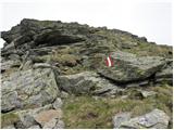 26
26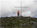 27
27
Discussion about the trip Draßnitz - Hochkreuz (via Unterdraßnitzer Alm)
To post a comment you must log in:
If you do not yet have a username, you must first
register.