Edelweiss - Monte Volaia / Wolayer Kopf (path 176)
Starting point: Edelweiss (1224 m)
| Latitude/Longitude: | 46,58860°N 12,84965°E |
| |
Route name: path 176
Walking time: 3 h 45 min
Difficulty: very difficult marked way
Elevation gain: 1246 m
Elevation difference along the route: 1260 m
Map: Tabacco 01 1:25.000
Recommended equipment (summer): helmet
Recommended equipment (winter): helmet, ice axe, crampons
Views: 974
 | 3 people like this post |
Access to starting point:
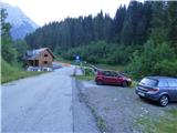
From Trbiž/Tarvisio we go on the highway towards Videm/Udine. We leave the highway at the exit for Tolmezzo. At Tolmezzo we then also leave the road which runs towards the mountain pass Passo di Croce Carnico / Plöckenpass and go towards Villa Santina. In Villa Santina at the roundabout, we go straight following the signs Ovaro, Sappada. We follow this road all the way to Forni Avoltri, where we turn right following the signs Collina. We then follow the asphalt road to the settlement Collina. After the end of the settlement Collina we continue for a few hundred meters and then we will notice the Edelweiss cottage on the left side. We park on the parking lot on the right side of the road near the mentioned cottage.
Route description:
From the parking lot, we return on the main road to a smaller bridge where we will notice an information board, which marks the path Sentiero Naturalistico Troi di Corvats. We go on the mentioned relatively wide path and we start ascending through the forest. At the smaller cottage in the forest, the path turns to the left and a little later we join a somewhat wider cart track. The mentioned cart track crosses a stream, then we have to be somewhat more attentive. When the cart track turns to the left, we leave the wide cart track and we go left upwards on a narrow footpath. The junction is somewhat poorly visible and it isn't specifically marked. The path on which we go is otherwise marked with normal blazes.
From the junction, we then ascend on a narrow footpath and soon from the right a slightly better beaten footpath joins us. We continue ascending through the forest, and here and there from shorter clearings a little view opens up towards the south. A little higher we come on a somewhat longer unvegetated strip along which we ascend steeply. Higher, the path turns to the left and then mostly in ascent it crosses slopes where there are a lot of fallen trees. Further, we ascend on the path which runs on the right side of the valley high above the stream Rio Chianaletta. Here also a view opens up on a saddle and grassy slopes on the south side of the peak Sasso Nero. Later we get very close to the streambed and then we also cross it to the left side. Here the path turns into a strip of thin forest and then follows an ascent on a mostly grassy slope beside increasingly rare trees. Such a path then brings us to the abandoned mountain pasture Casera Chianaletta where the footpath is somewhat poorly visible.
At the ruins on the mountain pasture the path turns sharply to the left and then in ascent crosses somewhat steeper slopes towards the south. When we reach a wide grassy ridge the path turns again sharply right and further for some time it runs on the mentioned ridge from which wonderful views open up also towards the west. The ridge then ends and the path brings us on an indistinct little saddle. Here we at first continue slightly to the right, then the path brings us on steeper slopes. Further, we mostly cross steeper grassy slopes to the left. In wet weather the slope is also somewhat dangerous for slipping. The path also ascends a little a few times and then brings us to a junction where from the left the path from the notch Forcella Ombladeet joins.
After the junction the path turns to the right and then for quite some time ascends in zigzags on the increasingly panoramic slope. The grass then ends and we ascend on a rocky slope all the way to the military ruins from the time of the First World War, which are located along the ridge below the summit Sasso Nero. From the ridge a wonderful view also opens up on the Austrian side towards Monte Coglians and other nearby peaks in the mountain group.
Here the path turns to the left and becomes more demanding. Further, the path runs on the left side of the ridge and on a ledge crosses exposed slopes. The path isn't secured therefore even more caution is needed. We continue crossing the exposed slope, along the path we will notice a few more military trenches and ruins and then the path brings us to a smaller notch and a tunnel where a secured climbing path from the Austrian side used to end. The mentioned path is now closed as the signs also warn.
For some time we still cross steep slopes on the west side of the ridge, then the path turns somewhat to the right and starts to ascend more steeply. The ascent is relatively steep and we have to help ourselves also with our hands. For some time we ascend like this then the path turns to the left and crossing follows again. The path is here locally very narrow, occasionally there is also quite some scree on the path therefore caution is still needed. The path then starts ascending again and at the last steeper ascent we have to help ourselves with our hands again. When we reach the ridge we continue right and quickly reach the panoramic summit.
We can descend on the ascent path or over the notch Forcella Ombladeet on path 141 towards Collina. From Collina we then return by road to the starting point at the Edelweiss cottage. The mentioned path is even somewhat worse beaten and in places hard to follow.

Along the route: Casera Chianaletta (1814m), Tacca del Sasso Nero (2351m)
Photos:
 1
1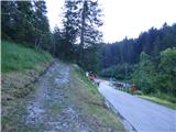 2
2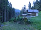 3
3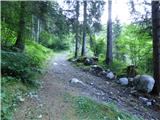 4
4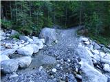 5
5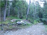 6
6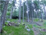 7
7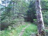 8
8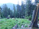 9
9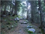 10
10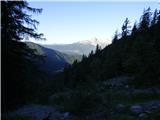 11
11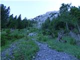 12
12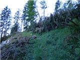 13
13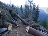 14
14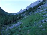 15
15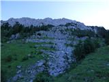 16
16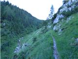 17
17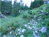 18
18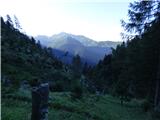 19
19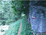 20
20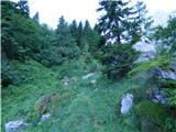 21
21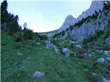 22
22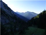 23
23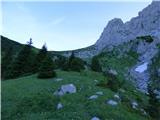 24
24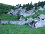 25
25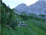 26
26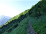 27
27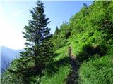 28
28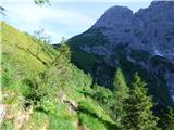 29
29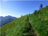 30
30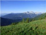 31
31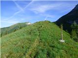 32
32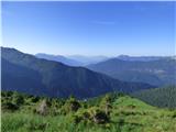 33
33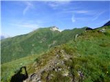 34
34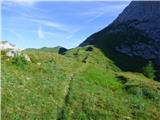 35
35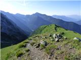 36
36 37
37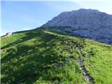 38
38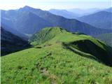 39
39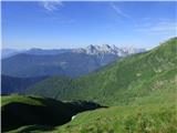 40
40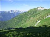 41
41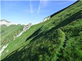 42
42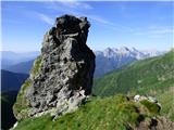 43
43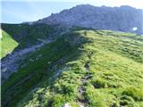 44
44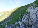 45
45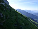 46
46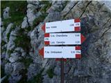 47
47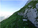 48
48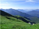 49
49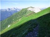 50
50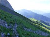 51
51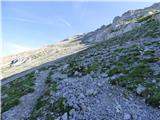 52
52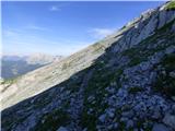 53
53 54
54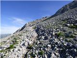 55
55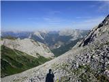 56
56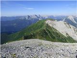 57
57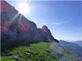 58
58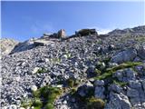 59
59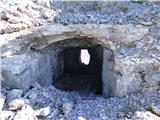 60
60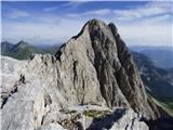 61
61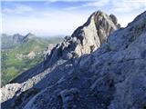 62
62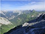 63
63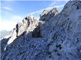 64
64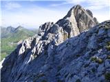 65
65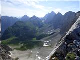 66
66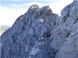 67
67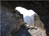 68
68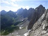 69
69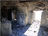 70
70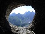 71
71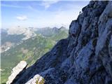 72
72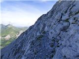 73
73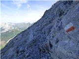 74
74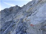 75
75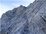 76
76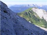 77
77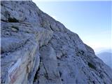 78
78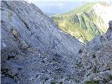 79
79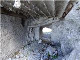 80
80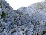 81
81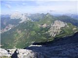 82
82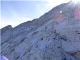 83
83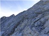 84
84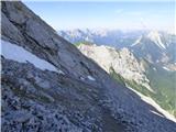 85
85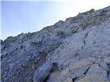 86
86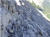 87
87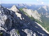 88
88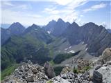 89
89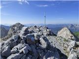 90
90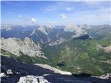 91
91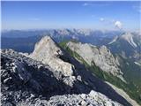 92
92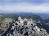 93
93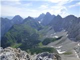 94
94
Discussion about the trip Edelweiss - Monte Volaia / Wolayer Kopf (path 176)
To post a comment you must log in:
If you do not yet have a username, you must first
register.