Ehrwald - Sonnalpin (via Gatterl)
Starting point: Ehrwald (1108 m)
| Latitude/Longitude: | 47,38801°N 10,93843°E |
| |
Route name: via Gatterl
Walking time: 6 h
Difficulty: partly demanding marked way
Elevation gain: 1468 m
Elevation difference along the route: 1610 m
Map:
Recommended equipment (summer):
Recommended equipment (winter): ice axe, crampons
Views: 1.650
 | 2 people like this post |
Access to starting point:
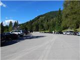
Through the Karawanks Tunnel, we drive into Austria, then continue driving towards Spittal and further towards Lienz (a little after Spittal, the highway ends). Further, we drive on a relatively nice and wide road through the Drau Valley, which brings us to Italy. The road further leads past Dobbiaco / Toblach and Brunico / Bruneck. We continue on the main road and then join the highway towards Austria (direction Brenner, Innsbruck). In Innsbruck, we continue on the highway, which runs west along the River Inn (at the highway junction, direction Innsbruck-West). We leave the highway at the exit for the Fernpaß pass. We continue driving across the mentioned pass, and when the road starts descending, we continue right towards the town of Ehrwald (at the exit there are also signs for Zugspitze). When driving through the town of Ehrwald, we turn right towards the Ehrwalder Almbahn cable car. Further, the road starts ascending, and we always follow the signs for the mentioned cable car. We park on one of the parking lots at the bottom station of the cable car.
Route description:
At the bottom station of the cable car, we first continue right along the road, then after some tens of meters continue left onto the gravel road following the signs for »Ehrwalder Alm«.
From the junction, a relatively gentle road runs along the forest and soon brings us to another fork. At the fork, we continue straight on the road, while to the right branches off the more demanding path (Immensteig) towards the lake Seebensee.
The road further runs along the ski slope at the edge of the forest and leads us past the bottom station of the chairlift and a small hut along the path. At the hut, where a view opens towards the summit Westliche Plattspitze, we continue slightly left and begin to ascend somewhat more steeply. The road then brings us into the forest and continues to ascend quite steeply. Higher up, we reach the left side of the circular gondola cable car and continue ascending through the forest. When we emerge from the forest back onto the ski slope, our path turns right and then runs along the right side of the cable car. The road further always runs near the cable car along the ski slope. Such a path, from which increasingly beautiful views open up, soon brings us to the hut on the Ehrwalder Alm pasture, where the upper station of the circular gondola cable car is also located. The pasture can also be reached by cable car in the summer months.
From the upper station of the cable car, we continue along the gravel road, which quickly brings us to a junction. We continue along the left road, while straight ahead the path leads to the nearby inn Gasthof Alpenglühn and further towards the lake Seebensee and the Coburger Hütte hut. After just some tens of meters of walking, we reach another fork. This time, we continue slightly right along the gravel road and follow the signs for the Hochfeldern Alm pasture.
Further on, we walk for some time along a fairly level gravel road that runs constantly towards the east. After approximately under half an hour of walking from the Ehrwalder Alm pasture, the path brings us to another marked fork.
We turn left onto the footpath (Max Klotz Steig) towards the Hochfeldern Alm pasture; straight along the road is a slightly longer path to the same pasture and a path towards the Gaistal valley. From the fork, we first ascend along the grassy slope beside the ski slope, then the path brings us into the forest. The well-trodden path through the forest first ascends somewhat more steeply, then crosses the slope gently ascending towards the east. Such a path soon rejoins the gravel road. From there follows only a short ascent along the road to the hut on the Hochfeldern Alm pasture.
At the hut, we continue left onto the footpath following the signs for »Knorrhütte«. The path then ascends the grassy slopes above the hut and later turns slightly right, bringing us to a fork.
At the fork, we continue right and soon cross a stream. Further on, the path ascends traversely along the grassy slopes; higher up, we ascend for some time also through dwarf pine scrub. The scenic path here constantly runs towards the northeast, bringing us to the saddle Am Brand below the slopes of the peak Östlicher Gatterlkopf.
On the saddle, the path turns slightly left and brings us to somewhat steeper slopes. Here, the path descends slightly and crosses the slopes towards the northeast. Such a path then brings us to a marked fork on the saddle Feldern Jöchl.
At the fork, we continue left towards the Knorrhütte hut; to the right, the path leads into the Gaistal valley and to the Rotmoos Alm pasture.
From the fork, the path first descends slightly more and crosses the slopes below the eastern slopes of the peak Östlicher Gatterlkopf. A short ascent follows to the saddle Gatterl, where the state border between Austria and Germany also lies. During the ascent to the saddle, the slope is somewhat steeper, and some steel cables provide assistance.
From the saddle, we descend a little further, and a view opens towards the Reintal valley and towards the Zugspitze summit. Further on, the path crosses fairly level slopes towards the north all the way to the Knorrhütte hut.
At the hut, where there is a fork, we continue left following the signs »Sonnalpin, Zugspitze«. From the hut, the path begins to ascend on scree towards the northwest, bringing us below the walls of the peak Innere Höllentalspitze. The path then turns slightly left and becomes somewhat gentler. Here, the path runs along the right side of the wide plateau named »Auf dem Platt«. From the path, we have a nice view of the ski slope and the peaks above the mentioned plateau all the time. The not overly steep path then runs westwards for some time all the way to a fork just before the Sonnalpin restaurant.
To the right, the path leads towards the Zugspitze summit; we continue left, and only a short ascent remains to the Sonnalpin restaurant, which is located by the ski slope.

Photos:
 1
1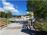 2
2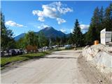 3
3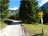 4
4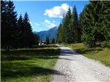 5
5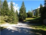 6
6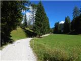 7
7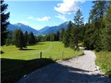 8
8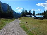 9
9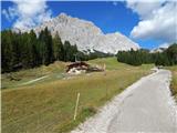 10
10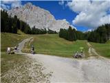 11
11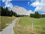 12
12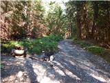 13
13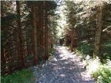 14
14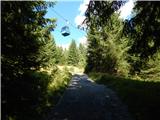 15
15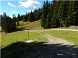 16
16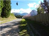 17
17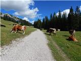 18
18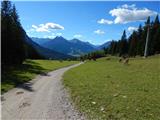 19
19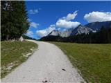 20
20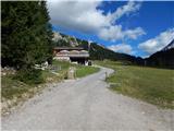 21
21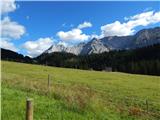 22
22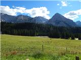 23
23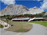 24
24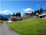 25
25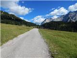 26
26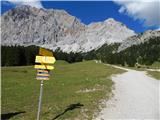 27
27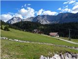 28
28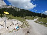 29
29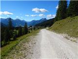 30
30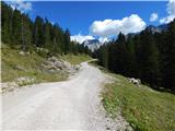 31
31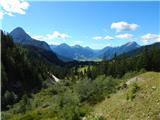 32
32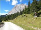 33
33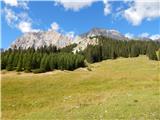 34
34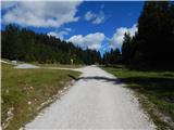 35
35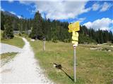 36
36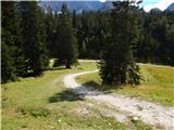 37
37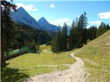 38
38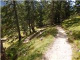 39
39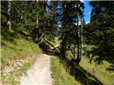 40
40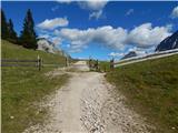 41
41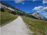 42
42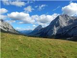 43
43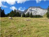 44
44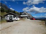 45
45 46
46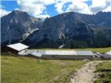 47
47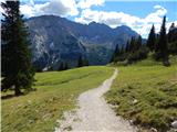 48
48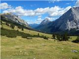 49
49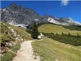 50
50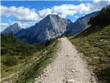 51
51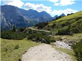 52
52 53
53 54
54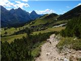 55
55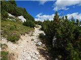 56
56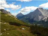 57
57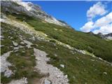 58
58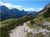 59
59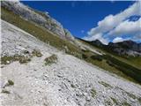 60
60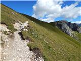 61
61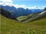 62
62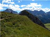 63
63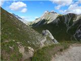 64
64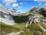 65
65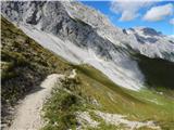 66
66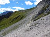 67
67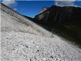 68
68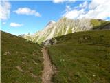 69
69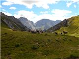 70
70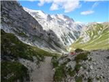 71
71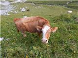 72
72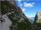 73
73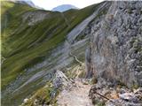 74
74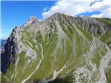 75
75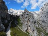 76
76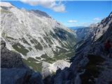 77
77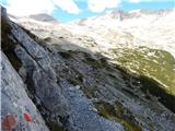 78
78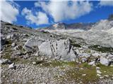 79
79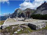 80
80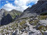 81
81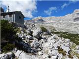 82
82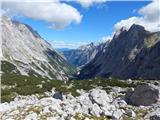 83
83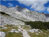 84
84 85
85 86
86 87
87 88
88 89
89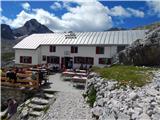 90
90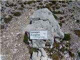 91
91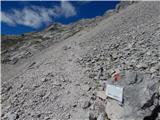 92
92 93
93 94
94 95
95 96
96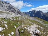 97
97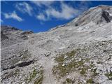 98
98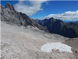 99
99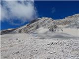 100
100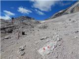 101
101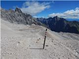 102
102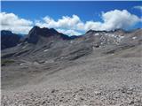 103
103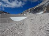 104
104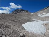 105
105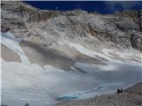 106
106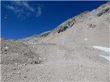 107
107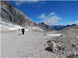 108
108 109
109 110
110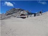 111
111 112
112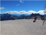 113
113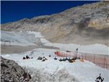 114
114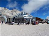 115
115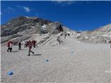 116
116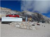 117
117
Discussion about the trip Ehrwald - Sonnalpin (via Gatterl)
To post a comment you must log in:
If you do not yet have a username, you must first
register.