Erschbaum - Große Kinigat / Monte Cavallino (Klettersteig)
Starting point: Erschbaum (1392 m)
| Latitude/Longitude: | 46,72111°N 12,50989°E |
| |
Route name: Klettersteig
Walking time: 4 h 30 min
Difficulty: extremely difficult marked way
Via ferrata: D
Elevation gain: 1297 m
Elevation difference along the route: 1297 m
Map:
Recommended equipment (summer): helmet, self belay set
Recommended equipment (winter): helmet, self belay set, ice axe, crampons
Views: 5.530
 | 2 people like this post |
Access to starting point:
From Kranjska Gora over Korensko sedlo to Austria, where at the first larger intersection we continue left towards Podklošter / Arnoldstein and Trbiž / Tarvisio. At the end of the settlement Podklošter signs for Šmohor / Hermagor direct us right onto a regional road, on which past the mentioned settlement we drive to the end of the Gailtal valley, or more precisely to the settlement Kötschach-Mauthen, where we turn right towards the settlement Oberdrauburg. The route ahead leads us over the alpine pass Gailbergsattel (982 m), after which we descend into the mentioned settlement. After we cross the bridge over the river Drava, we continue left towards the settlement Lienz. In the main roundabout in Lienz we continue "left" in the direction of the settlement Sillian and Italy. A few kilometers before Sillian in the settlement Tassenbach we turn left in the direction of the settlement Kartitsch into Upper Gailtal / Tiroler Gailtal. We continue through the settlement Kartitsch and then in the settlement Erschbaum we turn right downhill on a narrow road which after a short descent crosses a wooden bridge and brings us to an intersection of forest roads. Before the intersection near the sawmill there is also a parking lot where we park.
Route description:
From the starting point, we continue on the road and at the intersection we continue left following the signs »Erschbaumertal, Zum Klettersteig Gr. Kinigat«. The road is officially closed for traffic (prohibited traffic in both directions – forest road), but the vast majority continues driving and thus saves a good hour of walking.
The road is initially relatively flat and runs through the forest towards the east. At the intersections, we follow the signs for Erschbaumertal and Große Kinigat. The road later turns right towards the south and runs mostly along the stream upwards. Higher up the forest becomes sparser and a view opens up towards the peaks Kleine and Große Kinigat.
At the end of the valley Erschbaumertal where there is also a smaller parking lot the road ends and we continue slightly left on a footpath. The path here starts to ascend somewhat more steeply through larch forest and brings us to a junction at Tscharrhütte.
We continue left following the signs »Gr. Kinigat«, right leads the path towards the hut Obstansersee Hütte. The path further on is again somewhat flatter and leads to another junction.
Straight leads an easier path to Große Kinigat, we turn right following the signs »Zum Klettersteig Gr. Kinigat«. Further on our path is marked with red dots and is somewhat less trodden. The path then soon turns somewhat to the right and starts to ascend more steeply over scree. Such a path then brings us to the entrance to the climbing section of the path.
Here we must equip ourselves with a helmet and self-belaying device, climbing gloves are also recommended.
The climbing path is already in the initial section extremely demanding and ascends almost vertically several times on relatively smooth slabs (difficulty D). Further on difficulties C/D and D alternate mostly. After the vertical ascent where rare brackets also assist us (D), the path becomes somewhat easier (B) and brings us to Kartitscherköpfl where there is the first suitable resting place.
From here the path from the narrow notch ascends vertically again briefly (D), then becomes somewhat less steep and ascends along the ridge most of the time (B). In between the path ascends somewhat more steeply once more and then brings us to the west side of the ridge, where a view opens towards the summit Kleine Kinigat. Here the path crosses exposed slopes (difficulty up to C) and brings us back to the east side of the ridge where the climbing path soon ends.
The path then ascends over scree and brings us to a junction where the western path over the summit Pfannspitze joins from the right. At the signposts we continue left and after a short ascent a view opens towards the summit Große Kinigat. From the right the eastern path then joins and only a short ascent to the panoramic summit follows.
The described path is extremely demanding and suitable only for experienced mountaineers with sufficient arm strength and mandatory self-belaying.
The shortest descent path is the one that bypasses the summit on the eastern side and then descends into the Erschbaumertal valley (difficulty A/B). The second option is to continue from the summit towards the west and descend over the summit Pfannspitze and the saddle Rosskopftörl (difficulty A/B).

Along the route: Tscharrhütte (1935m), Kartitscherköpfl (2290m)
Photos:
 1
1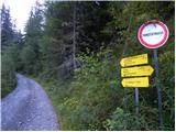 2
2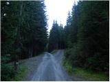 3
3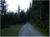 4
4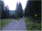 5
5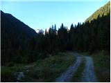 6
6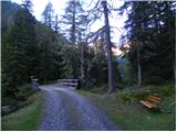 7
7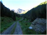 8
8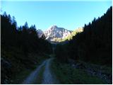 9
9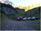 10
10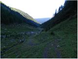 11
11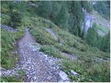 12
12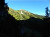 13
13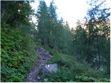 14
14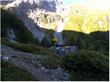 15
15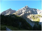 16
16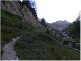 17
17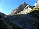 18
18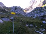 19
19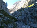 20
20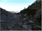 21
21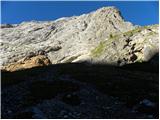 22
22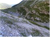 23
23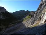 24
24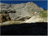 25
25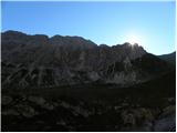 26
26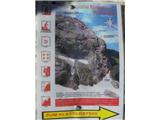 27
27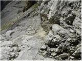 28
28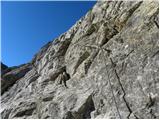 29
29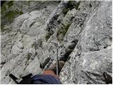 30
30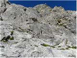 31
31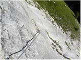 32
32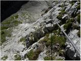 33
33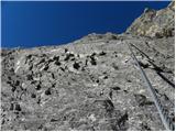 34
34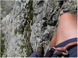 35
35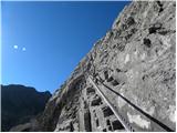 36
36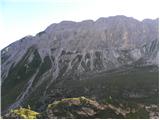 37
37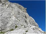 38
38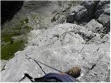 39
39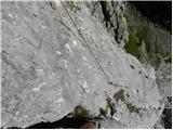 40
40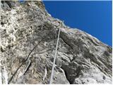 41
41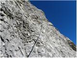 42
42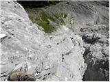 43
43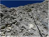 44
44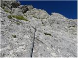 45
45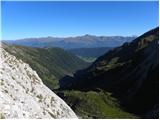 46
46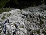 47
47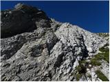 48
48 49
49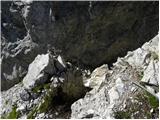 50
50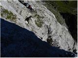 51
51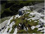 52
52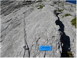 53
53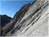 54
54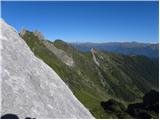 55
55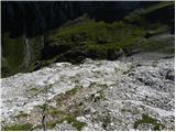 56
56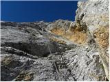 57
57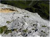 58
58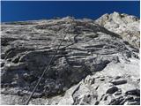 59
59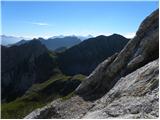 60
60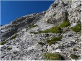 61
61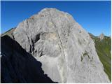 62
62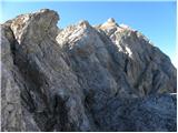 63
63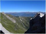 64
64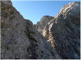 65
65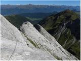 66
66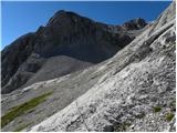 67
67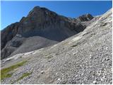 68
68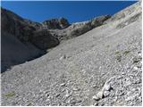 69
69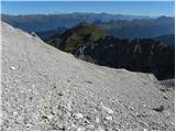 70
70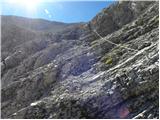 71
71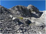 72
72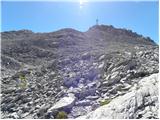 73
73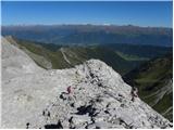 74
74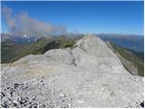 75
75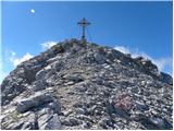 76
76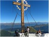 77
77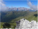 78
78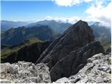 79
79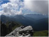 80
80
Discussion about the trip Erschbaum - Große Kinigat / Monte Cavallino (Klettersteig)
|
| MrvdMr-8229. 08. 2013 |
Hi, I'm interested if anyone has walked this path and how the ferrata is equipped. LP.
|
|
|
To post a comment you must log in:
If you do not yet have a username, you must first
register.