Etrachsee - Oberer Wildenkarsee
Starting point: Etrachsee (1368 m)
| Latitude/Longitude: | 47,22260°N 13,97700°E |
| |
Walking time: 2 h 15 min
Difficulty: easy marked way
Elevation gain: 685 m
Elevation difference along the route: 685 m
Map:
Recommended equipment (summer):
Recommended equipment (winter):
Views: 3.049
 | 2 people like this post |
Access to starting point:
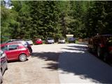
From the Beljak / Villach - Salzburg highway, take the St. Michael exit and follow the road ahead to Tamsweg, where we turn left towards the settlement Sauerfeld. We follow this road to the village Seebach (also possible from the town Murau), where signs for Krakaudorf direct us left. We then follow the signs towards Etrachsee lake, before which we park in the parking lot. The road is closed in winter.
Route description:
From the parking lot at Etrachsee we continue on the road in the direction of the summit Bauleiteck and mountain hut Rudolf Schober Hütte. The path ahead leads us past the mentioned lake, after which we come to some private cottages. We continue further on the road, which after a few minutes of walking brings us to a marked trail junction. We continue right uphill on the cart track, which starts to ascend more steeply. After a short ascent, the path brings us back to the road, which we follow to the next trail junction. Here we have two options for continuing: to the hut we can ascend on the road (straight) or on a pleasant footpath that turns left. If we have chosen the 5 minutes shorter footpath, we continue left and then after a few steps right uphill along the stream. A nice path that leads us over pastures, higher through numerous small bridges crosses the mentioned stream. The path, which in the meantime has already entered the forest, ascends more steeply and brings us to the mountain hut in a few minutes.
From the hut we continue in the direction of Bauleiteck on the path that gently ascends and quickly brings us to the next trail junction. Here we continue slightly left and follow the increasingly steep path that ascends through increasingly sparse, mostly coniferous forest to the next junction, where we continue left (right Bauleiteck). After a few more minutes of easy walking, the path brings us to the lake Unterer Wildenkarsee.
The path then descends to the lake, which at its end we also cross with the help of stones that are in the water. On the other side of the lake, the path ascends relatively steeply through a belt of dwarf pines. The steepness then eases somewhat and the path, with a nice view of the lake and blooming meadows, brings us one level higher. Here the path levels out and after a few dozen steps brings us to one of the most beautiful high mountain lakes.

Photos:
 1
1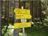 2
2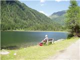 3
3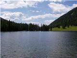 4
4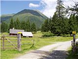 5
5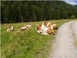 6
6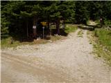 7
7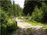 8
8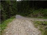 9
9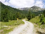 10
10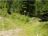 11
11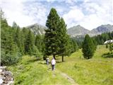 12
12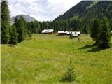 13
13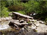 14
14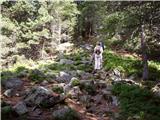 15
15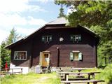 16
16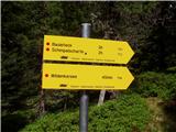 17
17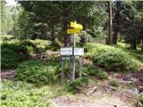 18
18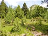 19
19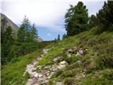 20
20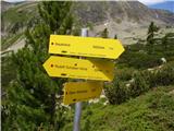 21
21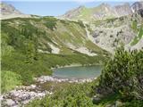 22
22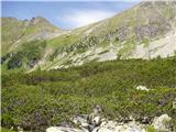 23
23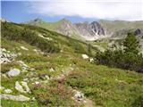 24
24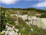 25
25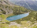 26
26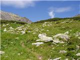 27
27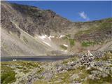 28
28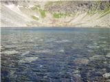 29
29
Discussion about the trip Etrachsee - Oberer Wildenkarsee
To post a comment you must log in:
If you do not yet have a username, you must first
register.