Starting point: Fiames (1292 m)
| Latitude/Longitude: | 46,57228°N 12,11735°E |
| |
Walking time: 2 h 45 min
Difficulty: partly demanding marked way
Elevation gain: 874 m
Elevation difference along the route: 890 m
Map: Tabacco 03 1:25.000
Recommended equipment (summer):
Recommended equipment (winter): ice axe, crampons
Views: 2.400
 | 2 people like this post |
Access to starting point:
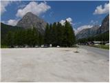
Over the border crossing at Rateče we drive to Trbiž / Tarvisio, where we head onto the highway in the direction of Videm / Udine. We leave the highway at the Tolmezzo exit and follow the road to the mentioned settlement. From Tolmezzo we continue in the direction of the settlement Ampezzo and the mountain pass Passo della Mauria. The road then starts descending and brings us into the Cadore valley, where we continue right (left Belluno and Cortina d'Ampezzo) in the direction of the settlement Auronzo. After a few additional km of driving, we come to the next bigger crossroad, where we go right in the direction of the settlement Misurina (left Tre Croci pass). From here we descend the road to a bigger crossroad where we continue left towards Cortina d'Ampezzo (right Austria). A few kilometers before Cortina d'Ampezzo we then park on a large parking lot by the hotel Fiames. The parking lot is on the right side of the road, and on the left side we will notice the stadium.
Route description:
From the parking lot at the hotel Fiames we continue by the main road or on a footpath by the river Boite in the direction of Cortina d'Ampezzo. After a few hundred meters, we then go right over a bridge to camp Olympia. Here signposts point us to the right on the path 408, which then leads on a macadam path by the camp. From the path a few times a view opens up on the nearby Punta Fiammes and on the valley of the river Boite, then the path slightly descends and brings us to a marked crossing.
At the crossing, the path branches off to the left towards the saddle Posporcora and climbing path to Col Rosa. We still continue on a gentle macadam path towards the north and after 15 minutes of walking, the path again brings us to a crossing where we go left on the path 447 following the signs »Col Rosa«.
The path here starts ascending and at first runs through the forest by a landslide. Later, the path turns a little to the right and ascends on a somewhat steeper and slightly crumbly slope by a wide gully. The path is here well maintained so the ascent does not cause any special problems. Further on, the path ascends through the forest for quite some time. Higher, the path turns a little to the left and brings us out of the forest onto a slope which is mostly covered with dwarf pines. From the path increasingly beautiful views start to open up, and by the path we will also notice numerous military tunnels and caverns.
In the last part, the path runs on the gentle northern slope of the mountain. Higher up the dwarf pines become rarer and a little below the summit the climbing path joins us from the right side. From here only a short ascent follows to the top.

Along the route: Olympia (1290m)
Photos:
 1
1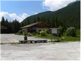 2
2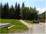 3
3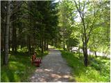 4
4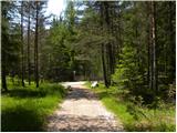 5
5 6
6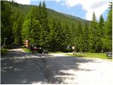 7
7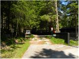 8
8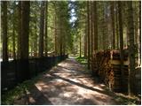 9
9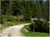 10
10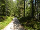 11
11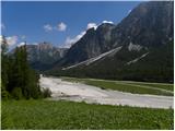 12
12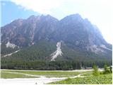 13
13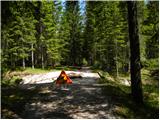 14
14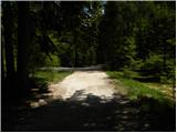 15
15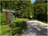 16
16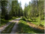 17
17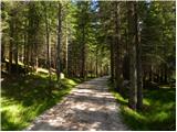 18
18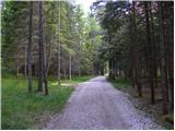 19
19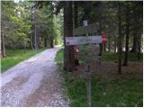 20
20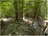 21
21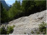 22
22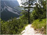 23
23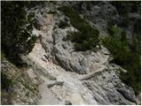 24
24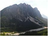 25
25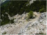 26
26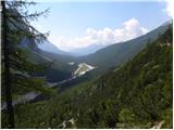 27
27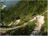 28
28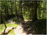 29
29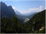 30
30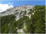 31
31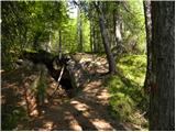 32
32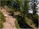 33
33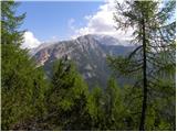 34
34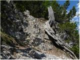 35
35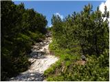 36
36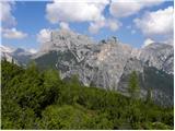 37
37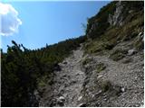 38
38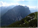 39
39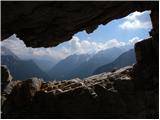 40
40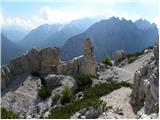 41
41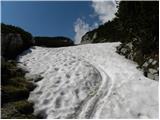 42
42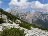 43
43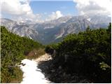 44
44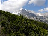 45
45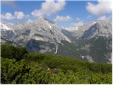 46
46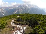 47
47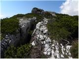 48
48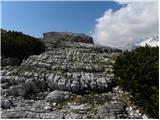 49
49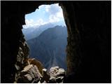 50
50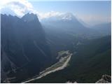 51
51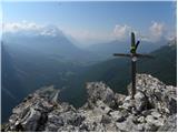 52
52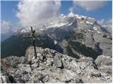 53
53
Discussion about the trip Fiames - Col Rosa
To post a comment you must log in:
If you do not yet have a username, you must first
register.