Forni di Sopra - Clap Varmost
Starting point: Forni di Sopra (1060 m)
| Latitude/Longitude: | 46,43230°N 12,57020°E |
| |
Walking time: 2 h
Difficulty: easy marked way
Elevation gain: 691 m
Elevation difference along the route: 691 m
Map: Tabacco 02, 1:25.000
Recommended equipment (summer):
Recommended equipment (winter): ice axe, crampons
Views: 4.696
 | 1 person like this post |
Access to starting point:
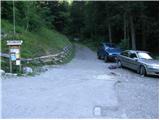
From Kranjska Gora via the border crossing Rateče to Trbiž / Tarvisio (also possible via the border crossing Predel) and further on the highway towards Videm / Udine. We leave the highway at Tolmezzo, from where we continue driving towards Ampezzo and further towards the Alpine pass Passo della Mauria (1298 m). Still before the mentioned pass, we arrive at the settlement Forni di Sopra, where approximately 100 m before the bottom station of the four-seater chairlift we turn right onto a narrow and higher also quite steep road. Along the mentioned road we drive above the settlement, and there at the smaller intersection we park at an appropriate spot (the road continues towards the ski area Forni di Sopra and is closed to public traffic with a traffic sign). From Kranjska Gora to the starting point it is approximately 122 km.
Route description:
From the starting point, we head onto a steep macadam road in the direction of the mountain hut Som Picol. The fairly steep road (gradient up to 30%) first leads us through the forest, then brings us to the cableway that leads to the hut Som Picol. Here the road turns slightly to the right and flattens a little. Higher up, beautiful views of the surrounding mountains begin to open, and the path brings us below the steep cliffs of the peak Clap Varmost (1751 m). Here our path, which continues along the road, the latter along a ski slope, turns left and brings us to a trough with water. From here we continue for a few more minutes and the path brings us to the mountain hut Rifugio Som Picol, which is located at the upper station of the four-seater chairlift that leads from the settlement Forni di Sopra to the hut Som Picol.
Just a little above the hut or behind the stations of the two nearby four-seater chairlifts, the road splits into two parts. We continue along the right somewhat narrower and also steeper road (the left road leads to the nearby restaurant), which ascends along the ski slope. Higher up, the road becomes somewhat steeper and, with a view of two artificial lakes and the surrounding mountains, brings us to a right-hand bend, where we leave the ski slope. The road then goes into the forest and brings us to a left-hand bend, in the middle of which the climbing path to Clap Varmost branches off to the right. From here we continue briefly along the road, then at the next signs for the peak Clap Varmost we leave the road and continue right in the indicated direction. The path ahead first ascends moderately through the forest, then brings us to a small junction, where a path from the upper station of the other four-seater chairlift joins from the left.
Here we continue right and continue the ascent along an increasingly steep path that ascends through the forest. Higher up, the trail flattens and brings us to the ridge, along which in one minute of further walking we step onto the panoramic summit.

Photos:
 1
1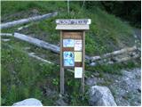 2
2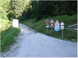 3
3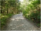 4
4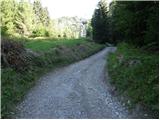 5
5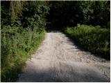 6
6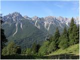 7
7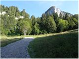 8
8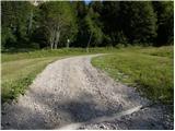 9
9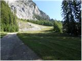 10
10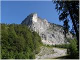 11
11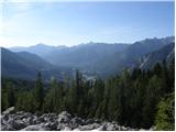 12
12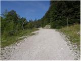 13
13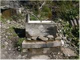 14
14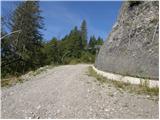 15
15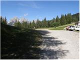 16
16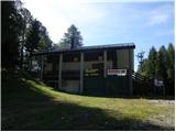 17
17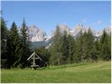 18
18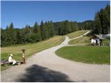 19
19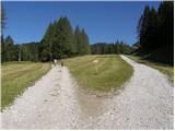 20
20 21
21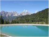 22
22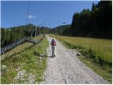 23
23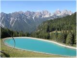 24
24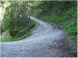 25
25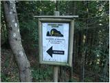 26
26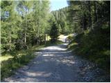 27
27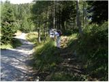 28
28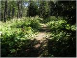 29
29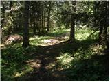 30
30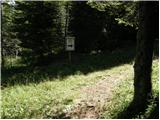 31
31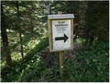 32
32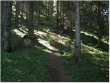 33
33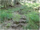 34
34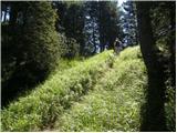 35
35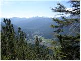 36
36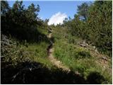 37
37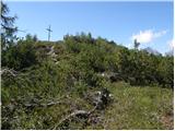 38
38 39
39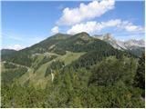 40
40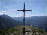 41
41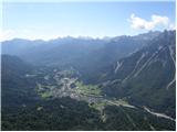 42
42 43
43
Discussion about the trip Forni di Sopra - Clap Varmost
|
| VanSims27. 05. 2018 |
Hmmm, why isn't the via ferrata on this mountain described, of which this is the descent path.
It's a typical sports via ferrata, French style, so lots of pegs, requires mainly arm strength, less technical knowledge.
Rating: one D detail, one C/D overhang, the rest easier. The rating on Bergsteigen for that vertical part is exaggerated. C/D is not constant but only the mentioned overhang at the beginning.
|
|
|
To post a comment you must log in:
If you do not yet have a username, you must first
register.