Gaber pri Semiču - Smuk (via Smuška cesta)
Starting point: Gaber pri Semiču (415 m)
| Latitude/Longitude: | 45,64500°N 15,15720°E |
| |
Route name: via Smuška cesta
Walking time: 50 min
Difficulty: easy marked way
Elevation gain: 130 m
Elevation difference along the route: 150 m
Map: Dolenjska - Gorjanci in Kočevski rog 1:50.000
Recommended equipment (summer):
Recommended equipment (winter):
Views: 4.109
 | 1 person like this post |
Access to starting point:
A) From the highway Ljubljana - Brežice, we take the exit Ivančna Gorica, then continue driving in the direction of Črnomelj. After Črmošnjice, the road ascends for a short time, then starts steeply descending. At the end of the longer right bend, where we will notice on the support wall the sign "pozdravljeni v Beli krajini", we turn left and then immediately right. We park about 50 meters ahead on a suitable spot above the mountain signposts.
B) From the highway Brežice - Ljubljana, we take the exit Novo mesto, then continue driving in the direction of Dolenjske Toplice and Podturn pri Dolenjskih Toplicah. In Podturn we join the main road Ivančna Gorica - Črnomelj, which we follow left in the direction of Črnomelj. After Črmošnjice, the road ascends for a short time, then starts steeply descending. At the end of the longer right bend, where we will notice on the support wall the sign "pozdravljeni v Beli krajini", we turn left and then immediately right. We park about 50 meters ahead on a suitable spot above the mountain signposts.
C) From Bela krajina we first drive to Semič, then continue driving towards Črmošnjice and Soteska. Before we arrive at the left bend with the sign "Pozdravljeni v Beli krajini" at the settlement Gaber pri Semiču we leave the main road and turn right and immediately again right onto the Smuška cesta. We park about 50 meters ahead on a suitable spot above the mountain signposts.
Route description:
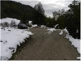
From the starting point, we walk to the mountain signposts, and from there we continue on the Smuška cesta in the direction of Smuk. At first, we walk on an asphalt road, on which we quickly arrive at some houses. Here the road slightly descends and brings us to the spot where the path branches off to the left to the church of St. Primož and Felicijan, to the summit Semenič and to Smuk over the summit Semenič.
Here we go straight and continue further on the asphalt road, which leads us above the vineyards. With nice views of Bela krajina and the surrounding hills we continue past several houses, then arrive at a marked junction, where we continue slightly left in the direction of the footpath to Smuk (slightly right Smuk - access with a car). From here we continue for a short time on the asphalt road, then behind the last house it changes into macadam. We continue on a gentle forest road, to which a little higher also joins the path from the railway station in Semič. We continue for a few minutes on a fairly gentle path, then arrive at a smaller junction, from where we continue slightly right in the direction of Smuk (slightly left Semenič). The forest road then moderately ascends and from the left also joins the path which leads from the church of St. Primož and Felicijan over Semenič to Smuk.
We continue on a somewhat steeper road, which quickly brings us to a marked junction, from where we continue in the direction of Smuk. Here we leave the road and through a strip of forest arrive at the panoramic grassy meadows of Smuk, through which in less than 5 minutes of further walking we ascend to the summit of Smuk.

Photos:
 1
1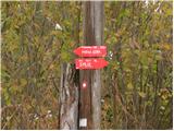 2
2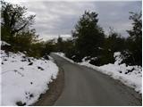 3
3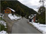 4
4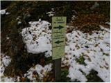 5
5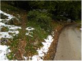 6
6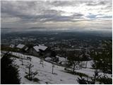 7
7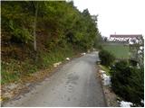 8
8 9
9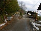 10
10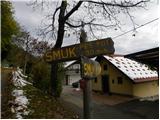 11
11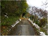 12
12 13
13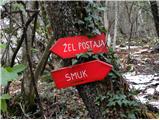 14
14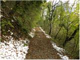 15
15 16
16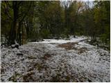 17
17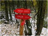 18
18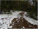 19
19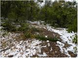 20
20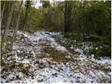 21
21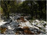 22
22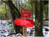 23
23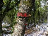 24
24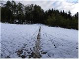 25
25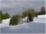 26
26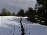 27
27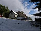 28
28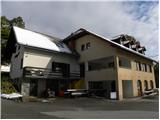 29
29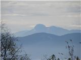 30
30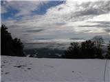 31
31 32
32
Discussion about the trip Gaber pri Semiču - Smuk (via Smuška cesta)
To post a comment you must log in:
If you do not yet have a username, you must first
register.