Gajševsko jezero - Castle Branek (Mallegg)
Starting point: Gajševsko jezero (181 m)
| Latitude/Longitude: | 46,53144°N 16,12567°E |
| |
Walking time: 25 min
Difficulty: easy marked way
Elevation gain: 44 m
Elevation difference along the route: 44 m
Map:
Recommended equipment (summer):
Recommended equipment (winter):
Views: 126
 | 1 person like this post |
Access to starting point:
We leave the Pomurska motorway at the Vučja vas exit, and then follow the signs for Ljutomer. When we arrive in Ključarovci, from the roundabout after the Petrol gas station, we take the exit toward the centre of Ključarovci. We continue through the settlement, and when Ključarovci ends, from the crossroads we proceed straight toward the settlements of Grabe and Branoslavci. When the settlement of Grabe ends, we cross the Ščavnica river, then turn right into the parking lot by Gajševsko Lake, where the described path begins.
Route description:
From the parking lot, we continue on an asphalt road which isn't marked but is part of the learning trail Pot po posutih zvezdicah, continuing south and bringing us in a few minutes to the settlement Branoslavci (the local name of the settlement was Prnožlavci), where at the crossroads by the fire station the first blazes appear.
We continue left (right Mala Nedelja) and proceed along the Pomurje Mountain Trail, which we leave at the first crossroads and continue right, where the 8th point of the path Pot po posutih zvezdicah is located. Next follows a short ascent, where the path leads us past a few houses, and higher up we reach the former castle Branek, where an information board is also located.
The description refers to the condition in September 2024, and the pictures are from April 2023 and September 2024.
Along the route: Branoslavci (184m)
Photos:
 1
1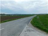 2
2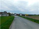 3
3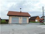 4
4 5
5 6
6 7
7 8
8 9
9 10
10 11
11 12
12 13
13 14
14
Discussion about the trip Gajševsko jezero - Castle Branek (Mallegg)
To post a comment you must log in:
If you do not yet have a username, you must first
register.