Golnik - Zavetišče v Gozdu
Starting point: Golnik (510 m)
| Latitude/Longitude: | 46,32760°N 14,33000°E |
| |
Walking time: 1 h
Difficulty: easy marked way
Elevation gain: 381 m
Elevation difference along the route: 381 m
Map: Karavanke - osrednji del 1:50.000
Recommended equipment (summer):
Recommended equipment (winter):
Views: 15.575
 | 2 people like this post |
Access to starting point:
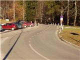
From the highway Ljubljana - Jesenice, we take the exit Kranj west and follow the road ahead in the direction of Golnik. There we park on the parking lot at the Golnik hospital.
Route description:
From the parking lot, we continue on the asphalt road past the hospital for approximately ten minutes to the spot where we encounter a signpost. Here the path directs us through a meadow by the fence back to the road. We only cross the road and again walk through a meadow by the fence. After that, we leave the last house in the village. The path then goes into the forest and moderately ascends. Soon the path brings us to a cart track, which we follow for only a few minutes. From the cart track, we go right again onto a footpath, which is pretty wide in parts. The path then leads past a vantage point and soon after that turns sharply left. A light ascent follows and we again come to a cart track. Here we go right and follow the cart track to the village. In the village we come to the road, where we continue straight on the lower path in the direction of the shelter. After a good five minutes of walking on the level road, we come to the shelter Zavetišče v Gozdu.
Photos:
 1
1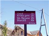 2
2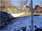 3
3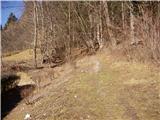 4
4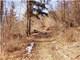 5
5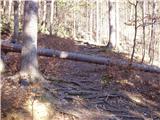 6
6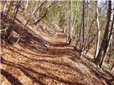 7
7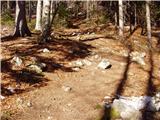 8
8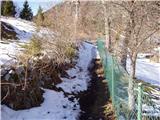 9
9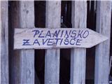 10
10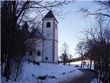 11
11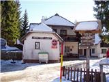 12
12
Discussion about the trip Golnik - Zavetišče v Gozdu
|
| ivona7. 12. 2011 |
Maybe someone can answer my question - does a bus (at least a smaller one) go to Zavetišče v Gozdu?
I think the road below in the village is steep and (too) narrow?!
Thanks for any answer.
|
|
|
|
| savinjcan657. 12. 2011 |
In the village, in the steep part the road is really very narrow and it would be best to call the hut if they have experience with buses to their stop.
L.P.
|
|
|
|
| pelican7. 12. 2011 |
When you had the traditional winter hike this year, there were quite a few buses at this parking lot.
|
|
|
|
| Kriška8. 12. 2011 |
That there were buses at the parking lot in Golnik doesn't surprise me, for them getting there is no problem.
The other thing is the road that ivona is probably asking about here - the road that branches off from the main (non-problematic road) in the direction of Vetrni and further to the village Gozd. This road is indeed so narrow in the lower part, and also has at least one sharp bend, so I very much doubt a bus could get through there. A van could though.
|
|
|
|
| jaz*8. 12. 2011 |
I agree with the previous one, however a smaller bus could drive the path to the shelter without major problems. ..it is really narrow and steep on at least two sections
|
|
|
To post a comment you must log in:
If you do not yet have a username, you must first
register.