Göriach - Hochgolling (Normalanstieg)
Starting point: Göriach (1443 m)
| Latitude/Longitude: | 47,24080°N 13,74530°E |
| |
Route name: Normalanstieg
Walking time: 4 h
Difficulty: difficult marked way
Elevation gain: 1420 m
Elevation difference along the route: 1430 m
Map:
Recommended equipment (summer): helmet
Recommended equipment (winter): helmet, ice axe, crampons
Views: 9.043
 | 1 person like this post |
Access to starting point:
From the highway Beljak/Villach - Salzburg, we head to the exit St. Michael (the exit is located between the two larger tunnels). We follow the road ahead towards the settlements St. Martin, Mariapharr and Göriach. We then follow the ascending road through the mentioned villages to the parking lot, which is located a few kilometers above the village Göriach, where we park on the large parking lot.
Route description:
From the parking lot, we continue on the road which in 5 minutes of walking brings us to a larger meadow in the middle of which we notice a larger number of wooden cottages. One of the cottages is also the mountain hut, which is situated on the right side of the path.
The path ahead gradually starts ascending and over two successive small bridges brings us to the spot from where a nice view opens up on the waterfall. After the waterfall, the worse road ascends one level higher and after half an hour of walking from the starting point brings us to a hamlet of private cottages. The path, which still runs on the road, brings us by numerous streams to a path junction, where we go right following the signs Hochgolling. The path which runs ahead on the road leads towards the hut Landawirsee Hütte. The path from the junction then crosses a stream and starts ascending steeper and steeper. When we again get very close to the stream, the steepness decreases and in front of us we can already see the notch Gollingscharte. The path towards the notch runs on rocky terrain; in early summer on this part of the path we will be ascending over some relatively large snowfields. On the notch (2326m) we then go right in the direction of Hochgolling, the path straight leads towards the hut Golling Hütte. The path then in a gentle ascent crosses the northwest slopes above the notch and brings us to the southwest slopes of the mountain. The path then turns slightly to the left and after some steep ascents brings us to a path junction. We choose the right easier path (Normalanstieg, Historischer Weg), the left path (up to 2nd grade of climbing) leads along the northwest ridge also to the summit of Hochgolling. The path ahead then crosses quite steep slopes towards the southeast and ascends steeply a few times (up to 1st grade of climbing). In early summer we will also cross some short steep snowfield on the path. Towards the end, the path turns again a little to the left and follows a somewhat steeper ascent towards the panoramic summit.

Along the route: Gollingscharte (2326m)
Photos:
 1
1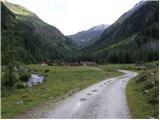 2
2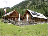 3
3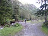 4
4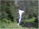 5
5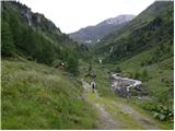 6
6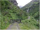 7
7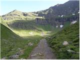 8
8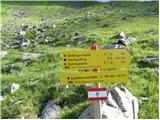 9
9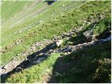 10
10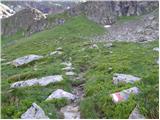 11
11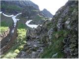 12
12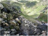 13
13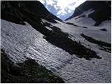 14
14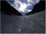 15
15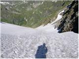 16
16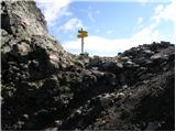 17
17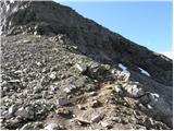 18
18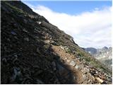 19
19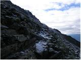 20
20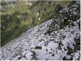 21
21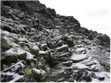 22
22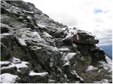 23
23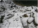 24
24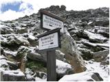 25
25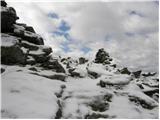 26
26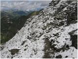 27
27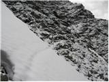 28
28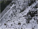 29
29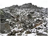 30
30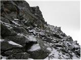 31
31
Discussion about the trip Göriach - Hochgolling (Normalanstieg)
|
| Nickster22. 07. 2008 |
One meter lower than Triglav
|
|
|
|
| VanSims9. 08. 2012 |
I'll just add a bit to the incomplete access description:
At the St. Michael exit, we leave the AC and go through St. Michael to the intersection where we turn left towards Mauterndorf (right Katschberg pass).
Or if we want to save on the Katschberg tunnel toll, already at Rennweg leave the AC and go over Katschberg pass and when we come out of the pass, at the same intersection go straight (left St. Michael and AC).
In any case, we then arrive in Mauterndorf, where we follow the signs to Tamsweg. We drive towards Tamsweg and DO NOT turn into Mariapharr village but a little after it we spot the sign for Göriach, which we follow. Then follow the signs all the way to Göriach (we can also drive to Tamsweg, where there is a shop, gas station, if we still have something to buy, eat,... also from Tamsweg by following signs we get to Göriach).
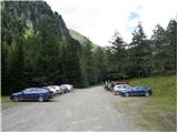
Once in Göriach we find ourselves at an intersection. Go straight and come to the second intersection where we turn left (there we already see the sign for Landawiser hütte). Then drive straight and soon the road turns into gravel, which becomes increasingly rough and there is about 6 km of it until we reach the parking lot from the first picture.
If I didn't know those places around St. Michael, because I often drive past the tunnels when going that way on the tourist AC and if I hadn't asked in Göriach, I wouldn't have found my way.
|
|
|
|
| Robie9. 09. 2023 21:09:40 |
Beautiful but very crowded tour. Helmet more than recommended.
|
|
|
To post a comment you must log in:
If you do not yet have a username, you must first
register.