Gorjane (Železno) - Rigelj
Starting point: Gorjane (Železno) (368 m)
| Latitude/Longitude: | 46,03780°N 15,57490°E |
| |
Walking time: 1 h 20 min
Difficulty: easy marked way
Elevation gain: 258 m
Elevation difference along the route: 290 m
Map:
Recommended equipment (summer):
Recommended equipment (winter):
Views: 55
 | 1 person like this post |
Access to starting point:
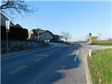
a) From the Sevnica - Krško road, head towards Brestanica, then follow the signs for Podsreda. Before starting to descend towards Podsreda, in the settlement of Gorjane we reach the Železno pass, where the described trail begins at the Gorjane bus station. There are no suitable parking spaces at the starting point.
b) Drive to Podsreda, then follow the signs for Krško, Sevnica and Brestanica. Before starting to descend towards Brestanica, in the settlement of Gorjane we reach the Železno pass, where the described trail begins at the Gorjane bus station. There are no suitable parking spaces at the starting point.
Route description:
From the bus station, head onto the side road, along which there are signs for Podsreda Castle and Krivec Eco-Farm, where the trail leads us past a few more houses; at the next intersection, go straight towards Podsreda Castle. The road then moderately ascends, later leading past a cross and one house, then continues through the forest for some time. Higher up, the road levels out and takes us to a marked intersection, from which we continue straight towards Podsreda Castle (right Krško and Brestanica).
A slight traverse descent through the forest follows, and we arrive at a well-maintained rest area near the chapel of St. Florian, from where a nice view of Podsreda Castle opens up.
Continue along the road and within a few minutes of further walking arrive at the castle, where there is a logbook box on the outer side of the wall and a stamp above it.
Bypass the castle on the right side and continue the ascent on the asphalt road, which leads past two parking areas, then ascends through the forest to a marked junction, where we continue right towards Pišec, Bizeljsko and Veliki vrh (left Svete gore).
Just a little further from the junction, we leave the forest, where on a larger meadow the road turns left and forks again.
This time choose the left road, along which the Knafelc blazes continue (straight Slovenian mountain bike trail) and which soon returns to the forest. A traverse ascent through the forest follows; when the forest ends on the left, leave the marked trail and continue left, carefully over the pasture fence. Then just a short walk across the pasture to the antennas on Rigelj.
Starting point - Turnič 0:30, Turnič - Podsreda Castle 0:15, Podsreda Castle - junction after Podsreda Castle 0:10, junction after Podsreda Castle - junction on Marofu 0:05, junction on Marofu - Rigelj 0:20.
Description and photos refer to the condition in March 2026.

Along the route: Turnič (496m),
Podsreda castle (475m), Razpotje za Gradom Podsreda (524m), Razpotje na Marofu (544m), Odcep s ceste (615m)
Photos:
 1
1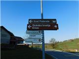 2
2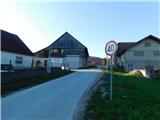 3
3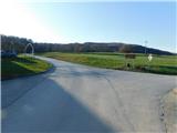 4
4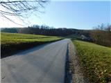 5
5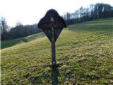 6
6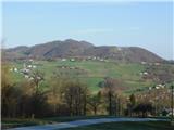 7
7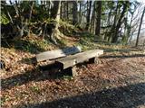 8
8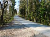 9
9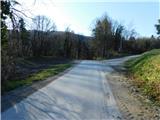 10
10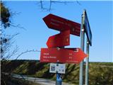 11
11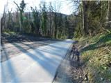 12
12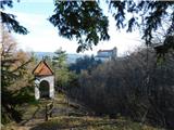 13
13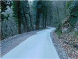 14
14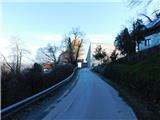 15
15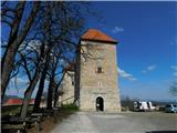 16
16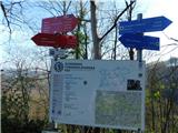 17
17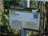 18
18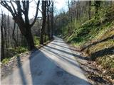 19
19 20
20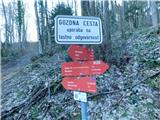 21
21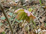 22
22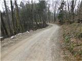 23
23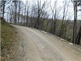 24
24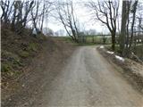 25
25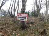 26
26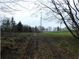 27
27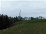 28
28 29
29
Discussion about the trip Gorjane (Železno) - Rigelj
To post a comment you must log in:
If you do not yet have a username, you must first
register.