 | Povodje - Šmarna gora
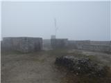
Šmarna gora is a 669 m peak northwest of Slovenia's capital. From the summit, with its restaurant and church, there is a beautiful view over Gore...
1 h 30 min |
 | Povodje - Šmarna gora (via Sedlo)
Šmarna gora is a 669 m peak northwest of Slovenia's capital. From the summit, with its restaurant and church, there is a beautiful view over Gore...
1 h 35 min |
| Šmartno - Šmarna gora (path around Šmarna gora)
Šmarna gora is a 669 m peak northwest of Slovenia's capital. From the summit, with its restaurant and church, there is a beautiful view over Gore...
1 h 30 min |
 | Vikrče - Šmarna gora (via Zatrep)
Šmarna gora is a 669 m peak northwest of Slovenia's capital. From the summit, with its restaurant and church, there is a beautiful view over Gore...
1 h 10 min |
| Skaručna - Šmarna gora
Šmarna gora is a 669 m peak northwest of Slovenia's capital. From the summit, with its restaurant and church, there is a beautiful view over Gore...
1 h 30 min |
| Skaručna - Šmarna gora (via Sedlo)
Šmarna gora is a 669 m peak northwest of Slovenia's capital. From the summit, with its restaurant and church, there is a beautiful view over Gore...
1 h 35 min |
 | Tacen - Šmarna gora (Partizanska steza)
Šmarna gora is a 669 m peak northwest of Slovenia's capital. From the summit, with its restaurant and church, there is a beautiful view over Gore...
1 h |
| Tacen (Sveti Jurij) - Šmarna gora (Romarska pot)
Šmarna gora is a 669 m peak northwest of Slovenia's capital. From the summit, with its restaurant and church, there is a beautiful view over Gore...
1 h |
| Tacen (Sveti Jurij) - Šmarna gora (Partizanska steza)
Šmarna gora is a 669 m peak northwest of Slovenia's capital. From the summit, with its restaurant and church, there is a beautiful view over Gore...
1 h |
 | Lipa - Šmarna gora (by road)
Šmarna gora is a 669 m peak northwest of Slovenia's capital. From the summit, with its restaurant and church, there is a beautiful view over Gore...
1 h 5 min |
 | Vikrče - Šmarna gora (Kovačeva steza)
Šmarna gora is a 669 m peak northwest of Slovenia's capital. From the summit, with its restaurant and church, there is a beautiful view over Gore...
1 h 10 min |
| Vikrče - Šmarna gora (learning trail)
Šmarna gora is a 669 m peak northwest of Slovenia's capital. From the summit, with its restaurant and church, there is a beautiful view over Gore...
1 h 20 min |
| Spodnje Pirniče - Šmarna gora (Kovačeva steza)
Šmarna gora is a 669 m peak northwest of Slovenia's capital. From the summit, with its restaurant and church, there is a beautiful view over Gore...
1 h 10 min |
| Spodnje Pirniče - Šmarna gora (learning trail)
Šmarna gora is a 669 m peak northwest of Slovenia's capital. From the summit, with its restaurant and church, there is a beautiful view over Gore...
1 h 10 min |
 | Povodje - Rašica (Vrh Staneta Kosca)
Vrh Staneta Kosca, better known as Rašica, is located north of Ljubljana, more precisely above the villages of Rašica and Dobeno. From the summit...
1 h 30 min |
 | Jablje Castle - Rašica (Vrh Staneta Kosca)
Vrh Staneta Kosca, better known as Rašica, is located north of Ljubljana, more precisely above the villages of Rašica and Dobeno. From the summit...
1 h 20 min |
| Loka - Rašica (Vrh Staneta Kosca)
Vrh Staneta Kosca, better known as Rašica, is located north of Ljubljana, more precisely above the villages of Rašica and Dobeno. From the summit...
1 h 20 min |
 | Selo pri Vodicah - Rašica (Vrh Staneta Kosca) (old path)
Vrh Staneta Kosca, better known as Rašica, is located north of Ljubljana, more precisely above the villages of Rašica and Dobeno. From the summit...
1 h 15 min |
 | Selo pri Vodicah - Rašica (Vrh Staneta Kosca) (by road)
Vrh Staneta Kosca, better known as Rašica, is located north of Ljubljana, more precisely above the villages of Rašica and Dobeno. From the summit...
1 h 20 min |
 | Selo pri Vodicah - Rašica (Vrh Staneta Kosca)
Vrh Staneta Kosca, better known as Rašica, is located north of Ljubljana, more precisely above the villages of Rašica and Dobeno. From the summit...
1 h 30 min |
 | Ljubljana (Podutik) - Toško Čelo
Toško Čelo is a 590-metre hill above the village of the same name. From the summit, or slightly below it, a beautiful view opens over part of Lju...
1 h |
 | Preval Prosca - Koreno (gentle path)
Koreno (also known as Korena) is a 729 m high hill located north of Horjul. From the summit, which features a large cross, the church of St. Moho...
1 h 15 min |
 | Preval Prosca - Koreno (steep path)
Koreno (also known as Korena) is a 729 m high hill located north of Horjul. From the summit, which features a large cross, the church of St. Moho...
1 h |
 | Sora - Hom (by road)
Hom is a 715 m high peak that rises steeply southwest of the village of Sora. From the summit, which is partly forested, there is a beautiful vie...
1 h 5 min |
 | Skalnica - Sveta Gora (by road)
Sveta Gora is known mainly among believers and locals. It is a well-known pilgrimage center above Nova Gorica. Believers come here from all over ...
1 h |
 | Tacen - Grmada (via Spodnja Kuhinja)
Grmada is a 676-meter-high mountain located west of the much more visited Šmarna gora. From the summit, which has a small takeoff area, a beautif...
1 h |
 | Vikrče - Grmada (via Zatrep)
Grmada is a 676-meter-high mountain located west of the much more visited Šmarna gora. From the summit, which has a small takeoff area, a beautif...
1 h 15 min |
 | Vikrče - Grmada (Mazijeva steza)
Grmada is a 676-meter-high mountain located west of the much more visited Šmarna gora. From the summit, which has a small takeoff area, a beautif...
1 h 5 min |
| Tacen (Sveti Jurij) - Grmada
Grmada is a 676-meter-high mountain located west of the much more visited Šmarna gora. From the summit, which has a small takeoff area, a beautif...
1 h 5 min |
 | Vikrče - Grmada (Kovačeva steza)
Grmada is a 676-meter-high mountain located west of the much more visited Šmarna gora. From the summit, which has a small takeoff area, a beautif...
1 h 10 min |
 | Lipa - Grmada (path via Peski)
Grmada is a 676-meter-high mountain located west of the much more visited Šmarna gora. From the summit, which has a small takeoff area, a beautif...
1 h |
| Lipa - Grmada (by road)
Grmada is a 676-meter-high mountain located west of the much more visited Šmarna gora. From the summit, which has a small takeoff area, a beautif...
1 h 10 min |
| Vikrče - Grmada (on Kovačeva steza and over Sedlo)
Grmada is a 676-meter-high mountain located west of the much more visited Šmarna gora. From the summit, which has a small takeoff area, a beautif...
1 h 15 min |
| Vikrče - Grmada (learning trail)
Grmada is a 676-meter-high mountain located west of the much more visited Šmarna gora. From the summit, which has a small takeoff area, a beautif...
1 h 20 min |
| Spodnje Pirniče - Grmada (learning trail)
Grmada is a 676-meter-high mountain located west of the much more visited Šmarna gora. From the summit, which has a small takeoff area, a beautif...
1 h 15 min |
| Spodnje Pirniče - Grmada (on Kovačeva steza and over Sedlo)
Grmada is a 676-meter-high mountain located west of the much more visited Šmarna gora. From the summit, which has a small takeoff area, a beautif...
1 h 15 min |
 | Star maln - Koča na Planini nad Vrhniko
Planina nad Vrhniko is for Vrhnika locals something like Šmarna gora for those from Ljubljana. It is 733 m high, reachable by several paths from ...
1 h |
 | Moravče - Sveti Miklavž above Sava
The Church of St. Miklavž is situated on a panoramic hill south of Moravče. From the summit, there is a beautiful view toward the nearby Limbarsk...
1 h 25 min |
 | Preval Prosca - Ključ
Ključ is a forest-covered peak located north of the village Brezje pri Dobrovi and south of Dolenja vas. The summit, which has a stamp box with l...
1 h |
 | Dolenja vas (Kosmulj) - Ključ
Ključ is a forest-covered peak located north of the village Brezje pri Dobrovi and south of Dolenja vas. The summit, which has a stamp box with l...
1 h 10 min |
 | Sveti Urh - Ključ
Ključ is a forest-covered peak located north of the village Brezje pri Dobrovi and south of Dolenja vas. The summit, which has a stamp box with l...
1 h |
 | Zazid - Jampršnik
Jampršnik is a little-known and even less visited peak located in the mountain chain southwest of Črni Kal. Despite its modest height, there is a...
1 h |
 | Prevala - Škabrijel (via Veliki hrib)
Škabrijel is a hill northeast of the town of Gorica. Since the vegetation on the summit was cleared and a tall metal observation tower was erecte...
1 h 5 min |
| Prevala - Škabrijel (via Hungarian pyramid)
Škabrijel is a hill northeast of the town of Gorica. Since the vegetation on the summit was cleared and a tall metal observation tower was erecte...
1 h |
 | Griže - Dragov dom na Homu (direct path)
Dragov dom is located on a scenic hill south of Šempeter. From the summit, where there is also the Church of St. Magdalena, there is a fine panor...
1 h 30 min |
| Griže - Dragov dom na Homu (via Lajnarjev hrib)
Dragov dom is located on a scenic hill south of Šempeter. From the summit, where there is also the Church of St. Magdalena, there is a fine panor...
1 h 40 min |
| Šešče pri Preboldu - Dragov dom na Homu (via Lajnarjev hrib)
Dragov dom is located on a scenic hill south of Šempeter. From the summit, where there is also the Church of St. Magdalena, there is a fine panor...
1 h |
| Šešče pri Preboldu - Dragov dom na Homu (Brdovska pot)
Dragov dom is located on a scenic hill south of Šempeter. From the summit, where there is also the Church of St. Magdalena, there is a fine panor...
1 h 15 min |
 | Grgar - Vodice (via Ranjeke)
Vodice (according to some records also Sveti Jakob) is a peak on the western part of the Banjška planota plateau. From the summit, which features...
1 h 30 min |
 | Gorica pri Slivnici - Rifnik
Rifnik is a 568-meter-high peak situated south of Šentjur pri Celju. The summit, known for its archaeological site, offers nice views towards Šen...
1 h 15 min |
 | Lopata - Planinski dom Šentjungert
The mountain hut is located just a few meters below the summit of Gora, where the Church of St. Kunigunda stands; it was built in the 14th centur...
1 h 30 min |
 | Grad Pišece - Veliki Špiček
Veliki Špiček is the highest peak of Brežice municipality. From the top a nice view spreads towards the south and east. Most of Brežice municipal...
1 h 5 min |
 | border crossing Lipica - Kokoš (by road)
The Koča na Kokoši mountain hut is located on Jirmanec peak, just 5 minutes from the forested Kokoš. From the summit, situated south of Lokavsko ...
1 h |
 | Lokev - Kokoš
The Koča na Kokoši mountain hut is located on Jirmanec peak, just 5 minutes from the forested Kokoš. From the summit, situated south of Lokavsko ...
1 h 30 min |
 | Krvavi Potok - Kokoš
The Koča na Kokoši mountain hut is located on Jirmanec peak, just 5 minutes from the forested Kokoš. From the summit, situated south of Lokavsko ...
1 h 30 min |
 | Povir - Stari tabor (harder path)
Stari Tabor is a panoramic peak located west of Divača, north of Lokev, and south of the village of Povir. From the summit, which has a stamp and...
1 h 15 min |
 | Vilenica - Stari tabor (Vilenica - Stari Tabor - Povir)
Stari Tabor is a panoramic peak located west of Divača, north of Lokev, and south of the village of Povir. From the summit, which has a stamp and...
1 h 40 min |
 | Šober - Tojzlov vrh
Tojzlov vrh is a forested hill on the eastern part of Kozjak. On the summit stands a small stone NOB monument and, more recently, also a summit l...
1 h |
 | Adergas - Štefanja gora (via benches)
Štefanja gora, where the Church of St. Stephen stands, is located above Cerklje na Gorenjskem. Just a few tens of meters below the summit lies th...
1 h |
 | Adergas - Štefanja gora (via šterna)
Štefanja gora, where the Church of St. Stephen stands, is located above Cerklje na Gorenjskem. Just a few tens of meters below the summit lies th...
1 h |
 | Velesovo - Štefanja gora (via benches)
Štefanja gora, where the Church of St. Stephen stands, is located above Cerklje na Gorenjskem. Just a few tens of meters below the summit lies th...
1 h 10 min |
 | Velesovo - Štefanja gora (via Šterna)
Štefanja gora, where the Church of St. Stephen stands, is located above Cerklje na Gorenjskem. Just a few tens of meters below the summit lies th...
1 h 10 min |
 | Mekinje nad Stično - Pristava above Stična
Pristava nad Stično is a small village on a scenic rise north of Stična. Slightly above the village near the Partizanski dom lies a broad, panora...
1 h 5 min |
 | Polhov Gradec - Visoki hrib
Visoki hrib is a 602-meter-high hill located south of Polhov Gradec. From the summit, which is partly overgrown with forest, a beautiful view ope...
1 h 15 min |
 | Belica - Kregovnik
Kregovnik is a lesser-known peak on the southeastern ridge of the 898-meter-high Polhograjska Grmada. From its mostly forested summit, there are ...
1 h |
 | Preska - Sveti Florijan (Tehovec)
The Church of St. Florijan is a subsidiary church located in the village of Tehovec above Medvode. From the church, first mentioned in 1548, a ni...
1 h 15 min |
| Sora - Sveti Florijan (Tehovec)
The Church of St. Florijan is a subsidiary church located in the village of Tehovec above Medvode. From the church, first mentioned in 1548, a ni...
1 h 15 min |
 | Komare doline - Veliki Gradež
Veliki Gradež is a 507-meter-high rise between Zazid and Movraž. From the summit, amid expansive pastures, there is a fine view of the Primorska ...
1 h 30 min |
 | Šentilj v Slovenskih goricah - Plački vrh
Plački vrh is a peak in Slovenske Gorice. It lies in the municipality of Kungota, right on the border with Austria.A 28-meter-high lookout tower ...
1 h |
 | Svečina - Plački vrh
Plački vrh is a peak in Slovenske Gorice. It lies in the municipality of Kungota, right on the border with Austria.A 28-meter-high lookout tower ...
1 h 35 min |
 | Skaručna - Smledniški hrib (Stari grad) (via Zapoški hrib)
Stari grad (also known as Smlednik Castle) is located on a small hill southwest of Valburga. In recent years, the castle has been renovated and n...
1 h 40 min |
 | Repnje - Smledniški hrib (Stari grad)
Stari grad (also known as Smlednik Castle) is located on a small hill southwest of Valburga. In recent years, the castle has been renovated and n...
1 h 15 min |
 | Narin - Šilentabor
Šilentabor is a 751-meter-high peak just above the village of the same name. From the summit, near which there is a bench and a logbook box, ther...
1 h |
 | Krvavi Potok - Veliko Gradišče
Veliko Gradišče is a 742-meter-high peak south of the village Lokev on the Karst and east of Kokoš. From the summit, marked by a concrete boulder...
1 h |
 | Gaber pri Semiču - Smuk (via Semenič)
Smuk is a 545-meter-high peak above Semič. The summit features the Church of St. Lawrence, a hunting cabin, and nearby ruins of Smuk (or Turn) Ca...
1 h 10 min |
 | Grgar - Frančiškov hrib
Frančiškov hrib is a less prominent peak on Skalnica, whose highest point is the 681-meter-high Sveta Gora. From the panoramic summit, which feat...
1 h 15 min |
 | Log - Pečke (steep path)
Pečke is an easily accessible peak that has seen fewer visitors lately, located north of the main Pohorje ridge. It gets more visits only on May ...
1 h |
 | Šahovec - Trebni vrh (Baragova pot)
Trebni vrh is a 581-meter-high hill located south or southwest of Trebnje. On the forested summit stands a bench, and nearby is a logbook box wit...
1 h 5 min |
| Trebnje Castle - Trebni vrh (via caves and hunting lodge)
Trebni vrh is a 581-meter-high hill located south or southwest of Trebnje. On the forested summit stands a bench, and nearby is a logbook box wit...
1 h |
 | Brezje pri Dobrovi - Vrh (Debeli hrib) (via Strmca)
Vrh is a 540-meter-high hill on the Debeli hrib ridge, which lies between the Ljubljana Marshes and the Horjulščica river valley. The view from t...
1 h 15 min |
 | Dragomer - Vrh (Debeli hrib) (on Pentlja)
Vrh is a 540-meter-high hill on the Debeli hrib ridge, which lies between the Ljubljana Marshes and the Horjulščica river valley. The view from t...
1 h |
 | Treskavac - Obzova
Obzova is the highest point on the island of Krk. Like the entire surrounding area, the summit is completely rocky. Interesting are the pools nea...
1 h 30 min |
 | Žička kartuzija - Babček (via crossing Podgranček)
Babček is an indistinct peak on the hiking trail between Konjiška gora and Boč. An asphalt road runs practically right below the summit. There ar...
1 h 10 min |
 | Žička kartuzija - Babček
Babček is an indistinct peak on the hiking trail between Konjiška gora and Boč. An asphalt road runs practically right below the summit. There ar...
1 h 10 min |
 | Velesovo - Apnišče (via Šterna)
Apnišče is a 740 m high mountain between Možjanca and Štefanja gora. It is the highest point of the Šenčur municipality. The forested summit offe...
1 h 10 min |
 | Rdeči Kal - Ostri vrh (above Globodol) (via Velika raven)
Ostri vrh is a 523-meter-high peak located between Vrbovec, Rdeči Kal, Gorenji, Srednji, and Dolenji Globodol, Dolnji and Gornji Ajdovec, and Pod...
1 h 15 min |
| Dom Frata - Ostri vrh (above Globodol)
Ostri vrh is a 523-meter-high peak located between Vrbovec, Rdeči Kal, Gorenji, Srednji, and Dolenji Globodol, Dolnji and Gornji Ajdovec, and Pod...
1 h 20 min |
| Rdeči Kal - Ostri vrh (above Globodol) (via Dom LD Dobrnič)
Ostri vrh is a 523-meter-high peak located between Vrbovec, Rdeči Kal, Gorenji, Srednji, and Dolenji Globodol, Dolnji and Gornji Ajdovec, and Pod...
1 h |
 | Okrog (Lazar) - Zaplaz
Zaplaz is a 543-meter-high hill located above Čatež, a settlement best known as the endpoint of the Levstik Trail (From Litija to Čatež). The sum...
1 h 10 min |
| Bridge over Dušica - Zaplaz
Zaplaz is a 543-meter-high hill located above Čatež, a settlement best known as the endpoint of the Levstik Trail (From Litija to Čatež). The sum...
1 h |
 | Bridge over Dušica - Bajturn (Zaplaški hrib) (on ridge)
Bajturn, or Zaplaški hrib, at 609 meters, is the highest peak in the Trebnje municipality. The summit features a pleasant bench with a table, a b...
1 h 20 min |
| Bridge over Dušica - Bajturn (Zaplaški hrib) (on north slope)
Bajturn, or Zaplaški hrib, at 609 meters, is the highest peak in the Trebnje municipality. The summit features a pleasant bench with a table, a b...
1 h 30 min |
| Okrog (Lazar) - Bajturn (Zaplaški hrib) (on ridge)
Bajturn, or Zaplaški hrib, at 609 meters, is the highest peak in the Trebnje municipality. The summit features a pleasant bench with a table, a b...
1 h 30 min |
| Okrog (Lazar) - Bajturn (Zaplaški hrib) (on north slope)
Bajturn, or Zaplaški hrib, at 609 meters, is the highest peak in the Trebnje municipality. The summit features a pleasant bench with a table, a b...
1 h 40 min |
 | Radovljica - Lipnica Castle (Pusti grad above Lipnica) (on natural learning trail)
Lipniški Castle, or Pusti grad above Lipnica (German: Waldenberg), is located on a panoramic hill above the Sava and Lipnica watercourses, more p...
1 h 20 min |
 | Višnja Gora - Sveti Duh (Polževo)
The Church of the Holy Spirit is located at 630 meters above sea level on a hill above Hotel Polževo. The stamp is a few dozen meters away, along...
1 h 30 min |
 | Lake Gradišče - Sveti Mohor on Mohorjev hrib (via Vinje pri Moravčah)
The church of St. Mohor is situated on a panoramic rise, the lower peak of Mohorjev hrib above Moravče. From the top, a beautiful view opens up t...
1 h 35 min |
 | Bad Gleichenberg (Sägewerk Weiss) - Stradner Kogel
Stradner Kogel is the highest hill in southeastern Styria, Austria. The hill is of volcanic origin, and the summit offers no views in any directi...
1 h 15 min |
| Haag - Stradner Kogel
Stradner Kogel is the highest hill in southeastern Styria, Austria. The hill is of volcanic origin, and the summit offers no views in any directi...
1 h 10 min |
 | Moravče - Gorišca
Gorišca is a 698-meter-high peak located southwest of the Ušte - Žerenk mountain hut. The summit, which has a transmitter, offers no good views d...
1 h 15 min |
 | Zgornje Poljčane - Ljubična gora
Ljubična gora is an elongated hill above the settlements of Ljubično, Zbelovo and Zbelovska gora. The peak is hidden in forest and not well visib...
1 h 15 min |
| Zgornje Poljčane - Ljubična gora (po Jakobovi poti)
Ljubična gora is an elongated hill above the settlements of Ljubično, Zbelovo and Zbelovska gora. The peak is hidden in forest and not well visib...
1 h 15 min |
 | Oplotnica - Brinjeva gora (above Zreče) (above quarry)
Brinjeva gora is a prominent hill situated between Zreče and Oplotnica. It is known for several churches located along its entire ridge. Several ...
1 h 30 min |
 | Oplotnica - Brinjeva gora (above Zreče) (on forest path)
Brinjeva gora is a prominent hill situated between Zreče and Oplotnica. It is known for several churches located along its entire ridge. Several ...
1 h 30 min |
 | Zreče (Terme Zreče) - Brinjeva gora (above Zreče) (via Golika)
Brinjeva gora is a prominent hill situated between Zreče and Oplotnica. It is known for several churches located along its entire ridge. Several ...
1 h |
 | Puštal (Na Dobravi) - Sveti Andrej (above Zminec)
The Church of St. Andrew is located on a panoramic hill in the Sveti Andrej settlement. From the church, there is a fine view of the Škofjeloško ...
1 h 15 min |
 | Predgrad - Kozice (by road)
Kozice is a 741-meter-high peak with an RTV transmitter located above the left bank of the Kolpa River. From the viewpoint on the southern subpea...
1 h 30 min |
 | Liboje - Kamčič (via organic farm Kralj - southern approach)
Kamčič is a wooded peak in the Posavje Hills, located north of Šmohor between Kotečnik to the left and Veliki Slomnik to the right. It is recogni...
1 h 10 min |
 | Velika Kostrevnica - Kožljevec
Kožljevec (also Kožlevec) is a 533-meter-high hill above Cerovica in the municipality of Šmartno pri Litiji. The forested summit features a logbo...
1 h 10 min |
 | Velenje (Stari trg) - Veliko Gradišče
Gradišče is a hill above Pesje near Velenje.It has two peaks: Veliko Gradišče and Malo Gradišče.Veliko Gradišče lies west of the St. James church...
1 h |
 | Wildon - Buchkogel (Wildoner Berg)
Buchkogel or Wildoner Berg is a 550-meter-high hill in southern Styria. Buchkogel together with the peaks Wildoner Schlossberg (450 m) and Bockbe...
1 h 30 min |
 | Bad Gleichenberg (Eichgraben Weg) - Gleichenberger Kogel (via Mühlsteinbruch)
Gleichenberger Kogel is a 598-meter-high mountain of volcanic origin located above Bad Gleichenberg in Styria....
1 h 10 min |
| Bad Gleichenberg (Eichgraben Weg) - Gleichenberger Kogel
Gleichenberger Kogel is a 598-meter-high mountain of volcanic origin located above Bad Gleichenberg in Styria....
1 h 5 min |
 | Bad Gleichenberg (Eichgraben Weg) - Bschaidkogel (via Steinriegel)
Bschaidkogel is a 563-meter-high mountain located northeast of the town of Bad Gleichenberg....
1 h 30 min |
 | Rein - Pfaffenkogel
Pfaffenkogel is a 734 m high hill in the western part of the Grazer Bergland in Austrian Styria. The summit is located north of the town of Gratw...
1 h 30 min |
 | Vuzenica - Sveti Janez Krstnik (Šentjanž nad Dravčami)
The Church of St. John the Baptist stands in the settlement Šentjanž nad Dravčami, situated south of Dravče and north of the Levovnik farm. From ...
1 h 25 min |
 | Vuzenica - Sveti Primož (Sveti Primož na Pohorju)
The Church of St. Primož is situated on a panoramic part of the settlement Sveti Primož na Pohorju. Slightly below the church there is a larger N...
1 h 30 min |
 | Straßengel - Frauenkogel
Frauenkogel is a 683-meter-high hill in the western part of the Graz mountains in Steiermark.The hill is located not far northwest of Graz.On the...
1 h 10 min |
 | Zgornje Poljčane - Rančka
Rančka is a 615-meter-high peak located west to southwest of Boč. Just below the summit is a stamp box with a bench nearby; the highest point its...
1 h 25 min |
| Lovnik - Rančka
Rančka is a 615-meter-high peak located west to southwest of Boč. Just below the summit is a stamp box with a bench nearby; the highest point its...
1 h |
 | Loka pri Žusmu (Hudi graben) - Plešivec (Rudnica)
Plešivec is a forest-covered peak on Rudnica, its highest point. The summit has a summit register box, a bench, and a table....
1 h 40 min |
| Šentjanž - Leskovški hrib
Leskovški hrib is a 721-meter peak in Posavsko hribovje above the Church of Our Lady of Sorrows in Leskovec, Podboršt. From the top there is a be...
1 h |
 | Donji Borki - Petrov vrh above Daruvar
Petrov vrh is one of the peaks on Papuk Mountain. It is located above the town of Daruvar and is a popular destination for local residents. There...
1 h |
 | Prebold - Žvajga (northern peak) (western path)
The northern peak of Žvajga is a 620-meter-high hill located south to southwest of Prebold and northwest of the slightly higher southern peak. A ...
1 h 5 min |
 | Liganj - Lužinski breg
Lužinski breg is a panoramic peak above Lovran on Učka. From the summit, where there is a bench with a table and a logbook, the highest peak of U...
1 h |
 | Jama Pekel (parking lot) - Apno (via Pogorišče)
Apno is a 525-metre-high mountain located on the Ponikovski karst. The summit has some benches, a summit register box, but due to the forest ther...
1 h 25 min |
| Jama Pekel (parking lot) - Apno (shorter path)
Apno is a 525-metre-high mountain located on the Ponikovski karst. The summit has some benches, a summit register box, but due to the forest ther...
1 h |
 | Grad Pišece - Intermedija (via Velika bukva)
Intermedija is a 662-meter-high peak in the Orlica range. From the summit, there is a beautiful view mainly to the north and northeast, where on ...
1 h 5 min |