Lopata - Planinski dom Šentjungert
Starting point: Lopata (258 m)
| Latitude/Longitude: | 46,26720°N 15,23170°E |
| |
Walking time: 1 h 30 min
Difficulty: easy marked way
Elevation gain: 307 m
Elevation difference along the route: 350 m
Map: Zgornja Savinjska dolina 1 : 50.000
Recommended equipment (summer):
Recommended equipment (winter):
Views: 21.104
 | 2 people like this post |
Access to starting point:
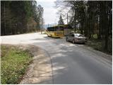
From the highway Ljubljana - Maribor we go to the exit Žalec and follow the road towards Arja vas. At the crossroad at the end of Arja vas, we continue left towards Celje. Further, the road through the village Levec brings us to Celje, where at the big crossroad (almost at the beginning of Celje) we continue left towards the village Lopata. Only a few dozen meters after the village Lopata, the road towards Šentjungert branches off to the left. We park on the parking lot by the bus stop at the beginning of the road towards the village Šentjungert.
From the Maribor side we can leave the highway at exit Celje - center, and then to the above-mentioned crossroad we drive in the direction of Ljubljana. Further, follow the above description.
Route description:
From the bus stop, we continue on the asphalt road in the direction of Gora. The road, which at first ascends gently, leads us through the village Gorica, after which we come to the dispersed settlement Šentjungert, where the blazes direct us to the left, at first past houses and then across a meadow upwards. At the top of the meadow we come to the road, where we continue right onto the yard of one of the houses and then immediately left onto a footpath, which higher up ascends along the pasture fence. Only a little further, we again step onto the road, which we follow for a few steps to the next junction. The blazes direct us onto a footpath which ascends more steeply through the forest. After a short ascent, we again step onto the road, which we follow upwards. We continue along the road, which from the forepeak just ascended, in a gentle descent brings us to the saddle between the two peaks. Further, we continue on the road, which ascends somewhat more steeply and brings us to the mountain hut Šentjungert in a few minutes.

Along the route: Gorica (270m)
Photos:
 1
1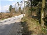 2
2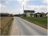 3
3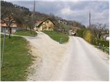 4
4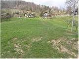 5
5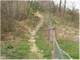 6
6 7
7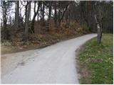 8
8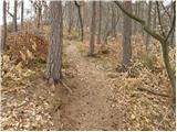 9
9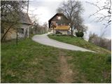 10
10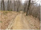 11
11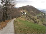 12
12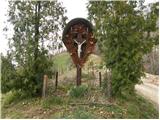 13
13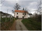 14
14 15
15
Discussion about the trip Lopata - Planinski dom Šentjungert
|
| VMA3. 02. 2011 |
There are still many paths to Kunigunda. For example from the direction of Galicija, Šmartno v Rožni dolini, Vojnik, which are much nicer than this one described. Paths are well marked. 
|
|
|
|
| tt113. 02. 2012 |
Šentjungert is awesome! Exceptional views, from Pohorje, Boč, Celjska koča, Posavsko hribovje, Menina planina, Dobrovelj, Golt, Uršlja gora, Paški Kozjak, Kamniške Alpe, Šmartinsko jezero, Celje to Spodnja Savinjska dolina. Practically the entire Celje basin with surrounding hills. A hill worth the ascent and views
|
|
|
To post a comment you must log in:
If you do not yet have a username, you must first
register.