Prevala - Škabrijel (via Hungarian pyramid)
Starting point: Prevala (325 m)
| Latitude/Longitude: | 45,98380°N 13,66470°E |
| |
Route name: via Hungarian pyramid
Walking time: 1 h
Difficulty: easy marked way
Elevation gain: 321 m
Elevation difference along the route: 330 m
Map: Goriška - izletniška karta 1:50.000
Recommended equipment (summer):
Recommended equipment (winter):
Views: 5.250
 | 2 people like this post |
Access to starting point:
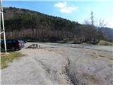
A) We drive to Nova Gorica, then continue towards Tolmin and Kobarid. We follow the main road towards Tolmin only to Solkan, where at the traffic-light intersection we turn right towards Sveta Gora and Grgar. The ascending road leads past the Solkan quarry, then a little higher turns sharply right and takes us to the Skalnica inn, behind which we first reach a crossroads where a steep road branches left towards Sveta Gora, and shortly after another crossroads where the road continues slightly left towards Grgar, Čepovan and Banjšice; we continue slightly right towards Trnovo and Lokvam. From the crossroads we drive a further 100 m, then park on a large macadam parking lot on the left side of the road.
B) From Tolmin or Most na Soči we drive along the main road towards Nova Gorica, then just before Nova Gorica, precisely at the traffic-light intersection in Solkan, we turn left towards Sveta Gora and Grgar. The ascending road leads past the Solkan quarry, then a little higher turns sharply right and takes us to the Skalnica inn, behind which we first reach a crossroads where a steep road branches left towards Sveta Gora, and shortly after another crossroads where the road continues slightly left towards Grgar, Čepovan and Banjšice; we continue slightly right towards Trnovo and Lokvam. From the crossroads we drive a further 100 m, then park on a large macadam parking lot on the left side of the road.
C) From Goriška Brda we drive to Solkan, where at the first intersection after the new Solkan Bridge we continue straight towards Sveta Gora. The ascending road leads past the Solkan quarry, then a little higher turns sharply right and takes us to the Skalnica inn, behind which we first reach a crossroads where a steep road branches left towards Sveta Gora, and shortly after another crossroads where the road continues slightly left towards Grgar, Čepovan and Banjšice; we continue slightly right towards Trnovo and Lokvam. From the crossroads we drive a further 100 m, then park on a large macadam parking lot on the left side of the road.
Route description:
From the parking lot we cross the road, then continue in the direction of the marked trail to Škabrijel. On the other side of the road we first continue along a rocky cart track, then after crossing the power line, from where a nice view opens up onto the Solkan Bridge with the world's largest stone arch, we arrive at a junction by which there is a small bench.
From the junction we continue straight (left is the usual trail to Škabrijel from Prevala) and along the cart track first descend slightly, then begin a gentle to moderate ascent. The trail continues through the forest, only on a short section offering some views towards Sveta Gora, the Soča River and Sabotin. Higher up, when the trail levels out completely, we reach a junction where we continue left towards Škabrijel (straight to Kekec).
From the junction onwards we walk along a somewhat narrower cart track, which takes us past the renovated Hungarian pyramid. Higher up the signs for Škabrijel direct us left from the cart track onto a marked footpath that then leads us past the Štefan bivouac in a moderate ascent to the summit of Škabrijel, where a metal observation tower stands from which fine views open up.
Description and pictures refer to the conditions in 2016 (February).

Photos:
 1
1 2
2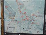 3
3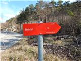 4
4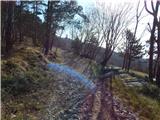 5
5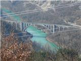 6
6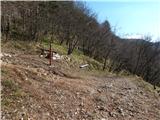 7
7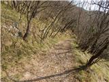 8
8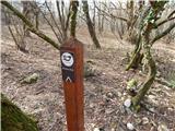 9
9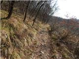 10
10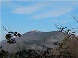 11
11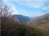 12
12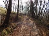 13
13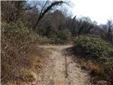 14
14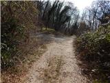 15
15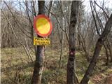 16
16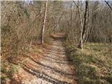 17
17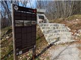 18
18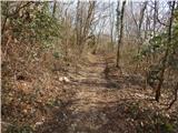 19
19 20
20 21
21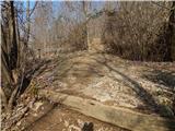 22
22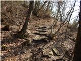 23
23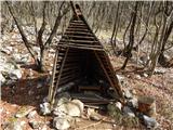 24
24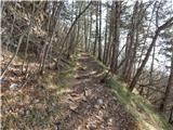 25
25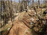 26
26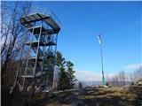 27
27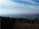 28
28 29
29
Discussion about the trip Prevala - Škabrijel (via Hungarian pyramid)
To post a comment you must log in:
If you do not yet have a username, you must first
register.