Gorjane (Železno) - Veliki Špiček
Starting point: Gorjane (Železno) (368 m)
| Latitude/Longitude: | 46,03780°N 15,57490°E |
| |
Walking time: 2 h 50 min
Difficulty: easy marked way
Elevation gain: 318 m
Elevation difference along the route: 495 m
Map:
Recommended equipment (summer):
Recommended equipment (winter): ice axe, crampons
Views: 56
 | 1 person like this post |
Access to starting point:
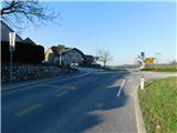
a) From the Sevnica - Krško road, head towards Brestanica, then follow the signs for Podsredo. Before starting to descend towards Podsredo, in the settlement of Gorjane we reach the Železno pass, where the described trail begins at the Gorjane bus station. There are no suitable parking spaces at the starting point.
b) Drive to Podsredo, then follow the signs for Krško, Sevnica and Brestanica. Before starting to descend towards Brestanica, in the settlement of Gorjane we reach the Železno pass, where the described trail begins at the Gorjane bus station. There are no suitable parking spaces at the starting point.
Route description:
From the bus station, head onto the side road marked for Podsreda Castle and Krivec Ecological Farm, where the trail leads past a few houses, and at the next intersection go straight towards Podsreda Castle. The road then moderately ascends, later passing a cross and one house, then continues through the forest for a while. Higher up, the road levels out and brings us to a marked intersection, from which we continue straight towards Podsreda Castle (right to Krško and Brestanica).
A slight transverse descent through the forest follows, and we arrive at a well-maintained rest area near the chapel of St. Florian, from where a nice view of Podsreda Castle opens up.
Continue along the road and within a few minutes of further walking, we reach the castle, where there is a stamping box on the outer side of the wall and a stamp above it.
Bypass the castle on the right side and continue the ascent on the asphalt road, which leads past two parking lots, then ascend through the forest to a marked junction, where we continue right towards Pišec, Bizeljski and Veliki vrh (left to Svete gore).
Just a little further from the junction, we leave the forest, where on a larger meadow the road turns left and forks again.
This time, choose the left road, along which Knafelc's markers continue (straight Slovenian mountain bike trail) and which soon returns to the forest. A transverse ascent through the forest follows; when the forest ends on the left, a view opens to the nearby Rigelj, the peak with antennas, and we quickly ascend to a marked junction, where a trail from the Shelter in Pečice joins from the right, specifically the trail past the Švajger farmstead.
The trail continues with nice views along the pastures of the Pusti Vrh hamlet, then temporarily returns to the forest. When we leave the forest, with views of Veliki vrh, the highest peak of the Orlice range, we walk to a junction in the middle of the Preska hamlet, where we continue straight (left another trail to Svete gore) to a branch towards Veliki vrh one minute away.
Continue straight along the road (also possible right over Veliki vrh, but the trail is somewhat longer and poorly marked in parts), which bypasses the Šulc farm on the left side, where there is the PPKB stamp (Planinska pot Krško - Brežice).
A few more minutes along the meadows, then the road enters the forest and gradually turns south, where we quickly reach the pass below Šuljc's slope, which is also a marked junction.
From the marked junction, continue left onto the marked footpath towards Velika bukva, Pišec and Bizeljski (sharply left forest road allowing continuation to Svete gore, slightly left forest road running parallel to our marked trail, straight to Kerinov spomenik, 1 minute). The trail leads through the forest with some shorter ascents and descents; initially it runs right of the road, later crosses it and continues left of the road for a while, then along it for some time. When we reach a sort of pass, leave the road and continue left on the marked trail, which gently, and moderately further on, ascends through the forest. Higher up, the trail brings us near the highest point of Intermedija peak, where we go left and reach the summit of Intermedija in a few steps.
Continue on the marked trail, which begins to descend through the forest; a few minutes lower, return to the road, along which we continue with a slight ascent to the Bivak of the Pišece Hunting Association.
Behind the bivouac, from the forest road go slightly left onto the trail marked for Veliki Špiček. The trail then begins to ascend transversely along the northwest slopes of the nearby Veliki vrh; when we reach the ridge higher up, go left towards Veliki Špiček, reaching its summit after two minutes of further walking.
Starting point - Turnič 0:30, Turnič - Podsreda Castle 0:15, Podsreda Castle - junction after Podsreda Castle 0:10, junction after Podsreda Castle - junction at Marof 0:05, junction at Marof - Pusti Vrh 0:20, Pusti Vrh - Preska 0:15, Preska - Kerinov spomenik 0:20, Kerinov spomenik - Intermedija 0:30, Intermedija - Bivak of the Pišece Hunting Association 0:10, Bivak of the Pišece Hunting Association - Veliki Špiček 0:15.
Description and photos refer to the status in March 2026.

Along the route: Turnič (496m),
Podsreda castle (475m), Razpotje za Gradom Podsreda (524m), Razpotje na Marofu (544m), Pusti Vrh (634m), Preska (625m), Kmetija Šulc (625m),
Kerin Memorial (614m),
Intermedija (662m),
Bivak Lovske družine Pišece (594m), Razpotje pod Velikim Špičkom (677m)
Photos:
 1
1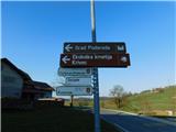 2
2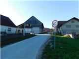 3
3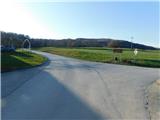 4
4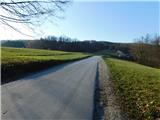 5
5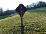 6
6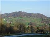 7
7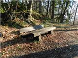 8
8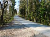 9
9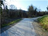 10
10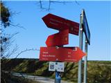 11
11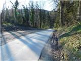 12
12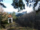 13
13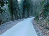 14
14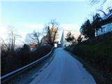 15
15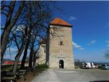 16
16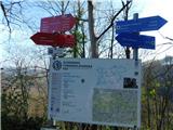 17
17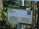 18
18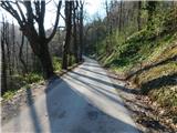 19
19 20
20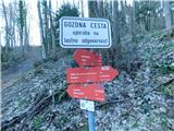 21
21 22
22 23
23 24
24 25
25 26
26 27
27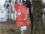 28
28 29
29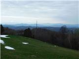 30
30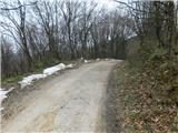 31
31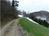 32
32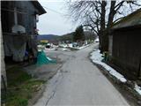 33
33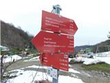 34
34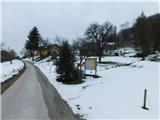 35
35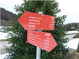 36
36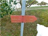 37
37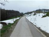 38
38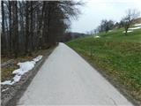 39
39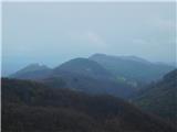 40
40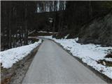 41
41 42
42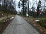 43
43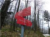 44
44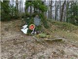 45
45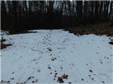 46
46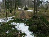 47
47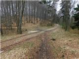 48
48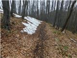 49
49 50
50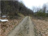 51
51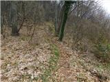 52
52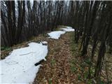 53
53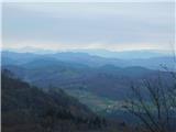 54
54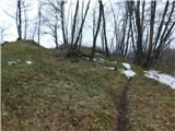 55
55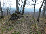 56
56 57
57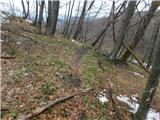 58
58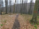 59
59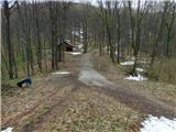 60
60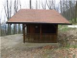 61
61 62
62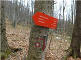 63
63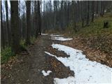 64
64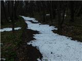 65
65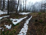 66
66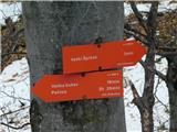 67
67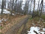 68
68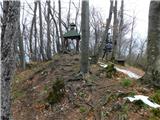 69
69 70
70
Discussion about the trip Gorjane (Železno) - Veliki Špiček
To post a comment you must log in:
If you do not yet have a username, you must first
register.