Gornji Senik / Felsőszölnök - Janezov breg / János-hegy
Starting point: Gornji Senik / Felsőszölnök (280 m)
| Latitude/Longitude: | 46,87571°N 16,16429°E |
| |
Walking time: 25 min
Difficulty: easy marked way
Elevation gain: 102 m
Elevation difference along the route: 102 m
Map:
Recommended equipment (summer):
Recommended equipment (winter): ice axe, crampons
Views: 80
 | 1 person like this post |
Access to starting point:
From the road Kuzma - Gornji Petrovci, at the settlement Martinje we turn onto the road towards Hungary and continue driving towards the place Gornji Senik / Felsőszölnök. After a short descent we arrive in the mentioned place, where we park in the arranged parking lot near the church.
Route description:
From the parking lot we continue along the main road, where we first pass the church, kindergarten and store to the marked intersection. Here we turn left in the direction of the viewpoint on Janezov breg, and at the cultural center we turn left again in the direction of Tromejnik. The path then leads us past a small fire station, where we turn right in the direction of the hamlet Zgornji Janezov breg / Felsőszölnök-Jánoshegy (straight ahead the path leads towards Tromejnik). Continuing, we pass a few more houses, where the path begins to visibly ascend, and the asphalt ends before the forest. We continue the ascent through the forest, initially still past individual houses, then through dense forest on a poorer gravel road that forks higher up.
While the left, somewhat poorer road leads towards the hamlet Zgornji Janezov breg, we continue right and then immediately right again at the cross. Only a few dozen steps of walking follow and we arrive at the viewing tower on Janezov breg.
The description refers to the situation in May 2026, and the photos are from July 2022 and May 2026.

Photos:
 1
1 2
2 3
3 4
4 5
5 6
6 7
7 8
8 9
9 10
10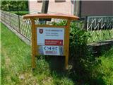 11
11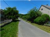 12
12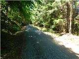 13
13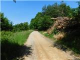 14
14 15
15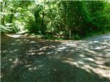 16
16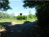 17
17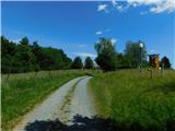 18
18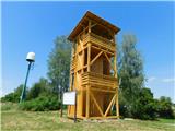 19
19 20
20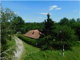 21
21
Discussion about the trip Gornji Senik / Felsőszölnök - Janezov breg / János-hegy
To post a comment you must log in:
If you do not yet have a username, you must first
register.