Gößgraben - Hochalmspitze (via Steinerne Mandln)
Starting point: Gößgraben (1600 m)
| Latitude/Longitude: | 46,98040°N 13,33510°E |
| |
Route name: via Steinerne Mandln
Walking time: 5 h 30 min
Difficulty: very difficult marked way
Elevation gain: 1760 m
Elevation difference along the route: 1780 m
Map:
Recommended equipment (summer): helmet, self belay set, ice axe, crampons
Recommended equipment (winter): helmet, self belay set, ice axe, crampons
Views: 6.976
 | 3 people like this post |
Access to starting point:
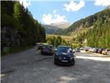
From the Karawanks Tunnel, we follow the highway towards Salzburg to the Gmünd exit. Then we follow the signs for the Maltatal valley. We follow the road that runs through the mentioned valley to the settlement Koschach. When we notice the Fallbach waterfall (highest waterfall in Carinthia) on the right, we will soon come to a junction where we turn left across the bridge, which crosses the Malta River. Shortly after, we turn left again onto a narrower road steeply uphill into the Gößgraben valley (signs for the Gießener Hütte mountain hut). We follow the road all the way to the large parking lot below the Goskarspeicher dam. The last few kilometers of the road are open only in the summer months when the Gießener Hütte mountain hut is open (from the beginning of July to the end of September).
Route description:
From the parking lot, we continue on the asphalt road which is closed to traffic. After a few minutes of ascent, we come to a junction where we continue right on the macadam road where the sign »Gießener Hütte« directs us. Left is only a short ascent to the Gößkarspeicher lake.
At the junction, we also enter the Hohe Tauern National Park (Nationalpark Hohe Tauern). The road ascends all the time and increasingly beautiful views open towards the Reißeck mountain group. During the ascent we also cross grazing fences several times, as livestock grazes by the road in the summer months. Further, we can walk on the road all the time or take marked shortcuts. The forest becomes thinner and in the last part of the path towards the hut we walk by rocky terrain. Here a nice view also opens towards the Hochalmspitze summit and numerous streams which flow down the slope. We continue on the road and soon come to the Gießener Hütte hut.
From the hut, we continue on the footpath which immediately above the hut brings us to a junction. Left leads the path towards the Mallnitzer Scharte notch and Arthur von Schmid Haus hut, we continue slightly right following the signs »Hochalmspitze«. Shortly after, an easy path to the nearby Winterleitenkopf peak branches off to the right.
The path further mostly runs on rocky slabs which are initially nicely arranged so the ascent causes no problems. Here we enter the core area of the Hohe Tauern National Park and after a short ascent we come to another junction.
Left leads the path towards the Lassacher Winklscharte notch and to Hochalmspitze via the western ridge (Detmolder Grat). At the junction we continue right on path 536 named Rudolstädter Weg. On the slope where we ascend there are more and more rocky slabs so the trail is poorly visible. Orientation nevertheless is not particularly difficult as numerous markers assist us. During the ascent we cross smaller streams several times, higher the path brings us also to two lakes.
The path further continues mostly towards the north and brings us near the Trippkees glacier. Here we walk right of the main part of the glacier towards the part of the glacier located under the wall near the Steinerne Mandln towers. For ascent on the glacier we will need winter equipment, we head towards the secured path which starts in the wall at the end of the glacier (also marked with a somewhat larger marker).
The glacier in the last part is very steep and is not to be underestimated. In early summer or when there is still somewhat more snow the last few meters are even steeper. Additional problems can be caused by a possible randkluft at the end of the glacier. In late summer, when rocks appear from under the snow there is also considerable danger of falling rocks.
From the edge of the glacier follows a short almost vertical ascent on staples, which brings us to the ledge. We continue left and ascend traversely on a well-secured path. The path then turns right upwards and ascends relatively steeply all the way to the ridge at the famous Steinerne Mandln towers. The path here is continuously well secured.
On the ridge where a view opens towards the Hochalmkees glacier, we continue left and a short somewhat exposed ascent along the steel cable follows. The ridge then becomes somewhat less demanding but is no longer secured so some caution is still needed. Further the ridge becomes wider and the ascent is not demanding. As we walk on rocky slabs some care is needed since some larger rocks are not entirely stable. Later the ridge narrows somewhat again and another steep ascent along the steel cable follows. Further the ridge is wider again and the ascent causes no more problems. Such a path then runs all the way to the forepeak Schneewinkelspitze. Towards the main summit to which there are only a few dozen meters the ridge becomes somewhat steeper again and slightly exposed.
We can descend via the ascent path or via the western ridge where a secured path leads. The path to the west side is steeper than the described one but well secured. Usually we will also need winter equipment on this path but the snowfield is relatively short. In late summer it is possible that we will not need winter equipment.

Photos:
 1
1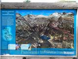 2
2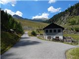 3
3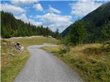 4
4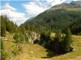 5
5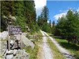 6
6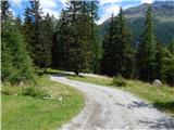 7
7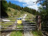 8
8 9
9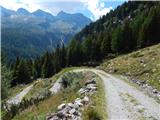 10
10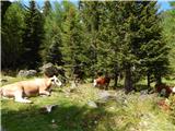 11
11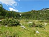 12
12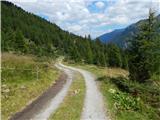 13
13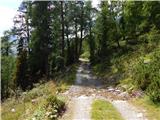 14
14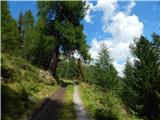 15
15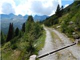 16
16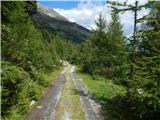 17
17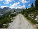 18
18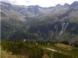 19
19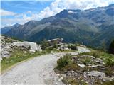 20
20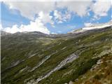 21
21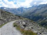 22
22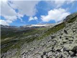 23
23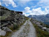 24
24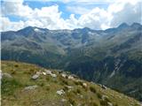 25
25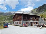 26
26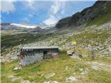 27
27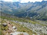 28
28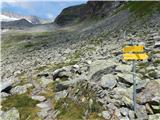 29
29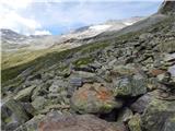 30
30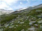 31
31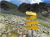 32
32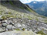 33
33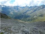 34
34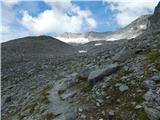 35
35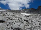 36
36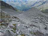 37
37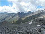 38
38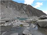 39
39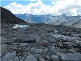 40
40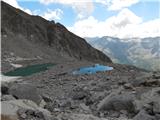 41
41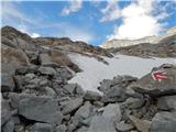 42
42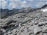 43
43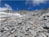 44
44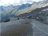 45
45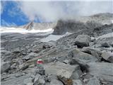 46
46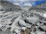 47
47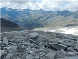 48
48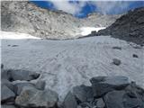 49
49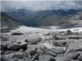 50
50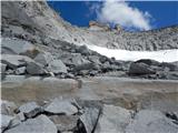 51
51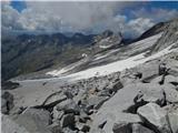 52
52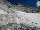 53
53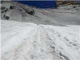 54
54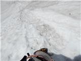 55
55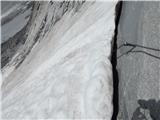 56
56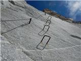 57
57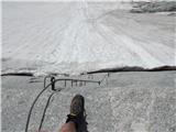 58
58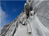 59
59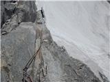 60
60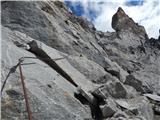 61
61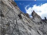 62
62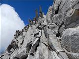 63
63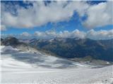 64
64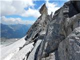 65
65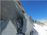 66
66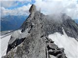 67
67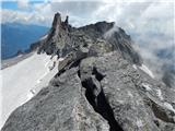 68
68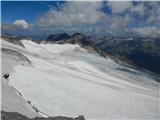 69
69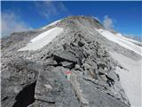 70
70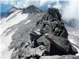 71
71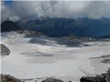 72
72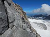 73
73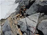 74
74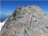 75
75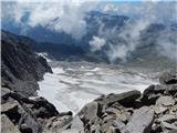 76
76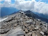 77
77 78
78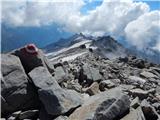 79
79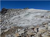 80
80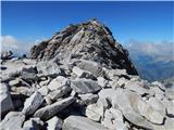 81
81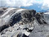 82
82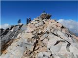 83
83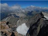 84
84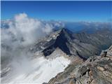 85
85 86
86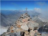 87
87
Discussion about the trip Gößgraben - Hochalmspitze (via Steinerne Mandln)
|
| J.P.11. 08. 2019 |
The trail is exceptionally beautiful and worth the effort. We chose the path via Steinerne Mandln for ascent and descent. No peculiarities, except for the necessary winter equipment for climbing the glacier before entering the secured path. As written: the last meters are quite steep and at the end of the glacier there is no place to exit. Head for the red dot or the metal. Those who know can do an abseil on the way back and save a lot of time scrambling on the glacier. Hikers who went via the western side shared with us that they had no snow on the path or it could be avoided and the climbing path is well secured. Good luck. Regards
|
|
|
|
| planinec Maks28. 08. 2022 19:23:46 |
I tried to summit the peak on 24.8. The path is IMPASSABLE and DANGEROUS due to rockfall. There was no snowfield, part of the wall has collapsed and there are no protections in the first 50 meters of the wall at all. The hanging rope indicated that someone abseiled on descent. The hut warden said the path is closed, which surprised me as there were no signs anywhere
|
|
|
|
| mpp30. 08. 2022 08:04:56 |
Do you have any photo of the rockfall?
|
|
|
To post a comment you must log in:
If you do not yet have a username, you must first
register.