Starting point: Grant (725 m)
| Latitude/Longitude: | 46,20730°N 13,87900°E |
| |
Walking time: 3 h 30 min
Difficulty: easy marked way
Elevation gain: 1241 m
Elevation difference along the route: 1241 m
Map: TNP 1:50.000
Recommended equipment (summer):
Recommended equipment (winter): ice axe, crampons
Views: 11.780
 | 1 person like this post |
Access to starting point:
From Podbrdo we drive towards Tolmin or vice versa, but only to the village of Koritnica. In Koritnica we will notice a sign for the village Rut, which directs us right (from Tolmin sharply left). We then follow the mostly ascending road to the mentioned village, where there is also a smaller junction. We continue left towards the village Grant, to which we arrive after approximately 1 km of additional driving. In the village there are no designated parking spots, therefore we park at an appropriate place somewhere nearby.
Route description:
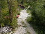
At the end of the village Grant we look for the continuation of the marked path, which further runs on a poorer road or cart track. Further on, some junctions follow, where we follow the otherwise rare blazes, and we quickly ascend above the village. Higher we leave the nearby pasture, then we ascend to a wider macadam road, which we cross, and continue the ascent through the forest. Quite a steep path, along which the blazes are more frequent further on, and higher it crosses another forest road. Above the road the path turns slightly to the left, then it starts to ascend quite steeply. Higher the steepness eases a bit, then we join a wider cart track path, which we follow to the left, and along it we quickly arrive at a marked junction, where we continue right in the direction of Rodica (straight Koča na planini Razor and Geološka pot).
Behind the junction named Mladinska koča we start to ascend along a nicely preserved mule track, which after a few minutes turns sharply to the left, then for quite some time ascends diagonally towards the left, first still through the forest, then through dwarf pines. During the diagonal ascent the path leads us also over some gullies, the passages over them are not demanding, as the path is wide all the time. With nice views on Idrijsko and Cerkljansko hribovje, at the right serpentine we get completely close to the summit of Jehlc, which we see in front of us all the time during the crossing. At this serpentine the pathless approach to the mentioned summit continues straight ahead (the last part before the ridge is demanding), we however continue on the marked path, which continues further on the mule track. Two serpentines higher a still easier approach to the previously mentioned summit branches off to the left, we however continue ascending through dwarf pines. A little higher we reach the ridge, which stretches from Jehlc to the main ridge of Spodnje Bohinjske gore, and the path withdraws from it several times, once to the left, another time to the right side. Higher dwarf pines are replaced by grasses and stones, and nicer views open up with every step. A few more serpentines follow, where we ascend over a steeper slope, then the slope flattens and the path brings us to a marked junction, where we join the path from the Bohinj side.
Here we continue right (left Šija, Ski hotel Vogel and Ribčev Laz) and along the moderately steep ridge in good 10 minutes of further walking we ascend to the 1966 meters high summit of Rodica.

Photos:
 1
1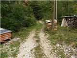 2
2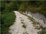 3
3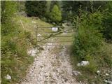 4
4 5
5 6
6 7
7 8
8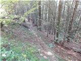 9
9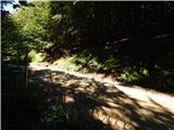 10
10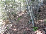 11
11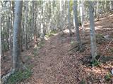 12
12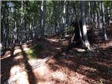 13
13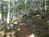 14
14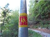 15
15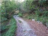 16
16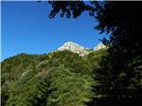 17
17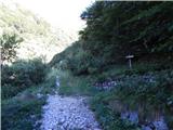 18
18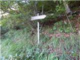 19
19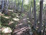 20
20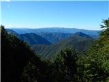 21
21 22
22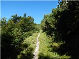 23
23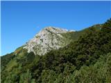 24
24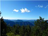 25
25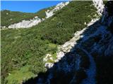 26
26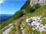 27
27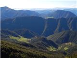 28
28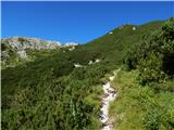 29
29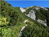 30
30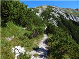 31
31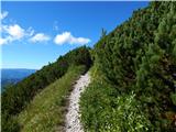 32
32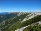 33
33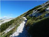 34
34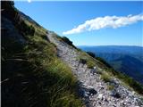 35
35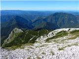 36
36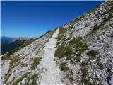 37
37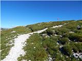 38
38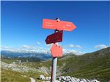 39
39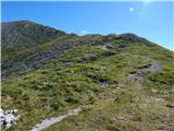 40
40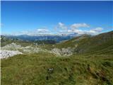 41
41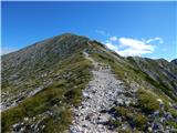 42
42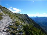 43
43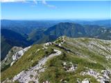 44
44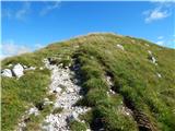 45
45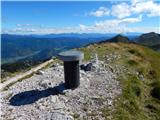 46
46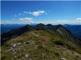 47
47 48
48
Discussion about the trip Grant - Rodica
|
| PUHIPUHI20. 07. 2019 |
Today we walked this trail. I think the label MARKED trail is inappropriate. From the village towards Rodica there are no markings; it's completely impossible to know which path is right. We reached the described path after many wrong attempts at picture 15. On return we turned here onto the right path. Markings in this section are very sparse and really very faded; almost invisible. The path crosses the road approx. 6x. But at one point the path ahead is again impossible to find. The section of path between pictures 7 and 10 still remains unknown to us.
|
|
|
|
| gasperv15. 08. 2022 10:31:35 |
In these days we walked this path and my comment would be similar to the previous one. In the village itself, it's hard to find a suitable starting point.
We came across the markers quite high up - at the Tregile junction where the path from Rut village joins.
I have a quite old map - 2006 and on it the path from Grant village is drawn. On the maPZS app, however, the path from Rut village is drawn.
|
|
|
|
| darinka429. 12. 2023 11:04:21 |
I do agree with the predecessors. We left the car at the end of the village. At the monument to the fallen. Since we went from there for the first time the GPS track from Jernej who went from there some time ago was very helpful for us. We crossed the road several times. Only on one tree was Rodica written in red letters. Otherwise the paths are still visible. But in poor condition. Further on when the path joins the one from Rutarski gozd everything is known.
|
|
|
To post a comment you must log in:
If you do not yet have a username, you must first
register.