Heidi Alm - Schwarzkofel (ridge path)
Starting point: Heidi Alm (1872 m)
| Latitude/Longitude: | 46,86340°N 13,83130°E |
| |
Route name: ridge path
Walking time: 2 h
Difficulty: easy marked way
Elevation gain: 296 m
Elevation difference along the route: 475 m
Map:
Recommended equipment (summer):
Recommended equipment (winter): ice axe, crampons
Views: 3.342
 | 2 people like this post |
Access to starting point:
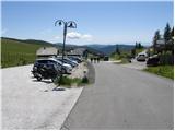
A) Through the Karawanks Tunnel, we drive to Austria, and then we continue driving on the Tauern motorway, which we leave already at the Villach bypass and continue driving towards the town of Feldkirchen. Further, we drive along Osojsko jezero / Ossiacher See to the already mentioned town. In Feldkirchen we continue left in the direction of the mountain pass Turacher Höhe and drive on past the towns of Himmelberg, Gnesau, Mitterdorf to the town of Wiedweg, where from the left the road from Bad Kleinkirchheim also joins. From the mentioned intersection, we continue towards the mountain pass Turacher Höhe only a few hundred meters, then signs for the mountain pasture Heidialm and village and lake Falkertsee direct us left onto an ascending road. We follow the mentioned road to its end, where we park on one of the many parking lots.
B) From Štajerska or Koroška, we first drive to Dravograd and then over the border crossing Vič into Austria, where we then follow the signs for Celovec / Klagenfurt. Further, we drive on the so-called Southern motorway, which we leave at Klagenfurt (direction Feldkirchen). Further, we drive on a regional road, by which we arrive at the already mentioned town. In Feldkirchen we continue right in the direction of the mountain pass Turacher Höhe and drive on past the towns of Himmelberg, Gnesau, Mitterdorf to the town of Wiedweg, where from the left the road from Bad Kleinkirchheim also joins. From the mentioned intersection, we continue towards the mountain pass Turacher Höhe only a few hundred meters, then signs for the mountain pasture Heidialm and village and lake Falkertsee direct us left onto an ascending road. We follow the mentioned road to its end, where we park on one of the many parking lots.
Route description:
From the parking lot, we go in the direction of the park Heidi-Alm to which we have 130 m. After 130 m a path branches off to the left towards the mentioned park (to view the park an entrance fee must be paid), and we go straight and continue the path on the road, which quickly brings us to the high mountain lake Falkertsee.
From the lake, which we bypass on the left side, the path starts to ascend moderately and continues on an increasingly poor road. A little higher we arrive at a marked junction, where we continue left in the direction of the peak Rodresnock (straight to saddle Falkertscharte, Rodresnock and Falkert over the mentioned saddle and the climbing path to Falkert). The path ahead first crosses gentle slopes to the left, then passes onto the steep slopes of Rodresnock, where it starts to ascend steeply. With nice views of lake Falkertsee and the eponymous village we ascend one level higher, where the path flattens and turns right and quickly reaches a panoramic and unvegetated ridge. Further, we ascend on and along the ridge, which to the left is extensive and grassy, to the right steeply descends towards the cirque between Rodresnock and the peak Falkert. Occasionally steeper ridge path, from which beautiful views open up reaching all the way to the Slovenian mountains, then flattens and brings us to a poorly marked junction, where to the left downwards branches off a marked but less trodden path, which leads to the nearby Schwarzkofel and further towards the valley.
We continue in the mentioned direction (straight Rodresnock 5 minutes) and continue on a path which starts to descend more steeply towards the southeast. After a few minutes the path flattens and brings us to a wide grassy ridge, along which we continue a gentle descent. A little lower we arrive at an indistinct saddle between Rodresnock and Schwarzkofel. From here we start to ascend gently, following the panoramic path all the way to the top of Schwarzkofel, which we have been seeing for quite some time.

Along the route: Falkertsee (1872m)
Photos:
 1
1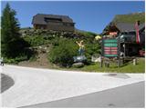 2
2 3
3 4
4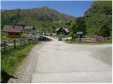 5
5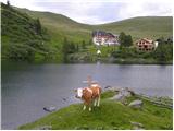 6
6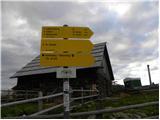 7
7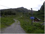 8
8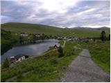 9
9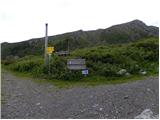 10
10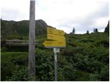 11
11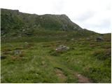 12
12 13
13 14
14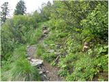 15
15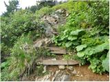 16
16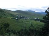 17
17 18
18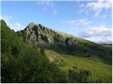 19
19 20
20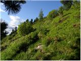 21
21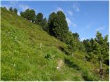 22
22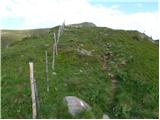 23
23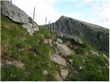 24
24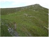 25
25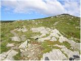 26
26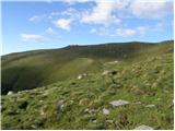 27
27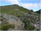 28
28 29
29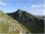 30
30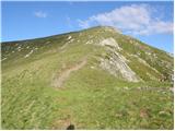 31
31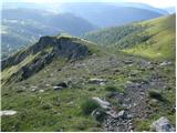 32
32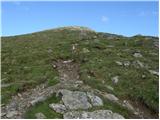 33
33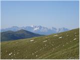 34
34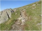 35
35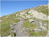 36
36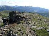 37
37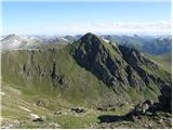 38
38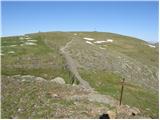 39
39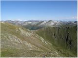 40
40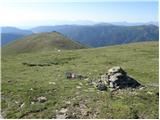 41
41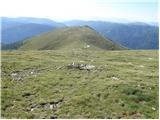 42
42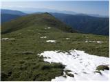 43
43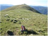 44
44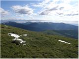 45
45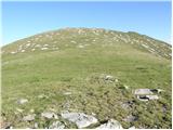 46
46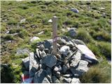 47
47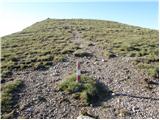 48
48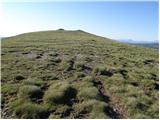 49
49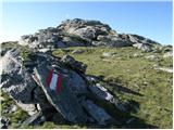 50
50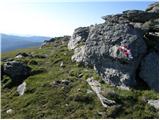 51
51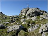 52
52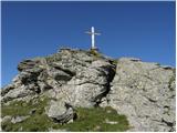 53
53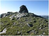 54
54 55
55
Discussion about the trip Heidi Alm - Schwarzkofel (ridge path)
To post a comment you must log in:
If you do not yet have a username, you must first
register.