Starting point: Hibje (1000 m)
| Latitude/Longitude: | 46,36860°N 14,24470°E |
| |
Route name: by road
Walking time: 1 h 45 min
Difficulty: easy marked way
Elevation gain: 634 m
Elevation difference along the route: 634 m
Map: Karavanke - osrednji del 1:50.000
Recommended equipment (summer):
Recommended equipment (winter):
Views: 41.841
 | 2 people like this post |
Access to starting point:
From the highway Ljubljana - Jesenice, at the Podtabor junction we continue in the direction of Ljubelj and Tržič. We continue driving on the fast road towards Ljubelj, then just before the gas station we turn right in the direction of Tržič and Begunje. The road then starts descending, and at the first crossroad we continue left (direction Begunje) through the underpass, through which we arrive in Bistrica pri Tržiču. A little further, a sign for Begunje directs us right onto a narrower and ascending road, which we then follow through the villages Brezje and Hudi Graben. After Hudi Graben, only a few 100 m after the crossroad where the road to the villages Leše and Paloviče branches off to the left, we will notice on the right side a macadam road and next to it signposts for Dobrča. We head onto the mentioned macadam road (the turn from the main road is sharp to the right) and then follow it to an altitude of approx. 1000 m, where at the smaller crossroad we notice hiking signposts and below them a parking lot.
Access from Begunje is also possible.
Route description:
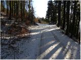
From the parking lot we continue on the left upper and wider road (the right rougher road ends quickly), which soon makes a left turn, then for quite some time ascends transversely towards the west. Higher up, the road makes a sharp right turn and gradually transitions into dense forest. Further on, the road makes a few more zigzags, then brings us to a barrier (it is possible to drive here by car too, but the road is quite steep and rutted in places). We continue past the barrier and continue the ascent along the road, which soon brings us to the ridge of Dobrča. Here the road turns right and gradually passes onto the northern slopes. The road, from which we get some views of the main Karavanks ridge, soon brings us to Podgorska planina. Here we continue right, and after a few minutes of further walking we arrive at Koča na Dobrči.
From the hut we return to the lower part of Podgorska planina (2 minutes), then continue the path towards Dobrča. We bypass the huts on Podgorska planina on the right side, then ascend over a scenic grassy slope and continue the ascent on the path, which soon enters initially sparse forest, becoming denser higher up. When the gradient eases, two paths join us from the right, but in both cases we continue straight ahead. The path then steepens again and after a few minutes of further walking brings us to the summit of Dobrča.

The trip can be extended to the following destinations: Šentanski vrh
Photos:
 1
1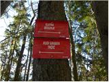 2
2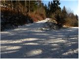 3
3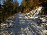 4
4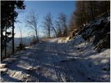 5
5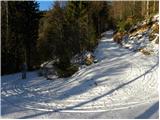 6
6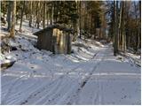 7
7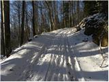 8
8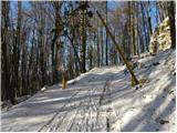 9
9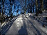 10
10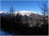 11
11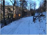 12
12 13
13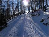 14
14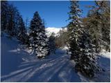 15
15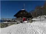 16
16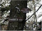 17
17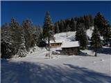 18
18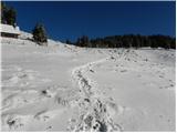 19
19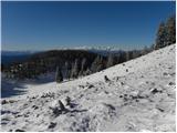 20
20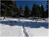 21
21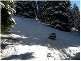 22
22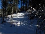 23
23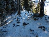 24
24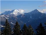 25
25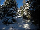 26
26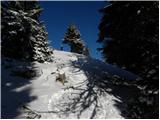 27
27 28
28
Discussion about the trip Hibje - Dobrča (by road)
|
| zamet28. 05. 2009 |
I'm interested in the path to Dobrča. Last year I drove from the direction of Begunje-Tržič, and somewhere in the middle I think the village Hudi graben had a sign for Dobrča by the road in the forest, how far is it from there to the top or can you park your car there..
|
|
|
|
| Saten2. 08. 2009 |
Yesterday afternoon I went for a walk to Dobrča. Nice weather, friendly hikers I met on the way, friendly caretakers in the hut at Dobrča. Everything would be ideal if it weren't for the hunting society Begunjščica group of young guys who brought a speaker in front of the hut and blasted music at full volume, echoing across the entire alpine pasture up to the top of Dobrča. If anyone knows the person in charge of this hunting society, please warn him to check who he gives the hut keys to.
|
|
|
|
| mijado3. 08. 2009 |
We experienced this too, so the Begunjščica hunting society should seriously consider who they give keys to!
As for the caretakers at the Dobrča hut, "hat off"; friendly, good food, large portions,... Recommend!
|
|
|
|
| hostar3. 08. 2009 |
Bravo Slovenian envy, just because we can't all be there it's already a disaster. Last weekend music at the hut on Dobrča didn't bother us, even though it could be heard all the way to the top, this weekend music at Roblek didn't either, and I heard it even on Dobrča. But this no, this was a party for all true mountaineers, even the helicopter that had to bring a new supply of beer at 2 pm for the "lovers of mountain peace" didn't bother us, even though it caused additional noise.
|
|
|
|
| Kriška3. 08. 2009 |
Wherever anyone in the mountains indulges in disturbing the peace of nature, they are extremely inconsiderate and disturb both mountain visitors and animals whose world we are invading.
|
|
|
|
| hostar5. 08. 2009 |
Exactly so and equally disturbing factor for the mountain world is mass tourism, where most don't stick to marked trails at all but wander everywhere, preferably with dogs off leash!
|
|
|
|
| jasmin0127. 01. 2011 |
mountains are not for getting drunk....they are for enjoying the beauties and peace....
a mountaineer's greeting
|
|
|
|
| Daaam27. 01. 2011 |
well yeah... I like it when every now and then in some hut a bit more gets poured than necessary 
|
|
|
|
| hostar27. 01. 2011 |
It's much more useful if there's a party in the hut in the evening, than the wandering of "nature and peace lovers" on pathless terrain, and disturbing the real inhabitants of the mountains (especially animals), whose life in this beautiful world is certainly not easy.
|
|
|
|
| hostar29. 01. 2011 |
But fewer people who think they can do whatever they want in the mountains and trample everywhere. Let's respect the mountain dwellers, they were theirs before ours!!
|
|
|
|
| Alfista9. 02. 2013 |
Yesterday on Dobrča quite nice.
Diesel smell along the way, because they plowed 2x up and 2x down.
Road cleared to the hut.
|
|
|
|
| slamca9. 02. 2013 |
Smell up, smell down; need to ensure bellies are full and thirst quenched 
|
|
|
|
| Alfista9. 02. 2013 |
There was a Lada Niva parked up there with all four chains on, so it goes even without plowing, or one track would be enough, unless they plowed for the well-known craftsman who has a weekend house nearby too.
|
|
|
|
| iztok.maltar9. 02. 2013 |
How does that plowed road look now? Is it down to the ground, or could one sledge?
|
|
|
|
| Alfista9. 02. 2013 |
Too many places down to the ground to sledge.
But probably some extra centimeters fell today.
|
|
|
|
| Alfista11. 02. 2013 |
Given what's up on the pole (next to the hut), it looks like it will always be plowed.
|
|
|
|
| hostar16. 02. 2013 |
I hope there's no decision on the pole accidentally prohibiting plowing. It was issued a while ago. Otherwise, how will the noble mountaineers get to the schnapps and struklji then.
|
|
|
|
| Alfista17. 02. 2013 |
I think that because of what's on the pole, the road must be passable at least with off-road vehicles.
And it's not a sign but elements for all kinds of connections.
|
|
|
|
| hostar17. 02. 2013 |
It won't go.
|
|
|
|
| BananaBronson26. 09. 2017 |
On Saturday, 23. 9., we forgot a dark blue baby romper on Dobrča (at the top or at the highest parking lot below it). We ask the possible finder to call 041 749 086, we will reward them, anyway it's unlikely it will fit them.
|
|
|
|
| BananaBronson27. 07. 2020 |
On Saturday it was on Dobrča quite lonely and very tasty. To all who are like me and would like to drive as far as allowed, I advise from the heart: rather park two hairpin turns before the no-traffic sign. The road there is really desperately torn up.
|
|
|
To post a comment you must log in:
If you do not yet have a username, you must first
register.